Pinckney in Lawrence in Douglas County, Kansas — The American Midwest (Upper Plains)
Lawrence
Photographed by Thomas Onions, June 28, 2009
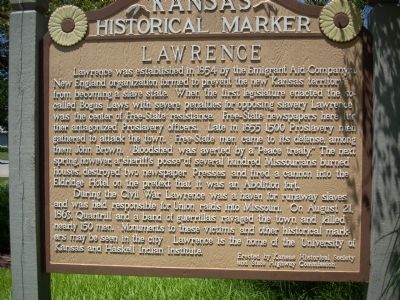
1. Lawrence Marker
Closeup of Lawrence Marker
During the Civil War Lawrence was a haven for runway slaves and was held responsible for Union raids into Missouri. On August 21, 1863, Quantrill and a band of guerrillas ravaged the town and killed nearly 150 men. Monuments to these victims and other historical markers may be seen in the city. Lawrence is home of the University of Kansas and Haskell Indian Institute.
Erected by Kansas
this page online
Topics and series. This historical marker is listed in these topic lists: Education • Government & Politics • Settlements & Settlers • War, US Civil. In addition, it is included in the Kansas Historical Society series list. A significant historical year for this entry is 1854.
Location. 38° 58.401′ N, 95° 14.346′ W. Marker is in Lawrence, Kansas, in Douglas County. It is in Pinckney. It is on 6th Street, on the right when traveling west. The marker is on the north side of 6th Street as you travel west between Ketucky and Tennessee Streets. Touch for map. Marker is at or near this postal address: 230 West 6th Street, Lawrence KS 66044, United States of America. Touch for directions.

Regionally, this marker is in Eastern Kansas and specifically in Bleeding Kansas Border War Country. It is also in the American Midwest, in the Corn Belt, on the prairies, on the Southern Plains, and on the Santa Fe Trail Corridor. Globally, it is in North America, the Western Hemisphere, the Western World, and the Anglosphere. Historically, it finds itself in
Photographed by Thomas Onions, June 28, 2009
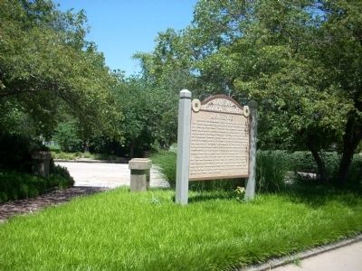
2. Lawrence Marker and Constant Park
Other nearby markers. At least 8 other markers are within walking distance of this marker: Historic Pinckney Neighborhood (a few steps from this marker); Santa Fe Steam Locomotive 1073 (about 400 feet away, measured in a direct line); Buford M. Watson Jr. Park (about 600 feet away); Indigenous Lands (about 800 feet away); Iⁿ'zhúje'waxóbe (about 800 feet away); Lynching in America / Lynching in Douglas County (approx. 0.2 miles away); John Brown and the Siege of Lawrence, September 14-15, 1856 (approx. 0.2 miles away); Free State Hotel (approx. ¼ mile away). Touch for a list and map of all markers in Lawrence.
Also see . . .
1. Kansas Historical Markers. Official State Link to the Kansas Historical Markers (Submitted on July 3, 2009, by Thomas Onions of Olathe, Kansas.)
2. Lawrence Massacre. The Wikipedia Link to the Lawrence Massacre. (Submitted on July 3, 2009, by Thomas Onions of Olathe, Kansas.)
Additional keywords. Bleeding Kansas Lawrence Massacre
Photographed by Thomas Onions, June 28, 2009
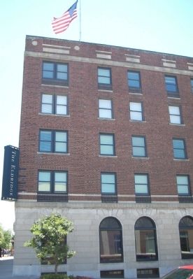
3. Eldridge (Free-State) Hotel
This was the site of the two hotels - 1 destroyed by Sheriff Jones and 1 by William Quantrill.
Photographed by Thomas Onions, June 28, 2009
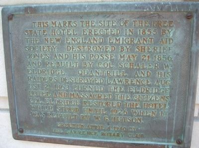
4. Lawrence Marker
Historical Marker on Eldridge Hotel
Photographed by Thomas Onions, June 28, 2009
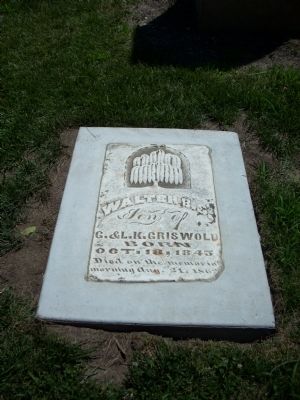
5. Headstone of Walter Griswold
Walter Griswold is buried in the Pioneer Cemetery on the campus of Kansas University and was a victim of Quantrill's Raid.
Photographed by Thomas Onions, January 5, 2008
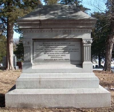
6. Lawrence Massacre Victims Memorial
This Memorial is in the Oak Hill Cemetery in Lawrence. This Cemetery has been described as Kansas's Arlington due to all of the historic figures from the early Territorial days buried here.
Credits. This page was last revised on February 10, 2023. It was originally submitted on July 3, 2009, by Thomas Onions of Olathe, Kansas. This page has been viewed 2,795 times since then and 87 times this year. Photos: 1, 2, 3, 4, 5, 6. submitted on July 3, 2009, by Thomas Onions of Olathe, Kansas. • Craig Swain was the editor who published this page.
