Jacksonville in Pulaski County, Arkansas — The American South (West South Central)
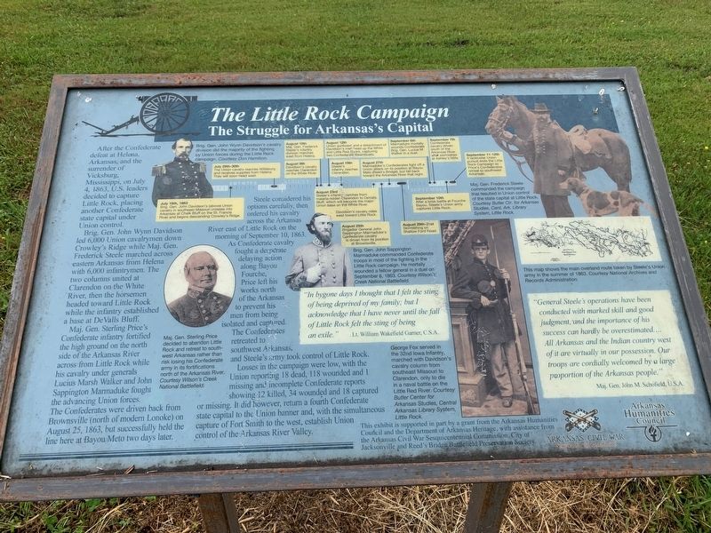
The Little Rock Campaign
The Struggle for Arkansas's Capital
Bridg. Gen. John Wayne Davidson led 6,000 Union cavalrymen down Crowley's Ridge while Maj. Gen. Fredrick Steele marched across eastern Arkansas from Helena with 6,000 infantrymen. The two columns united at Clarendon on the White River, then the horsemen headed toward Little Rock while the infantry established a base at DeValls Bluff.
Maj. Gen. Sterling Price's Confederate infantry fortified the high ground on the north side of the Arkansas River across from Little Rock while his cavalry under generals Lucius Marsh and John Sappington Marmaduke fought the advancing Union forces. The Confederates were driven back from Brownsville (north of modern Lonoke) on August 25, 18863, but successfully held the line here at Bauou Meto two days later.
Steele considered his options carefully, then ordered his cavalry across the Arkansas River east of Little Rock on the morning of September 10, 1863. As Confederate cavalry fought a desperate delaying action along Bayou Fourche, Price left his works north of the Arkansas to prevent his men from being isolated and captured. The Confederates retreated to southwest Arkansas, and Steele's army took control of Little Rock.
Losses in the campaign were low, with the Union reporting 18 dead, 118 wounded and 1 missing and incomplete Confederate reports showing 12 killed, 34 wounded and 18 captured or missing. It did however, return a fourth Confederate state capital to the Union banner and, with the simultaneous capture of Forth Smith to the west, established Union control of the Arkansa River Valley.
"In bygone days I thought that I felt the sting of being deprived of my family; but I acknowledge that I have never until the fall of Little Rock felt the sting of being an exile." Lt. William wakefield Garner, C.S.A.
"General Steel's operations have been conducted with marked skill and good judgement, and the importance of his success can hardly be overestimated. ...All Arkansas and the Indian country west of it are virtually in our possession. Our troops are cordially welcomed by a large proportion of the Arkansas people." Maj. Gen. John M. Schofield, U.S.A.
Erected by Arkansas Civil War Sesquicentennial Commission, Arkansas Humanities Council.
Topics and series. This historical marker is listed in this topic list: War, US Civil. In addition, it is included in the Arkansas Civil War Sesquicentennial Commission series list. A significant historical date for this entry is September 10, 1863.
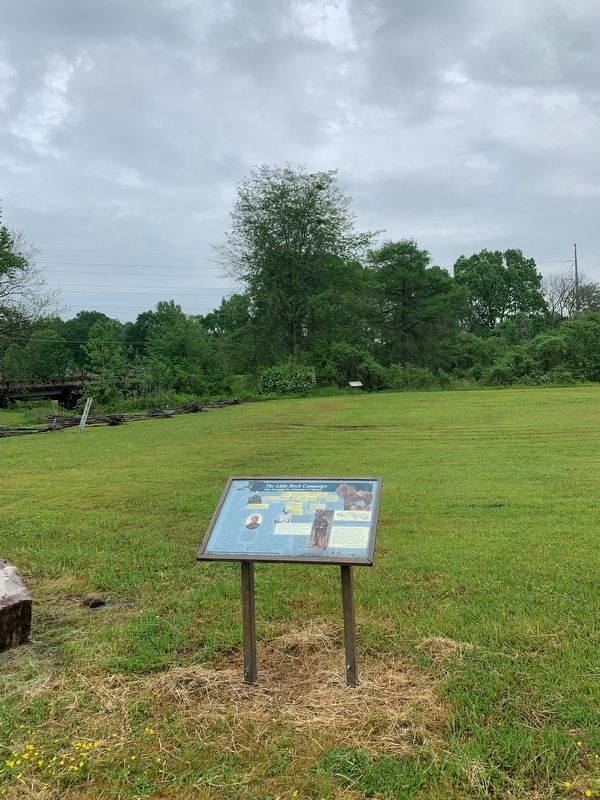
Location. 34° 50.612′ N, 92° 7.346′ W. Marker is in Jacksonville, Arkansas, in Pulaski County. Marker can be reached from South First Street (State Road 161) north of Lakeshore Drive, on the right when traveling north. Located in Reed's Bridge Battlefield Heritage Park. Touch for map. Marker is in this post office area: Jacksonville AR 72076, United States of America. Touch for directions.
Other nearby markers. At least 8 other markers are within walking distance of this marker. The Little Rock Campaign (here, next to this marker); Like Sorrow's Veil... (within shouting distance of this marker); The Defense of the Ford (about 500 feet away, measured in a direct line); Thunder on Bayou Meto (about 600 feet away); Marmaduke-Walker Duel (about 600 feet away); Brother Against Brother (approx. ¼ mile away); A Gallant Charge (approx. ¼ mile away); Our Batteries Opened a Tremendous Fire (approx. 0.4 miles away). Touch for a list and map of all markers in Jacksonville.
Credits. This page was last revised on August 27, 2022. It was originally submitted on August 23, 2022, by Thomas Smith of Waterloo, Ill. This page has been viewed 121 times since then and 37 times this year. Photos: 1, 2. submitted on August 23, 2022, by Thomas Smith of Waterloo, Ill. • Bernard Fisher was the editor who published this page.

