Kingston in Ulster County, New York — The American Northeast (Mid-Atlantic)
The Kingston-Rhinecliff Ferry
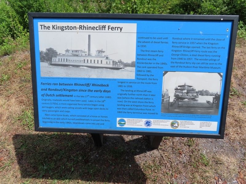
Ferries ran between Rhinecliff/Rhinebeck and Rondout/Kingston since the early days of Dutch settlement in the late 17th century (after 1680). Originally, rowboats would have been used. Later, in the 18th century (1700s), a more organized ferry service began using perriaugers, which were sailing vessels with large open decks to carry passengers and cargo.
Next came horse boats, which consisted of a horse or horses hitched to an axle which turned paddlewheels to propel the ferry. Beginning in the early 1840s, steamboats came into use and continued to be used until the advent of diesel ferries in 1930.
The first steam ferry between Rhinecliff and Rondout was the Knickerbocker in the 1840s. The Lark operated from 1860 to 1881, followed by the Transport, the ferry longest in service on the route from 1881 to 1938.
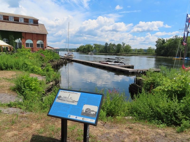
The landing at Rhinecliff was originally further north than it later was (where the railroad station is now). On the west shore the ferry landing was at Kingston Point which was then called Columbus Point. In 1869 the ferry terminus was moved to Rondout where it remained until the close of ferry service in 1957 when the Kingston- Rhinecliff Bridge opened. The last ferry on the Kingston-Rhinecliff Ferry route was the George Clinton, a steel diesel ferry running from 1946 to 1957. The wooden pilings of the Rondout ferry slip can still be seen to the east of the Hudson River Maritime Museum.
Funding for this sign was provide by a grant from the Hudson River Estuary Program, part of the New York State Department of Environmental Conservation. For more information, visit www.dec.ny.gov
Text and images for this sign were provided by the Hudson River Maritime Museum of Kingston, New York. For more information, visit www.hmm.org
The City of Kingston supports the creation and use of these interpretive panels on public and private property for the public good. Visit www.kingston-ny.gov
( photo captions )
— The steam ferryboat Transport ran the longest on the Kingston-Rhinecliff route, from 1881 to 1938. From the Hudson River Maritime Museum archives.
— The last ferry to run on the Kingston-Rhinecliff route was the George Clinton. Originally built for Lake Champlain, it operated here from 1946 to 1957. From the Hudson River Maritime Museum archives.
Erected by Hudson River Maritime Museum.
Topics. This historical marker is listed in these topic lists: Industry & Commerce • Waterways & Vessels. A significant historical year for this entry is 1930.
Location. 41° 55.157′ N, 73° 58.81′ W. Marker is in Kingston, New York, in Ulster County. Marker can be reached from Broadway near Rondout Landing, on the left when traveling south. Located at the Hudson River Maritime Museum. Touch for map. Marker is at or near this postal address: 50 Rondout Landing, Kingston NY 12401, United States of America. Touch for directions.
Other nearby markers. At least 8 other markers are within walking distance of this marker. The Cornell Steamboat Company (within shouting distance of this marker); Fulton’s Playground: Fun with Steamboats (about 300 feet away, measured in a direct line); Rondout-Sleighsburg Ferry: Riverside, a.k.a. Skillypot (about 300 feet away); Mary Powell Bell (about 400 feet away); Sections of the “Old Stone Road” (about 400 feet away); 1898 Mathilda Steam Engine (about 500 feet away); The Cornell Shops Building (about 500 feet away); The Tugboat Mathilda (about 500 feet away). Touch for a list and map of all markers in Kingston.
Also see . . . Hudson River Maritime Museum. (Submitted on August 23, 2022, by Michael Herrick of Southbury, Connecticut.)
Credits. This page was last revised on August 23, 2022. It was originally submitted on August 23, 2022, by Michael Herrick of Southbury, Connecticut. This page has been viewed 122 times since then and 21 times this year. Photos: 1, 2, 3. submitted on August 23, 2022, by Michael Herrick of Southbury, Connecticut.


