Confluence in Fayette County, Pennsylvania — The American Northeast (Mid-Atlantic)
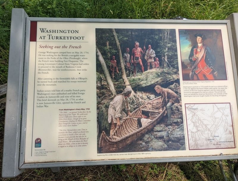
Washington at Turkeyfoot
Seeking out the French
After canoeing to the formidable falls at Ohiopyle, he turned back and marched his troops westward over the mountain.
Indian scouts told him of a nearby French party. Washington's men ambushed and killed Ensign Coulon de Jumonville and nine of his men. This brief skirmish on May 28, 1754, at what is now Jumonville Glen, opened the French and Indian War.
From Washington's Diary May, 1754
"The 20th,... we gained Turkey-foot, by the Beginning of the Night. We underwent several Difficulties about eight or ten Miles from thence, though of no great Consequence, finding the Waters sometimes deep enough for Canoes to pass, and at other times more shallow."
"The 21st, Tarried there some Time to examine the Place, which we found very convenient to build a Fort, not only because it was gravelly but also for its being at the Mouth of three Branches of small rivers... We went down the River about ten Miles, when at last it became so rapid as to oblige us to come ashore."
(caption) Exploring the wilderness by canoe was dangerous in the 18th-century.
(caption) Washington as Colonel of the Virginia Regiment, 1772. by Charles Willson Peale
Washington's portrait in 1722 recalls his part as a colonial officer in the war against the French fifteen years earlier. He wears the uniform of the First Virginia regiment, and the metal gorget around his neck asserts his role as a colonel. The portrait was done just before the American Revolution, but reminds us that Washington had once fought loyally for the king of England.
Erected by Great Allegheny Passage Conservancy; Ohiopyle State Park; National Park Service.
Topics and series. This historical marker is listed in these topic lists: Colonial Era • War, French and Indian. In addition, it is included in the Former U.S. Presidents: #01 George Washington series list. A significant historical date for this entry is May 20, 1754.
Location. 39° 48.917′ N, 79° 21.967′ W. Marker is in Confluence, Pennsylvania, in Fayette County. Marker is on Ramcat Road, on the right when traveling north. Marker is on the Great Alleghany Passage. Touch for map. Marker is in this post office area: Confluence PA 15424, United States of America. Touch for directions.
Other nearby markers. At least 8 other markers are within 5 miles of this marker, measured as the crow flies. Korean Veterans / Vietnam Veterans (approx. 0.4 miles away); World Wars I & II Memorial (approx. 0.4 miles away); Revolutionary War Memorial (approx. 0.4 miles away); Harnedsville (approx. 2.3 miles away); Nils G. Thompson (approx. 2.3 miles away); Honor Roll (approx. 2.3 miles away); Fort Hill (approx. 3.9 miles away); Great Crossings (approx. 4˝ miles away). Touch for a list and map of all markers in Confluence.
Credits. This page was last revised on September 3, 2022. It was originally submitted on August 26, 2022. This page has been viewed 349 times since then and 228 times this year. Photos: 1. submitted on August 26, 2022. • Bill Pfingsten was the editor who published this page.
