Near Meyersdale in Somerset County, Pennsylvania — The American Northeast (Mid-Atlantic)
Eastern Continental Divide
George Washington
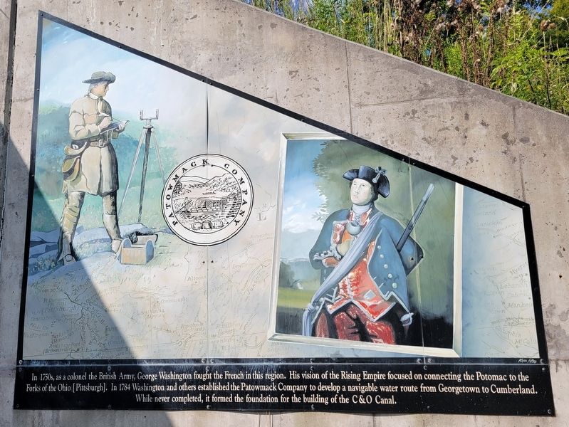
In 1750s, as a colonel the British Army, George Washington fought the French in this region. His vision of the Rising Empire focused on connecting the Potomac to the Forks of the Ohio [Pittsburgh]. In 1784 Washington and others established the Patowmack Company to develop a navigable water route from Georgetown to Cumberland. While never completed, it formed the foundation for the building of the C&O Canal.
Erected by Great Allegheny Passage.
Topics and series. This historical marker is listed in these topic lists: War, French and Indian • Waterways & Vessels. In addition, it is included in the Former U.S. Presidents: #01 George Washington series list. A significant historical year for this entry is 1784.
Location. 39° 45.199′ N, 78° 54.947′ W. Marker is near Meyersdale, Pennsylvania, in Somerset County. Marker is at the intersection of Great Allegheny Passage Trail and McKenzie Hollow Road, on the right when traveling west on Great Allegheny Passage Trail. Marker is located on the east side of the Eastern Continental Divide tunnel. Touch for map. Marker is in this post office area: Meyersdale PA 15552, United States of America. Touch for directions.
Other nearby markers. At least 8 other markers are within 5 miles of this marker, measured as the crow flies. St. Ignatius Church (approx. 4 miles away in Maryland); Our Dead Are Not Unknown Soldiers (approx. 4 miles away in Maryland); Mount Savage Iron Works (approx. 4.3 miles away in Maryland); The Castle (approx. 4.4 miles away in Maryland); St. Ignatius Stone (approx. 4.4 miles away in Maryland); St Patrick School Monument (approx. 4.4 miles away in Maryland); On This Site in 1844 (approx. 4.4 miles away in Maryland); Mount Savage In The Great War (approx. 4˝ miles away in Maryland).
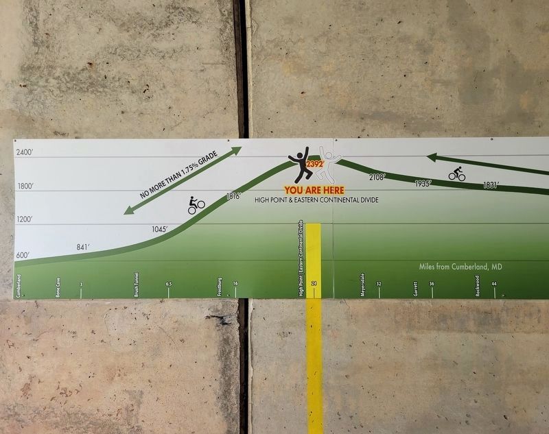
More about this marker. The highest point along the Great Allegheny Passage and the entire Pittsburgh-to-Washington, D.C. trip at 2,392 feet above sea level, the Eastern Continental Divide is a hydrographic divide separating the Chesapeake Bay and Mississippi River watersheds. It runs from western New York State to Florida.
Credits. This page was last revised on August 31, 2022. It was originally submitted on August 27, 2022, by Bradley Owen of Morgantown, West Virginia. This page has been viewed 218 times since then and 42 times this year. Photos: 1, 2, 3. submitted on August 27, 2022, by Bradley Owen of Morgantown, West Virginia. • Bill Pfingsten was the editor who published this page.


