
Cambridge in Dorchester County, Maryland — The American Northeast (Mid-Atlantic)
The Dorchester Waterman
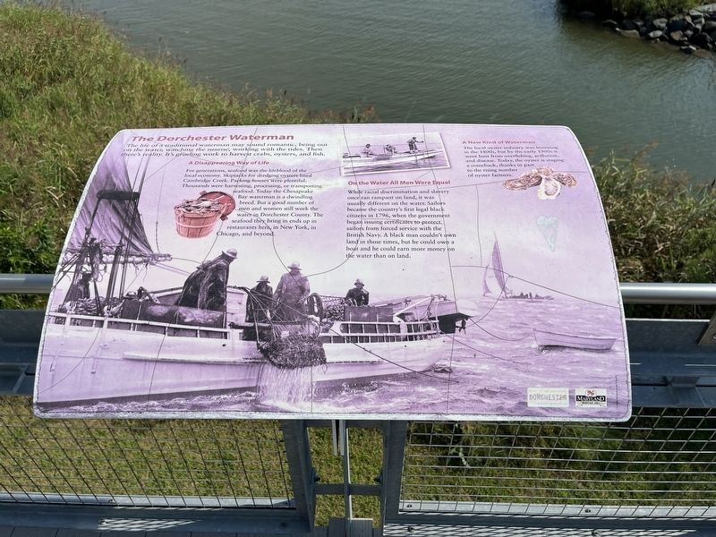
The life of a traditional waterman may sound romantic, being out on the water, watching the sunrise, working with the tides. Then there's reality. It's grueling work to harvest crabs, oysters, and fish.
A Disappearing Way of Life
For generations, seafood was the lifeblood of the local economy. Skipjacks for dredging oysters lined Cambridge Creek. Packing houses were plentiful. Thousands were harvesting, processing, or transporting seafood. Today the Chesapeake Bay waterman is a dwindling breed. But a good number of men and women still work the water in Dorchester County. The seafood they bring in ends up in restaurants here, in New York, in Chicago, and beyond.
On the Water All Men Were Equal
While racial discrimination and slavery once ran rampant on land, it was usually different on the water. Sailors became the country's first legal black citizens in 1796, when the government began issuing certificates to protect sailors from forced service with the British Navy. A black man couldn't own land in those times, but he could own a boat and he could earn more money on the water than on land.
A New Kind of Waterman
The
this page online
Erected by Maryland Heritage Area Authority.
Topics. This historical marker is listed in these topic lists: African Americans • Animals • Industry & Commerce • Waterways & Vessels. A significant historical year for this entry is 1796.
Location. 38° 34.293′ N, 76° 3.821′ W. Marker is in Cambridge, Maryland, in Dorchester County. It can be reached from Rosehill Place 0.1 miles north of Byrn Street, on the right when traveling north. Touch for map. Marker is at or near this postal address: 2 Rosehill Pl, Cambridge MD 21613, United States of America. Touch for directions.

Regionally, this marker is on the Eastern Shore. It is also in the American Mid-Atlantic, on the Delmarva Peninsula, in the Tidewater, in the Chesapeake Bay Region, and on the Eastern Seaboard. Globally, it is in the North Atlantic Region, North America, the Western Hemisphere, the Western World, and the Anglosphere. Historically,

Other nearby markers. At least 8 other markers are within walking distance of this marker: Barbara Mikulski (here, next to this marker); Choptank River's Natural History (here, next to this marker); Choptank River Bridge (here, next to this marker); A Landscape and Lifestyle Defined by Water (a few steps from this marker); Living off the Land (a few steps from this marker); Exploring Dorchester's Fragile Beauty (within shouting distance of this marker); Cambridge (within shouting distance of this marker); a different marker also named Maryland's Eastern Shore (within shouting distance of this marker). Touch for a list and map of all markers in Cambridge.
Another marker is no longer nearby. Maryland's Eastern Shore (was within shouting distance of this marker but has been replaced with another marker now near it).
Credits. This page was last revised on November 1, 2024. It was originally submitted on August 28, 2022, by Devry Becker Jones of Washington, District of Columbia. This page has been viewed 655 times since then and 33 times this year. Photos: 1, 2. submitted on August 28, 2022, by Devry Becker Jones of Washington, District of Columbia.
