Near Middlesboro in Bell County, Kentucky — The American South (East South Central)
Two Armies, One Railroad
— Cumberland Gap National Historical Park —
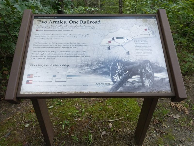
When 11 southern states broke their ties with the U.S. government in spring 1861, military commanders north and south of these mountains began to calculate how to use Cumberland Gap to aid their cause.
Federal commanders saw the Gap as one way to cut the Confederacy in two. The fact that sentiment was strong against secession in East Tennessee and the mountain counties worked in their favor.
Confederate generals saw the Gap as a favored defense against Union strikes that might cripple the saltworks, mines, and railroads vital to their war effort. Southerners also saw Cumberland Gap as a route to invade Kentucky and reclaim its resources for the Confederacy.
(captions)
Which Army Held Cumberland Gap? Confederate and Federal troops each garrisoned forts in the Gap twice.
East Tennessee & Virginia Railroad During the Civil War years only one railroad crossed the Appalachian mountains, linking the two largest Confederate armies. Troops, ammunition, and food moving from one side of the Confederacy to the other had to funnel through East Tennessee and Southwest Virginia.
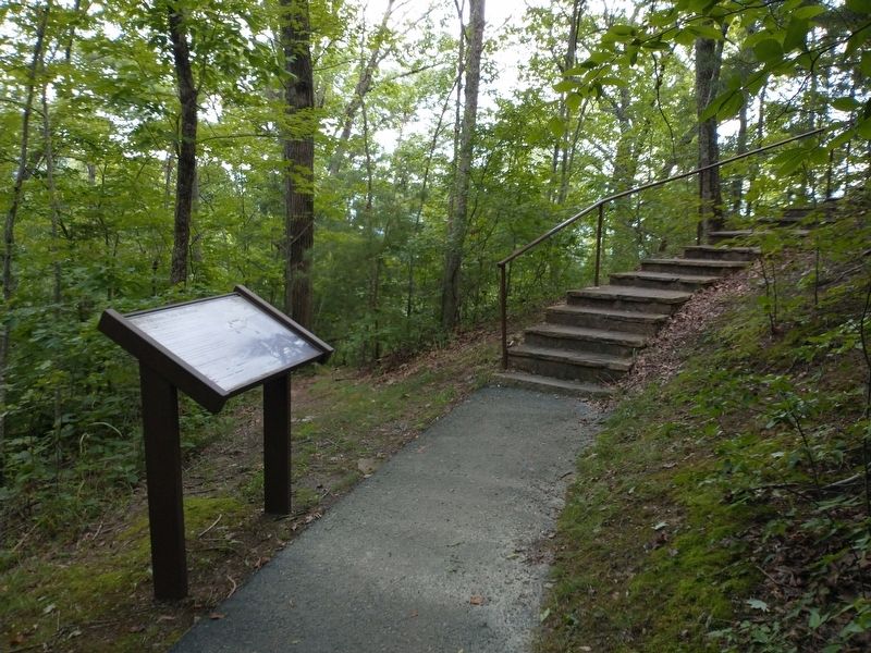
The stairs to your right climb to Civil War earthworks that overlook the Gap.
Erected by National Park Service, U.S. Department of the Interior.
Topics. This historical marker is listed in these topic lists: Forts and Castles • Railroads & Streetcars • War, US Civil. A significant historical year for this entry is 1862.
Location. 36° 36.508′ N, 83° 40.46′ W. Marker is near Middlesboro, Kentucky, in Bell County. Marker can be reached from Pinnacle View Road, 1.1 miles east of Old Wilderness Road (Kentucky Route 988), on the right when traveling east. Marker is located in the Cumberland Gap National Historical Park. Touch for map. Marker is in this post office area: Middlesboro KY 40965, United States of America. Touch for directions.
Other nearby markers. At least 8 other markers are within walking distance of this marker. Forts and Batteries, North and South (within shouting distance of this marker); Dirt-and-Log Forts (approx. 0.2 miles away); A Masterful Retreat (approx. 0.2 miles away); Cumberland Gap / Grant Visits Cumberland Gap (approx. 0.2 miles away); An Object Lesson Road (approx. 0.2 miles away); Two-Way Traffic (approx. 0.2 miles away); a different marker also named An Object Lesson Road (approx. 0.2 miles away); Warriors' Path (approx. ¼ mile away). Touch for a list and map of all markers in Middlesboro.
Also see . . . Cumberland Gap National Historical Park. National Park Service (Submitted on August 30, 2022.)
Credits. This page was last revised on August 30, 2022. It was originally submitted on August 30, 2022, by Tom Bosse of Jefferson City, Tennessee. This page has been viewed 183 times since then and 20 times this year. Photos: 1, 2, 3, 4. submitted on August 30, 2022, by Tom Bosse of Jefferson City, Tennessee. • Bernard Fisher was the editor who published this page.


