Lloyds in Dorchester County, Maryland — The American Northeast (Mid-Atlantic)
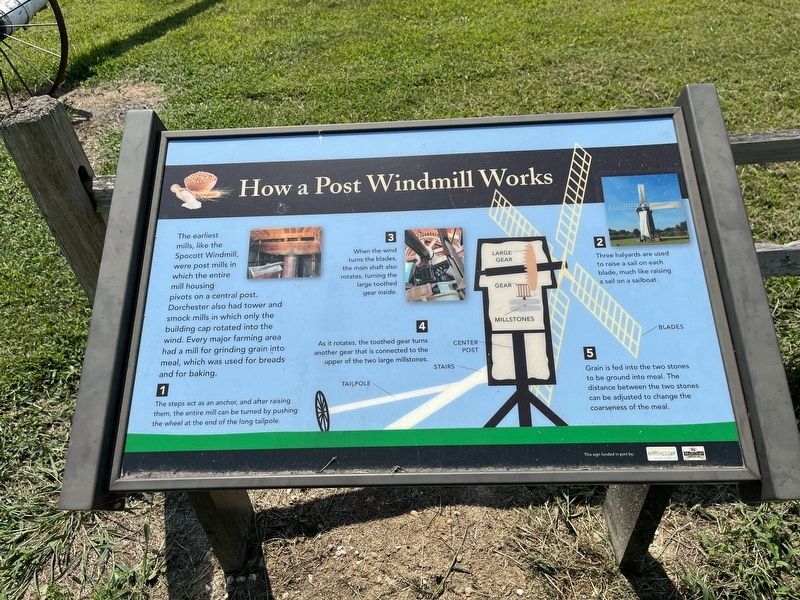
How a Post Windmill Works
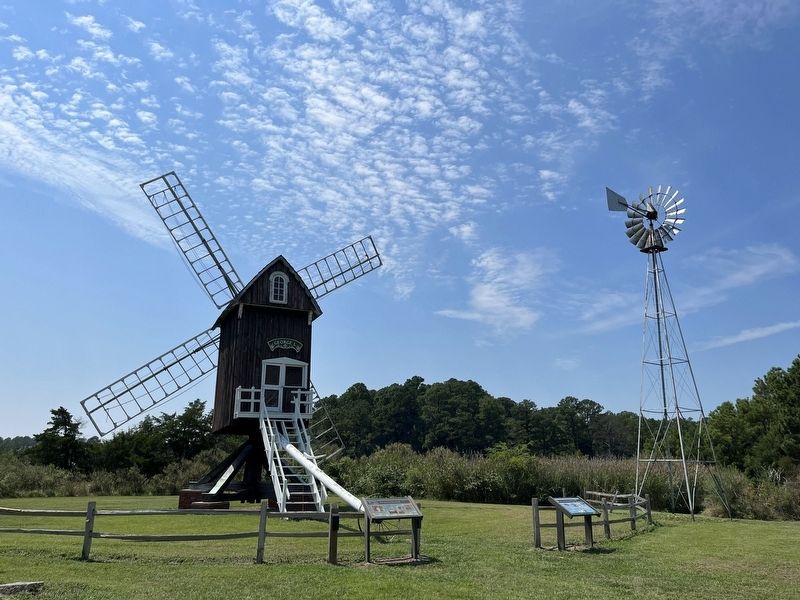
The earliest mills, like the Spocott Windmill, were post mills in which the entire mill housing pivots on a central post. Dorchester also had tower and smock mills in which only the building cap rotated into the wind. Every major farming area had a mill for grinding grain into meal, which was used for breads and for baking.
1️⃣
The steps act as an anchor, and after raising them, the entire mill can be turned by pushing the wheel at the end of the long tailpole.
2️⃣
Three halyards are used to raise a sail on each blade, much like raising a sail on a sailboat.
3️⃣
When the wind turns the blades, the main shaft also rotates, turning the large toothed gear inside.
4️⃣
As it rotates, the toothed gear turns another gear that is connected to the upper of the two large millstones.
5️⃣
Grain is fed into the two stones to be ground into meal. The distance between the two stones can be adjusted to change the coarseness of the meal.
Erected by Dorchester County; Maryland Heritage Area Authority.
Topics. This historical marker is listed in these topic lists: Agriculture • Industry & Commerce.
Location. 38° 35.317′ N, 76° 10.896′ W. Marker is in Lloyds, Maryland, in Dorchester County. Marker can be reached from Hudson Road (Maryland Route 343) east of Castle Haven Road, on the right when traveling east. Touch for map. Marker is at or near this postal address: 1609 Hudson Rd, Cambridge MD 21613, United States of America. Touch for directions.
Other nearby markers. At least 8 other markers are within 6 miles of this marker, measured as the crow flies. The Spocott Windmill (here, next to this marker); The Adaline Wheatley House (a few steps from this marker); The Castle Haven School (a few steps from this marker); a different marker also named Spocott Windmill (about 400 feet away, measured in a direct line); Gary’s Creek - Indian Path (approx. 0.2 miles away); “The Wilderness” (approx. 4.7 miles away); Annie Oakley House (approx. 5 miles away); Stanley Institute (approx. 5.2 miles away). Touch for a list and map of all markers in Lloyds.

Photographed By Devry Becker Jones (CC0), August 27, 2022
2. The Spocott Windmill and related markers
Credits. This page was last revised on August 30, 2022. It was originally submitted on August 30, 2022, by Devry Becker Jones of Washington, District of Columbia. This page has been viewed 252 times since then and 38 times this year. Photos: 1, 2. submitted on August 30, 2022, by Devry Becker Jones of Washington, District of Columbia.
