DeSoto in Washington County, Missouri — The American Midwest (Upper Plains)
Petroglyphs
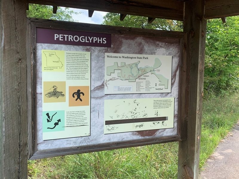
Prehistoric people left examples of rock carving in many locations in the state. Most of these are in the central eastern portion of the state where rock outcroppings are more common. These petroglyphs were chipped, pecked and ground into these exposed sections of dolomite above the Big River sometime between 500 and 2,000 years ago. These petroglyphs have been assigned to this time period based on the presence of symbols that occur only during that period, such as bilobed arrows and ceremonial maces. Archaeologists have no way to accurately date petroglyphs, and their content is the only possible dating technique.
At the time these carvings were made, American Indian people inhabited this part of Missouri. They hunted animals and gathered plants for food. They probably raised crops such as corn, beans, and squash at village sites along Big River. Long before Europeans arrived here, artists gathered at these stone outcroppings and created these images in the rock.
Topics. This historical marker is listed in these topic lists: Anthropology & Archaeology • Native Americans.
Location. 38° 4.746′ N, 90° 40.956′ W. Marker is in DeSoto, Missouri, in Washington County. Marker is on Scenic State Highway 104, 0.9 miles west of State Highway 21, on the left when traveling west. The marker stands in Washington State Park. Touch for map. Marker is at or near this postal address: 12444 Hwy 104, Potosi MO 63664, United States of America. Touch for directions.
Other nearby markers. At least 8 other markers are within 12 miles of this marker, measured as the crow flies. Rock Carvings (here, next to this marker); The Petroglyphs of Washington State Park (approx. 0.4 miles away); The Korean War (approx. 0.4 miles away); Veterans Memorial (approx. 7.1 miles away); In Memory of Aime Amant Vaille (approx. 10.7 miles away); Artesian Spring / Valles Mines (approx. 10.7 miles away); Slave Cabin (approx. 10.7 miles away); a different marker also named Veterans Memorial (approx. 11.4 miles away).
Credits. This page was last revised on August 31, 2022. It was originally submitted on August 31, 2022, by Thomas Smith of Waterloo, Ill. This page has been viewed 107 times since then and 16 times this year. Photo 1. submitted on August 31, 2022, by Thomas Smith of Waterloo, Ill. • Devry Becker Jones was the editor who published this page.
