DeSoto in Jefferson County, Missouri — The American Midwest (Upper Plains)
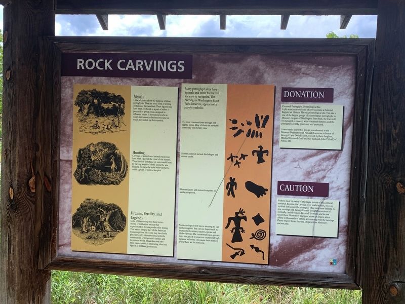
Rock Carvings
Rituals
Little is known about the purpose of these petroglyphs. They are not a form of writing and cannot be translated. These figures may have been produced as a part of either a personal or group ritual, designed to influence events in the natural world in which the American Indian live and on which the relied for their survival.
Hunting
Carvings of animals and animal tracks may have been a part of the ritual of the hunters. Their survival depended on a successful hunt. By carving a symbol of the animal he was hunting, perhaps the artist believed that he could capture or control its sprit.
Dreams, Fertility, and Legends
Some of the carvings may have been a record of symbolism such as that experienced in dreams produced by fasting. This was an integral part of the American Indian spiritual life. Some may have had a place in fertility rites concerned with the continuation of the carvers' families and the natural world. These also may have been memory devices illustrating tales and legends to tell later generations.
Topics. This historical marker is listed in these topic lists: Anthropology & Archaeology • Churches & Religion • Native Americans.
Location. 38° 4.747′ N, 90° 40.957′ W. Marker is in DeSoto, Missouri, in Jefferson County. Marker is at the intersection of Scenic State Highway 104 and State Highway 21, on the left when traveling west on State Highway 104Scenic . The marker stands in Washington State Park. Touch for map. Marker is at or near this postal address: 12444 Hwy 104, De Soto MO 63020, United States of America. Touch for directions.
Other nearby markers. At least 8 other markers are within 12 miles of this marker, measured as the crow flies. Petroglyphs (here, next to this marker); The Petroglyphs of Washington State Park (approx. 0.4 miles away); The Korean War (approx. 0.4 miles away); Veterans Memorial (approx. 7.1 miles away); In Memory of Aime Amant Vaille (approx. 10.7 miles away); Artesian Spring / Valles Mines (approx. 10.7 miles away); Slave Cabin (approx. 10.7 miles away); a different marker also named Veterans Memorial (approx. 11.4 miles away).
Credits. This page was last revised on August 31, 2022. It was originally submitted on August 31, 2022, by Thomas Smith of Waterloo, Ill. This page has been viewed 201 times since then and 49 times this year. Photos: 1, 2. submitted on August 31, 2022, by Thomas Smith of Waterloo, Ill. • Devry Becker Jones was the editor who published this page.

