Chincoteague in Accomack County, Virginia — The American South (Mid-Atlantic)
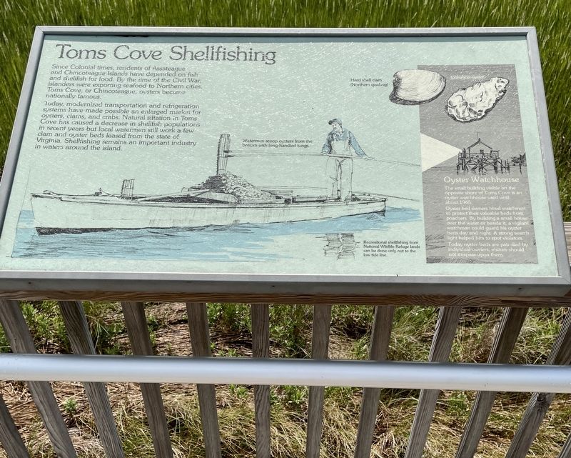
Tomís Cove Shellfishing
Assateague Island National Seashore
Today, modernized transportation and refrigeration systems have made possible an enlarged market for oysters, clams and crabs. Natural siltation in Toms Cove has caused a decrease in shellfish populations in recent years but local waterman still work a few clam and oyster beds leased from the state of Virginia. Shellfishing remains an important industry in waters around the island.
(sidebar)
oyster watchhouse
The small building visible on the opposite shore of Toms Cove is an oyster watchhouse used until about 1965.
Oyster bed owners hired watchmen to protect their valuable beds from poachers. By building a small house over the water or beside it, a vigilant watchman could guard his oyster beds day and night. A strong searchlight helped him to spot violators. Today oyster beds are patrolled by individual owners; visitors should not trespass upon them.
(captions)
Watermen scoop oysters from the bottom with long-handled tongs.
Recreational shellfishing from National Wildlife Refuge lands can be done only out to the low tide line.
Erected by National Park Service, Department of the Interior.
Topics. This historical marker is listed in these topic lists: Industry & Commerce • Settlements & Settlers • Waterways & Vessels. A significant historical year for this entry is 1965.
Location. 37° 53.397′ N, 75° 20.704′ W. Marker is in Chincoteague, Virginia, in Accomack County. Marker is at the intersection of National Seashore Lane and Stephen Decatur Hwy (Virginia Route 611), on the right when traveling west on National Seashore Lane. Marker is located on the Visitor Centerís boardwalk. Touch for map. Marker is at or near this postal address: 7206 National Seashore Lane, Chincoteague Island VA 23336, United States of America. Touch for directions.
Other nearby markers. At least 8 other markers are within 4 miles of this marker, measured as the crow flies. Coast Guard Station (here, next to this marker); Assateague Lighthouse (a few steps from this marker); Keeping the Forest Full of Life (approx. one mile away); The Wild Ponies (approx. 1.3 miles away); Welcome to Assateague Village (approx. 1.6 miles away); Still ShiningÖAfter All These Years (approx. 1.6 miles away); Assateague Light House (approx. 1.6 miles away); Miss Mollys Inn (approx. 3Ĺ miles away). Touch for a list and map of all markers in Chincoteague.
Credits. This page was last revised on September 3, 2022. It was originally submitted on August 31, 2022, by Brandon D Cross of Flagler Beach, Florida. This page has been viewed 228 times since then and 37 times this year. Photos: 1, 2. submitted on August 31, 2022, by Brandon D Cross of Flagler Beach, Florida. • Bill Pfingsten was the editor who published this page.

