Rainbow City in Etowah County, Alabama — The American South (East South Central)
Harmony Baptist Church
Photographed by Duane and Tracy Marsteller, September 12, 2020
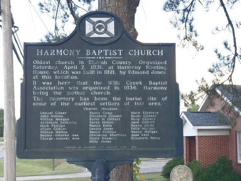
1. Harmony Baptist Church Marker
It was here that the Wills Creek Baptist Association was organized in 1836, Harmony being the mother church.
The cemetery has been the burial site of some of the earliest settlers of this area.
Charter members:
Lemuel Gilbert • Nancy Camp • Mary Elberson
John Melton • Elizabeth Gilbert • Susan Gilbert
William Morgan • Ruthe M. Gilbert • Rody Gilbert
Archibald Sutherlin • Sarah Melton • • Jane Gilbert
Mark Phillips • Nancy Bolin • Nancy Jones
Jilson Gilbert • Luvica Jones • Polly Morgan
William Melton • Nancy Phillips • Nancy Morgan
Nedley - colored man • Distimony Shuffield • Jane Best
George - colored man • Docie Dunaway • Elizabeth Perry
Milly Jones
Erected 1970 by Rainbow City Garden Club.
Topics. This historical marker is listed in these topic lists: African Americans • Cemeteries & Burial Sites • Religion & Religious Structures. A significant historical date for this entry is April 2, 1831.
Location. 33° 56.975′ N, 86° 2.988′ W. Marker is in Rainbow
this page online

Regionally, this marker is in North Alabama. It is also in the American South, specifically in the Deep South, in Appalachia, and specifically in Southern Appalachia. Globally, it is in North America, a Gulf of Mexico state, the Western Hemisphere, the Western World, and the Anglosphere. Historically, it finds itself in what was once the original Cherokee Nation, the territory of the Mississippian Culture, one of the Confederate States of America, and the Antebellum South.
Other nearby markers. At least 8 other markers are within 5 miles of this marker, measured as the crow flies: Old Harmony Cemetery (a few steps from this marker); Site of 1784 Indian Massacre (within shouting distance of this marker); Southern Hill Cemetery (approx. 4.1 miles away); Tom Sims (approx. 4.2 miles away); Sisters Missionary Servants Of The Most Blessed Trinity
Photographed by Duane and Tracy Marsteller, September 12, 2020
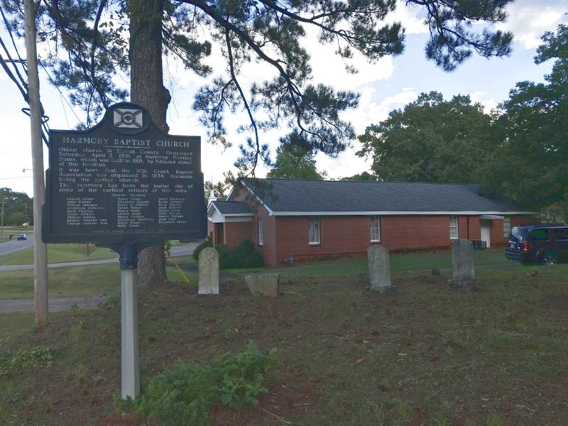
2. Harmony Baptist Church Marker
Credits. This page was last revised on September 2, 2022. It was originally submitted on September 17, 2020, by Duane and Tracy Marsteller of Murfreesboro, Tennessee. This page has been viewed 1,148 times since then and 90 times this year. Last updated on September 2, 2022, by Jeffrey Steakley of Gadsden, Alabama. Photos: 1, 2. submitted on September 17, 2020, by Duane and Tracy Marsteller of Murfreesboro, Tennessee. • Mark Hilton was the editor who published this page.
