Near Muscle Shoals in Colbert County, Alabama — The American South (East South Central)
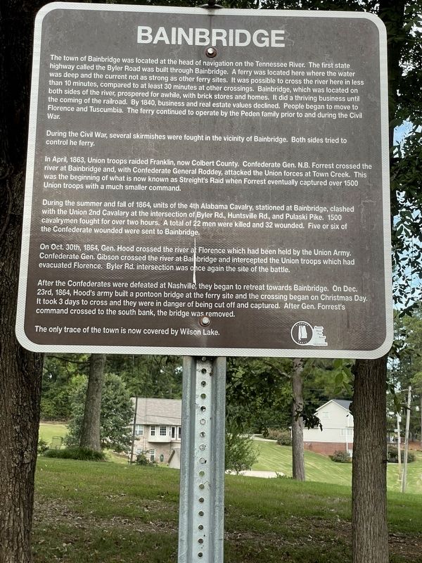
Bainbridge
During the Civil War, several skirmishes were fought in the vicinity of Bainbridge. Both sides tried to control the ferry.
In April, 1863, Union troops raided Franklin, now Colbert County. Confederate Gen. N.B. Forrest crossed the river at Bainbridge and, with Confederate General Roddey, attacked the Union forces at Town Creek. This was the beginning of what is now known as Streight's Raid when Forrest eventually captured over 1500 Union troops with a much smaller command.
During the summer and fall of 1864, units of the 4th Alabama Cavalry, stationed at Bainbridge, clashed with the Union 2nd Cavalary [sic] at the intersection of Byler Rd., Huntsville Rd., and Pulaski Pike. 1500 cavalrymen fought for over two hours. A total of 22 men were killed and 32 wounded. Five or six of the Confederate wounded were sent to Bainbridge.
On Oct. 30th, 1864, Gen. Hood crossed the river af Florence which had been held by the Union Army. Confederate Gen. Gibson crossed the river at Bainbridge and intercepted the Union troops which had evacuated Florence. Byler Rd. intersection was once again the site of the battle.
After the Confederates were defeated at Nashville, they began to retreat towards Bainbridge. On Dec. 23rd, 1864, Hood's army built a pontoon bridge at the ferry site and the crossing began on Christmas Day. It took 3 days to cross and they were in danger of being cut off and captured. After Gen. Forrest's command crossed to the south bank, the bridge was removed.
The only trace of the town is now covered by Wilson Lake.
Erected 2019 by Colbert County Landmarks Foundation.
Topics. This historical marker is listed in these topic lists: Settlements & Settlers • War, US Civil. A significant historical year for this entry is 1817.
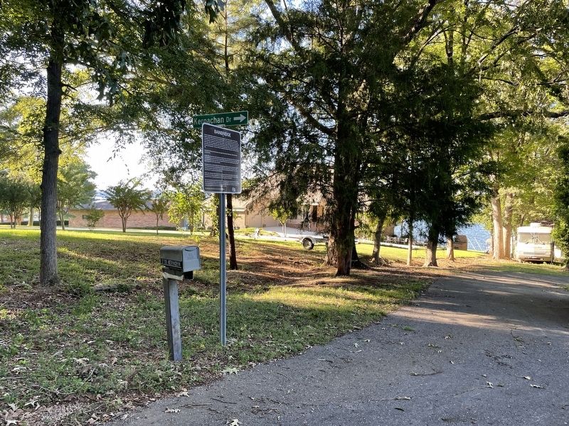
Location. 34° 48.295′ N, 87° 34.039′ W. Marker is near Muscle Shoals, Alabama, in Colbert County. Marker is on Bainbridge Road north of Bainbridge Circle, on the left when traveling north. Located on south bank of TN River (Lake Wilson), at very end of Bainbridge Road. Touch for map. Marker is at or near this postal address: 3741 Bainbridge Rd, Muscle Shoals AL 35661, United States of America. Touch for directions.
Other nearby markers. At least 8 other markers are within 4 miles of this marker, measured as the crow flies. Confederate Retreat at the Tennessee River (approx. one mile away); Clyde Carter House (approx. 2.4 miles away); Killen and the Canal System (approx. 3.1 miles away); World War II Memorial (approx. 3.2 miles away); World War I Memorial (approx. 3.2 miles away); The Korean War (approx. 3.2 miles away); Vietnam War Memorial (approx. 3.2 miles away); AGM-28 Hound Dog Missile (approx. 3.2 miles away). Touch for a list and map of all markers in Muscle Shoals.
More about this marker. Marker has a misspelling of Cavalry in 4th paragraph.
Credits. This page was last revised on December 19, 2023. It was originally submitted on September 3, 2022, by Joel S Mize of Muscle Shoals AL, Alabama. This page has been viewed 976 times since then and 272 times this year. Photos: 1. submitted on September 3, 2022, by Joel S Mize of Muscle Shoals AL, Alabama. 2. submitted on September 12, 2022, by Joel S Mize of Muscle Shoals AL, Alabama. • Mark Hilton was the editor who published this page.

