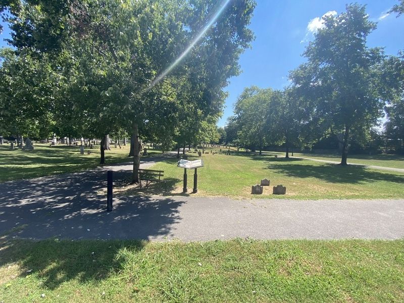
South Nashville in Davidson County, Tennessee — The American South (East South Central)
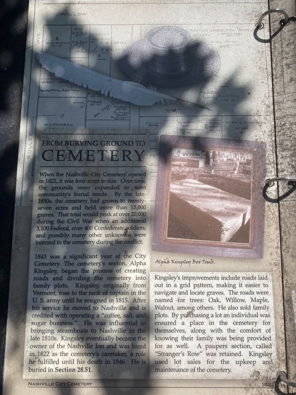
From Burying Ground to Cemetery
1843 was a significant year at the City Cemetery. The cemetery's sexton, Alpha Kingsley, began the process of creating roads and dividing the cemetery into family plots. Kingsley, originally from Vermont, rose to the rank of captain in the u.S. Army until he resigned in 1815. After his service, he moved to Nashville and is credited with operating a "coffee, salt, and sugar business." He was influential in bringing steamboats to Nashville in the late 1810s. Kingsley eventually became the owner of the Nashville Inn and was hired in 1822 as the cemetery's caretaker, a role he fulfilled until his death in 1846. he is buried in Section 28.51
Kingsley's improvements include roads laid out in a grid pattern, making it easier to navigate and locate graves. The roads were named for trees: Oak, Willow, Maple, Walnut, among others. he also sold family plots. By purchasing a lot in an individual was ensured a place in the cemetery for themselves, along with the comfort of knowing their family was being provided for as well. A paupers section, called "Stranger's Row" was retained. Kingsley used lot sales for the upkeep and maintenance of the cemetery.
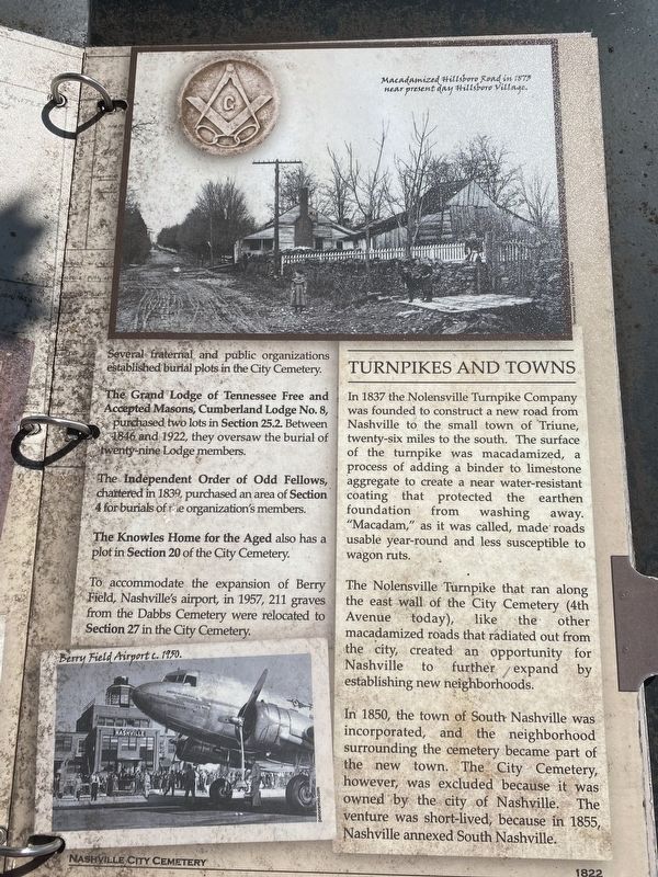
Several fraternal and public organizations established burial plots in the City Cemetery.
The Grand Lodge of Tennessee Free and Accepted Masons, Cumberland Lodge No. 8, purchased two lots in Section 25.2. between 1846 and 1922, they oversaw the burial of twenty-nine lodge member.
The Independent Order of Odd Fellows, chartered in 1839, purchased an area of Section 4 for burials of the organization's members.
The Knowles Home for the Aged also has a plot in Section 20 of the City Cemetery.
To accommodate the expansion of Berry Field, Nashville's airport, in 1957, 211 graves from the Dabbs Cemetery were relocated to Section 27 in the City Cemetery.
Turnpikes and Towns
In 1837 the Nolensville Turnpike Company was founded to construct a new road from Nashville to the small town of Triune, twenty-six miles to the south. The surface of the turnpike was macadamized, a process of adding a binder to limestone aggregate to create a near water-resistant coating that protected the earthen foundation from washing away "Macadam," as it was called, made roads usable year-round and less susceptible to wagon ruts.
The Nolensville Turnpike that ran along the east wall of the City Cemetery (4th Avenue today), like the other macadamized roads that radiated out from the city, created an opportunity for Nashville to further expand by establishing new neighborhoods.
In 1850, the town of South Nashville was incorporated, and the neighborhood surrounding the cemetery became a part of the new town. The City Cemetery, however, was excluded because it was owned by the city of Nashville. The venture was short-lived, because in 1855, Nashville annexed South Nashville.
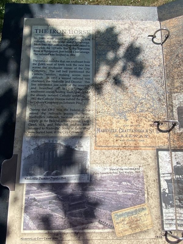
The Iron Horse
In 1848, work began on the state's first railroad, the Nashville and Chattanooga. more than two million dollars were raised to complete the 115 mile line to the Tennessee River at Bridgeport, just below Chattanooga. The railroad was finished in 1854.
The natural corridor that ran southeast from the gulch west of town took the new line across the southwest corner of the City Cemetery. The rail bed partitioned the Catholic section, making access more difficult. In 1853 a second railroad was chartered, the Nashville and Decatur. This line intersected just north of the cemetery and branched off in the cemetery's southwest corner, adding more obstacles to the already isolated Catholic cemetery. in 1902 the Catholic Diocese moved the graves to Cavalry cemetery on Lebanon Pike.
During the Civil War the Federal Army seized the railroads across the state. Nashville's railroads became arteries for supply as the Federal armies moved south. Dead, sick, and wounded soldiers were returned to Nashville. Some of those dead were buried in the City Cemetery.
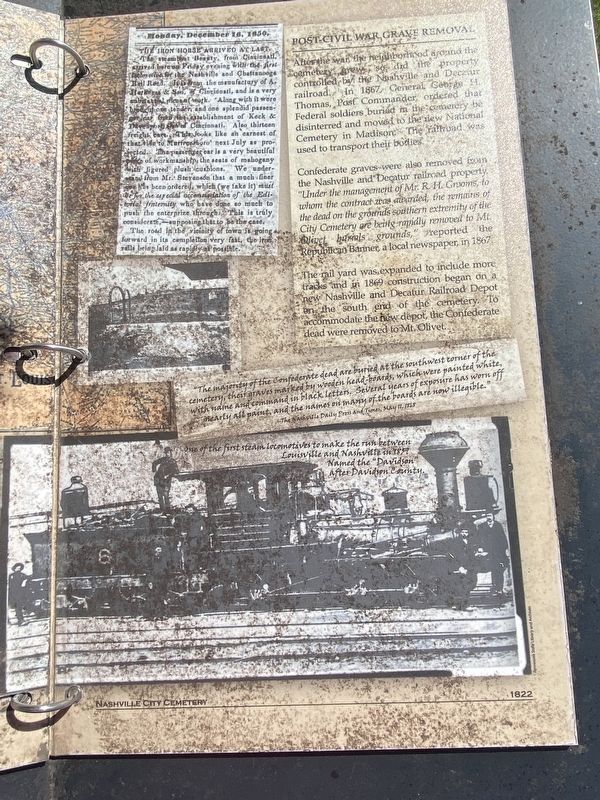
Post Civil War Grave Removal
After the war, the neighborhood around the cemetery grew so, did the property controlled by the Nashville and Decatur railroad. in 1867, General George H. Thomas, Post Commander ordered that Federal soldiers buried in the cemetery be disinterred and moved to the new National Cemetery in Madison. The railroad was used to transport their bodies.
Confederate graves were also removed from the Nashville and Decatur railroad property. "Under the management of Mr. R.H. Grooms, to whom the contract was awarded, the remains of the dead on the grounds southern extremity of the City Cemetery are being removed to Mt. Olivet burials grounds," reported the Republican banner, a local newspaper, in 1867.
The rail yard was expanded to include more tracks and in 1869 construction began on a new Nashville and Decatur Railroad Depot on the south end of the cemetery. To accommodate the new depot, the Confederate dead were removed to Mt. Olivet.
Erected by Nashville City Cemetery.
Topics. This historical marker is listed in these topic lists: Cemeteries & Burial Sites • Railroads & Streetcars • War, US Civil. A significant historical year for this entry is 1822.
Location. 36° 8.767′ N, 86° 46.146′ W. Marker is in Nashville, Tennessee, in Davidson County. It is in South Nashville. Marker can be reached from the intersection of 4th Avenue South and Oak Street, on the right when traveling south. Touch for map. Marker is at or near this postal address: 1001 4th Ave S, Nashville TN 37203, United States of America. Touch for directions.
Other nearby markers. At least 8 other markers are within walking distance of this marker. The Civil War and Its Aftermath (about 300 feet away, measured in a direct line); A History of Restoration (about 400 feet away); Nashville City Cemetery (about 500 feet away); The Free and the Unfree (about 500 feet away); A Community of Citizens and Soldiers (about 500 feet away); From Frontier to Civilization (about 500 feet away); Frontier Nashville / Athens of the West (about 500 feet away); John E. Hagey (about 500 feet away). Touch for a list and map of all markers in Nashville.
Credits. This page was last revised on February 7, 2023. It was originally submitted on September 4, 2022, by Darren Jefferson Clay of Duluth, Georgia. This page has been viewed 205 times since then and 41 times this year. Photos: 1, 2, 3, 4, 5. submitted on September 4, 2022, by Darren Jefferson Clay of Duluth, Georgia. • Bernard Fisher was the editor who published this page.
