Thompson's Station in Williamson County, Tennessee — The American South (East South Central)
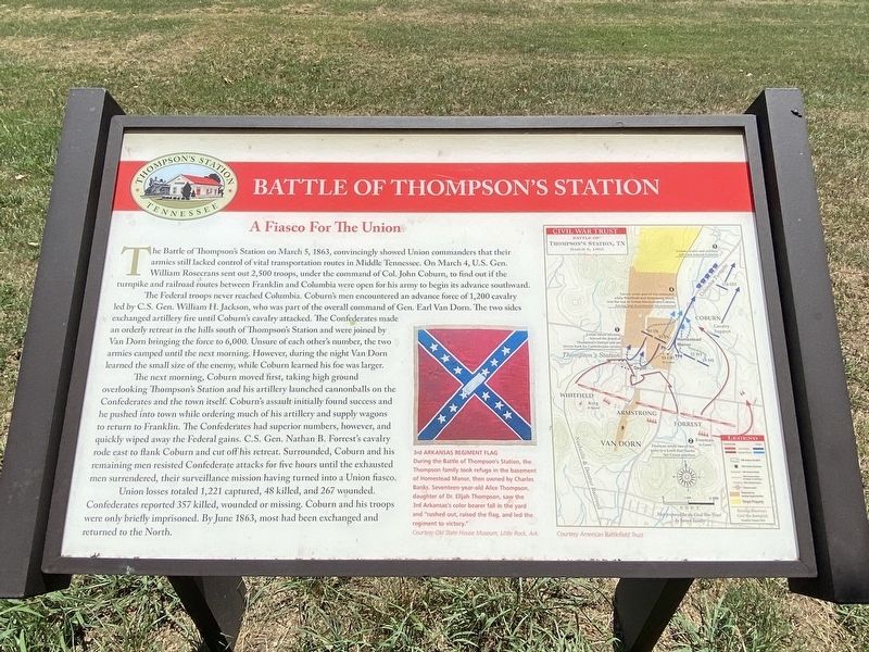
Battle of Thompson's Station
A Fiasco For The Union
The Federal troops never reached Columbia. Coburn's men encountered an advance force of 1,200 cavalry led by C.S. Gen. William H. Jackson, who was part of the overall command of Gen. Earl Van Dorn. The two sides exchanged artillery fire until Coburn's cavalry attacked. The Confederates made an orderly retreat in the hills south of Thompson's Station and were joined by Van Dorn bringing the force to 6,000. Unsure of each other's number, the two armies camped until the next morning. However, during the night Van Dorn learned the small size of the enemy, while Coburn learned his foe was larger.
The next morning, Coburn moved first, taking high ground overlooking Thompson's Station and his artillery launched cannonballs on the Confederates and the town itself. Coburn's assault initially found success and he pushed into town while ordering much of his artillery and supply wagons to return to Franklin. The Confederates had superior numbers, however, and quickly wiped away the Federal gains. C.S. Gen. Nathan B. Forrest's cavalry rode cast to flank Coburn and cut off his retreat. Surrounded, Coburn and his remaining men resisted Confederate attacks for five hours until the exhausted men surrendered, their surveillance mission having turned into a Union fiasco.
Union losses totaled 1,221 captured, 48 killed, and 267 wounded. Confederates reported 357 killed, wounded or missing. Coburn and his troops were only briefly imprisoned. By June 1863, most had been exchanged and returned to the North.
3rd Arkansas Regiment Flag
During the Battle of Thompson's Station, the Thompson family took refuge in the basement of Homestead Manor, then owned by Charles Banks. Seventeen year old Alice Thompson, daughter of Dr. Elijah Thompson, saw the 3rd Arkansas's color bearer fall in the yard and "rushed out, raised the flag, and led the regiment to victory."
Courtesy of Old State House Museum, Little Rock, Ark.
Topics. This historical marker is listed in this topic list: War, US Civil. A significant historical date for this entry is March 5, 1863.
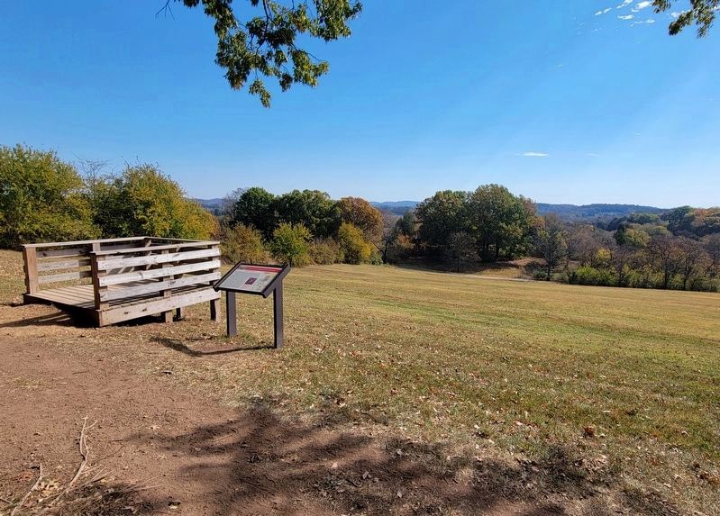
Location. 35° 48.501′ N, 86° 54.565′ W. Marker is in Thompson's Station, Tennessee, in Williamson County. Marker can be reached from Depot Trail. Located within Preservation Park. Touch for map. Marker is at or near this postal address: 2018 Depot Trl, Thompsons Station TN 37179, United States of America. Touch for directions.
Other nearby markers. At least 8 other markers are within walking distance of this marker. War and Occupation (about 400 feet away, measured in a direct line); Rebuilding the Countryside (about 600 feet away); Building a Railroad Town, 1855-1993 (about 700 feet away); Slavery at Thompson's Station (about 700 feet away); Early Settlers (approx. ¼ mile away); A Deep Past, Rich Land (approx. 0.4 miles away); Thompson's Station (approx. 0.6 miles away); Thompson's Station Train Depot (approx. 0.6 miles away). Touch for a list and map of all markers in Thompson's Station.
Credits. This page was last revised on October 23, 2022. It was originally submitted on September 4, 2022, by Darren Jefferson Clay of Duluth, Georgia. This page has been viewed 301 times since then and 51 times this year. Photos: 1. submitted on September 5, 2022, by Darren Jefferson Clay of Duluth, Georgia. 2. submitted on October 23, 2022, by Bradley Owen of Morgantown, West Virginia. • Mark Hilton was the editor who published this page.

