Near Norwich in Muskingum County, Ohio — The American Midwest (Great Lakes)
The Historic National Road in Ohio
Mile Markers
Inscription.
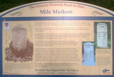
The Act of Congress in 1806, which authorized the construction of the National Road, required that mile markers be placed at regular intervals. These reference points reassured travelers that they were following the correct route. They also indicated the distance traveled and the distance to a destination.
The use of mile markers began in the Roman Empire with stone obelisks. The Roman mile markers appeared in the fourth century B.C. on the Empire’s legendary Appian Way, the road from Rome to Brindisi.
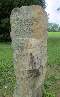
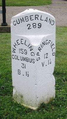
National Road mile markers were set at 1 mile intervals along the north side of the Road. Each states mile markers were a different design, but all displayed the same information. Ohio’s markers were square with round heads, made of an early form of concrete, sandstone, or limestone, while in Pennsylvania they were made of cast iron.
Ohio’s 5-foot tall markers were set 2 feet into the ground with 3 feet exposed. Each marker indicated the distance to Cumberland, Maryland, where the Road begins, and the name and mileage to the nearest cities and villages, for east and westbound travelers.
Whether the letters and numerals were painted or carved, markers followed a standard pattern of showing at the top the number of miles from the beginning of the National Road in Cumberland, Maryland. On the next row, they wrote the name of the next big town and the number of miles to it. On the left side of the marker, it would show eastbound travelers the next big town to the east. On the right side it would show westbound travelers the next big town to the west and the number of miles to go. On the lowest level, there was usually an initial and a small number. This indicated the nearest town. It did not need to be spelled out, because most people in the vicinity would recognize it from the initial.
By the 1920s, a uniform highway numbering system with standardized road signs replaced the old mile markers, but many remain along the Road. See how many you can indentify.
(3 pics, a crest) The Road That Helped Build The Nation An All American Road – National Scenic Byway
Erected by The Ohio National Road Association, Inc.
Topics. This historical marker is listed in this topic list: Roads & Vehicles.
Location. 39° 58.529′ N, 81° 49.355′ W. Marker is near Norwich, Ohio, in Muskingum County. Marker can be reached from the intersection of East Pike National Road (U.S. 40) and Zane Grey Road (County Route 199). Marker is in the parking lot of the National Road – Zane Grey Museum. Touch for map. Marker is at or near this postal address: 8850 E Pike, Norwich OH 43767, United States of America. Touch for directions.
Other nearby markers. At least 8 other markers
are within 2 miles of this marker, measured as the crow flies. Mile Markers (here, next to this marker); The Historic National Road (here, next to this marker); Warren Pony Truss Bridge (a few steps from this marker); Zane’s Trace Bridge (a few steps from this marker); Tomb Of The Unknown Soldier (about 400 feet away, measured in a direct line); Motels (about 500 feet away); Norwich (approx. 1.2 miles away); The Ralph Hardesty Stone House (approx. 1.7 miles away). Touch for a list and map of all markers in Norwich.
Additional commentary.
1. identical markers
There are at least two more markers, identical with this one; one in Kirkersville, Ohio and one in Reynoldsbirg, Ohio
— Submitted September 6, 2016, by Rev. Ronald Irick of West Liberty, Ohio.
Credits. This page was last revised on September 6, 2022. It was originally submitted on April 9, 2016, by Rev. Ronald Irick of West Liberty, Ohio. This page has been viewed 484 times since then and 24 times this year. Last updated on September 5, 2022, by Craig Doda of Napoleon, Ohio. Photos: 1, 2, 3, 4, 5. submitted on April 9, 2016, by Rev. Ronald Irick of West Liberty, Ohio. • J. Makali Bruton was the editor who published this page.
