Affton in St. Louis County, Missouri — The American Midwest (Upper Plains)
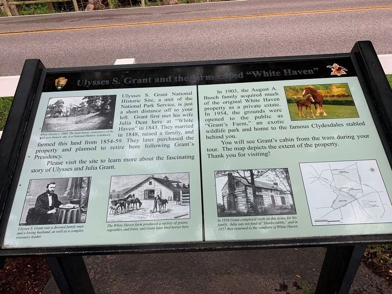
Ulysses S. Grant and the Farm at White Haven
Inscription.
Ulysses S. Grant National Historic Site, a unit of the National Park Service, is just a short distance off to your left. Grant first met his wife Julia Dent here at "White Haven" in 1843. They married in 1848, raised a family, and farmed this land from 1854-59. They later purchased the property and planned to retire here following Grant's Presidency.
Please visit the site to learn more about the fascinating story of Ulysses and Julia Grant.
In 1903, the August A. Busch family acquired much of the original White Haven property as a private estate. In 1954, the grounds were opened to the public as "Grant's Farm," an exotic wildlife park and home to the famous Clydesdales stabled behind you.
You will see Grant's cabin from the farm during your tour. The map depicts the extent of the property. Thank you for visiting!
[Captions:]
Ulysses S. Grant was a devoted family man and a loving husband, as well as a complex visionary leader.
The White Haven farm produced a variety of grains, vegetables, and fruits, and Grand later bred horses here.
In 1856 Grant completed work on this home for his family. Julia was not fond of "Hardscrabble," and in 1857 they returned to the comforts of White Haven.
Topics. This historical marker is listed in these topic lists: Agriculture • Animals • Industry & Commerce • Parks & Recreational Areas • Settlements & Settlers. A significant historical year for this entry is 1843.
Location. 38° 33.062′ N, 90° 21.199′ W. Marker is in Affton, Missouri, in St. Louis County. Marker is on Grant Road, 0.3 miles west of Gravois Road (State Highway 30), on the right when traveling west. The marker stands at the entrance to Grant's Farm. Touch for map. Marker is at or near this postal address: 7500 Bull Run Dr, Saint Louis MO 63123, United States of America. Touch for directions.
Other nearby markers. At least 8 other markers are within walking distance of this marker. In Memory of August A. Busch, Jr. (a few steps from this marker); Grant's Departure / ~150 Years Ago (about 300 feet away, measured in a direct line); Changes at White Haven / ~150 Years Ago - Grants Horses (about 300 feet away); Working Plantation / ~150 Years Ago - Emancipation (about 400 feet away); A Slave Plantation (about 400 feet away); White Haven (about 500 feet away); Outbuildings / ~150 Years Ago—Colored Troops (about 600 feet away); Green Haven? (about 600 feet away). Touch for a list and map of all markers in Affton.
Credits. This page was last revised on September 9, 2022. It was originally submitted on September 6, 2022, by Thomas Smith of Waterloo, Ill. This page has been viewed 111 times since then and 14 times this year. Photo 1. submitted on September 6, 2022, by Thomas Smith of Waterloo, Ill. • Devry Becker Jones was the editor who published this page.
Editor’s want-list for this marker. A wide shot of the marker in context. • Can you help?
