Lower Windsor Township near York in York County, Pennsylvania — The American Northeast (Mid-Atlantic)
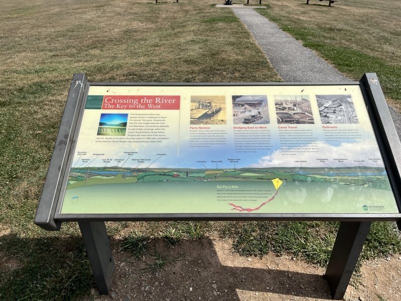
Crossing the River
The Key to the West
The Susquehanna River has always posed a challenge to travel. For almost 150 years, Wrightsville had the only bridge between here and Maryland. Conventional attempts to add bridge crossings with the Lower Susquehanna Gorge below Wrightsville were short lived due to storms, floods or ice jams. Success came in 1968 with completion of the Norman Wood Bridge near Suquehannock State Park.
Ferry Service
During the 1700s and 1800s boats ferried travelers across the Susquehanna. Drivers poled flat-bottomed ferry boats from one river bank to the other when crossings weren't blocked by flood, ice or low water. Wright's Ferry, on the main road from Philadelphia to York, was so well used that travelers sometimes had to wait two days for their turn.
Bridging East to West
Six bridges have been built across the Susquehanna between Wrightsville and Columbia. The first, built in 1814 at Wrightsville, was the longest covered bridge of its time. Destroyed by flooding and rebuilt to allow mules to pull canal boats across, it was burned by Union troops in 1863 to block Confederate troops. The bridge's stone piers are still visible. Travelers now use Veterans Memorial Bridge, the world's longest concrete, multiple-arch bridge.
Canal Travel
Rocky shallows and mysterious deeps made the Lower Susquehanna Gorge treacherous for early travelers. In 1802, the Susquehanna Canal was completed on the eastern shore, but flooding and ice still hindered travel. In 1840, the Susquehanna and Tidewater Canal opened along the west bank, with 29 locks allowing boats to journey the 43 miles from Havre de Grace, Maryland, to Wrightsville. Baltimore could then access Pennsylvania's coal, lumber and other raw materials.
Railroads
Railroads eventually made canals obsolete. Trains moved freight and people faster, with year-round dependability. Trains continue to run today, although converted railroad beds offer great opportunities for hiking and biking.
Go Fly a Kite
Samuel S. Lewis State Park occupies the top of Mt. Pisgah, a popular site to catch updrafts that send kites skyward. Walking, picnicking and playing disc golf are other summertime recreational opportunities. In the winter, hit the slopes with a sled or toboggan.
Erected by Pennsylvania Department of Conservation and Natural Resources.
Topics and series. This historical marker is listed in these topic lists: Bridges & Viaducts • Industry & Commerce • Railroads & Streetcars • War, US Civil • Waterways & Vessels. In addition, it is included in the Covered Bridges series list. A significant historical year for this entry is 1968.
Location.
Other nearby markers. At least 8 other markers are within 2 miles of this marker, measured as the crow flies. Parks are for People (within shouting distance of this marker); George E. Stine Arboretum (about 300 feet away, measured in a direct line); America's First Iron Steamboat (approx. 1.7 miles away); W. Henry Crumling (approx. 1.8 miles away); Wrightsville (approx. 1.8 miles away); Road of Remembrance (approx. 1.9 miles away); World War Memorial (approx. 2 miles away); Veterans Memorial (approx. 2 miles away).
Credits. This page was last revised on February 7, 2023. It was originally submitted on September 7, 2022, by Devry Becker Jones of Washington, District of Columbia. This page has been viewed 80 times since then and 17 times this year. Photos: 1, 2. submitted on September 7, 2022, by Devry Becker Jones of Washington, District of Columbia.

