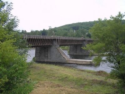
Minisink in Sullivan County, New York — The American Northeast (Mid-Atlantic)
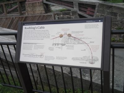
Roebling’s Cable
Upper Delaware Scenic and Recreational River
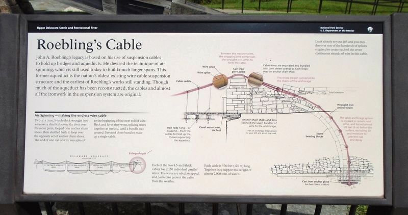
Air Spinning – making the endless wire cable
Two at a time, 36-inch-thick wrought iron wires were shuttled across the river over the stone piers, looped over anchor chain shoes, then shuttled back to loop over the opposite set of anchor chain shoes. The end of one roll of wire was spliced to the beginning of the next roll of wire. Back and forth they went, splicing wires together as needed, until a bundle was created. Seven of these bundles made up a single cable.
Each of the two 8.5-inch thick cables has 2,150 individual parallel wires. The wires are oiled, wrapped, and painted to protect the cable from the weather. Each cable is 576 feet (176 m) long. Together they support the weight of almost 2,000 of water.
Iron rods hang – or suspend – from the cables to hold up the trusses supporting the aqueduct. Between the masonry piers, the wrapping wire compresses the wrought iron wires to form the cables. Cable wires are separated and bundled into their seven strands as each loops over an anchor chain shoe. Anchor chain shoes and pins connect the seven bundles of wire to the anchorage. Shoes are pin-connected to the chains of the anchorage. The cable anchorage system is encased in cement and stone, and buried almost 20 feet (6 m) below the surface, excluding air and moisture to prevent rust and decay. Look closely to your left and you may discover one of the hundreds of splices required to create each of the seven continuous strands of wire into this cable.
Erected by National Park Service.
Topics. This historical marker is listed in this topic list: Waterways & Vessels.
Location. 41° 28.971′ N, 74° 59.019′ W. Marker is in Minisink, New York, in Sullivan County. Marker is at the intersection of New York State Route 97 and Minisink Road, on the left when traveling north on State Route 97. Touch for map. Marker is in this post office area: Eldred NY 12732, United States of America. Touch for directions.
Other nearby markers. At least 8 other markers are within walking distance of this marker. Life Along the Canal (a few steps from this marker); Delaware & Hudson Canal (a few steps from this marker); Bridge (within shouting distance of this marker); Roebling’s Delaware Aqueduct (within shouting distance of this marker); Battle of Minisink (within shouting distance of this marker); a different marker also named Battle of Minisink (about 300 feet away, measured in a direct line); Conflicts with Timber Rafts (about 400 feet away in Pennsylvania); Breaking the Ice (about 500 feet away in Pennsylvania). Touch for a list and map of all markers in Minisink.
More about this marker. The marker contains an illustration of the Delaware Aqueduct with the various parts labeled.
Related markers. Click here for a list of markers that are related to this marker. Markers found at the Delaware Aqueduct Nation Park Service Unit.
Also see . . . Roebling's Delaware Aqueduct. National Park Service website. (Submitted on July 6, 2009, by Bill Coughlin of Woodland Park, New Jersey.)
Credits. This page was last revised on August 7, 2018. It was originally submitted on July 6, 2009, by Bill Coughlin of Woodland Park, New Jersey. This page has been viewed 1,268 times since then and 33 times this year. Photos: 1, 2, 3, 4, 5. submitted on July 6, 2009, by Bill Coughlin of Woodland Park, New Jersey. 6. submitted on August 7, 2018, by William Fischer, Jr. of Scranton, Pennsylvania.
