
Resaca in Gordon County, Georgia — The American South (South Atlantic)
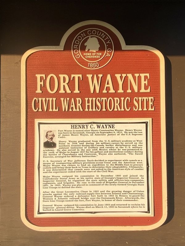
Henry C. Wayne
Fort Wayne
| — | Civil War Historic Site | — |
Photographed by Darren Jefferson Clay, September 17, 2022
1. Henry C. Wayne Marker
Fort Wayne is named after Henry Constantine Wayne. Henry Wayne was born in Savannah, Georgia on September 8, 1815. He was the son of James Moore Wayne, an Associate Justice of the U.S. Supreme Court.
Henry Wayne graduated from the U.S. military academy at West Point in 1838 and during his military career, he served on the northern frontier during the Canada border disturbances and was assistant instructor of artillery and cavalry at the U.S. military academy. He also served in the war with Mexico where he was promoted to the rank of Major in August 1847 for his gallant and meritorious conduct during the battles of Churubusco and Contreras. Wayne also authored, "The Sword Exercise, arranged for Military Instruction."
U.S. Secretary of War Jefferson Davis decided to experiment with camels as a means of transporting military provisions across Texas and the American west. Major Wayne was chosen to lead an expedition to the Middle East to procure camels and bring them back to Texas to determine their adaptability. Ultimately, it was determined that camels were not suited to the American style of combat and the experiment
this page online
Major Wayne resigned his commission in December 1860 and joined the Confederate States Army as his native state of Georgia's Inspector General. As Inspector General, he organized the state militia and officers into companies, regiments, and brigades. He rose to the rank of Brigadier General in December 1861. In 1862, Wayne was placed in command of the newly formed Georgia State Line Troops to defend the state.
After the Great Locomotive Chase in 1862 and the growing danger of Union attacks against the only railroad supply line between Atlanta and Chattanooga, General Wayne ordered a defensive fort built in 1863 in Resaca to guard the Western & Atlantic railroad bridge over the Oostanaula River. Afterwards, the State Line Troops named the fort, Fort Wayne, in honor of their commander.
General Wayne resigned his commission in June 1864 and returned to reclaim his inspector general duties. Wayne died on March 15, 1883 in Savannah where he is buried in Laurel Grove Cemetery.
Topics. This historical marker is listed in these topic lists: Bridges & Viaducts • Forts and Castles •
Photographed by Darren Jefferson Clay, September 17, 2022
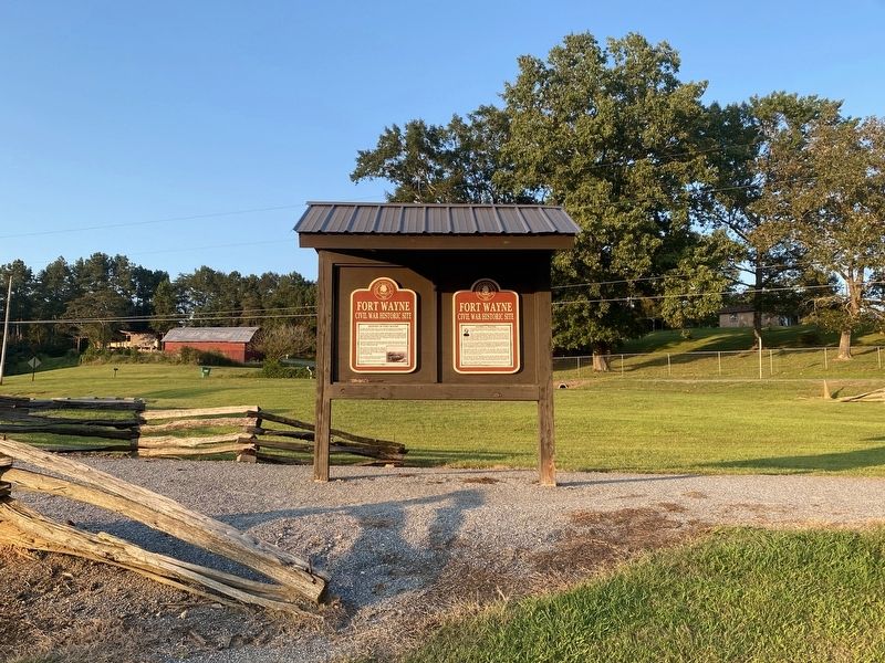
2. Henry C. Wayne Marker
Location. 34° 34.957′ N, 84° 56.279′ W. Marker is in Resaca, Georgia, in Gordon County. It can be reached from Taylor Ridge Road 136 miles east of Nicklesville Road NE, on the right when traveling east. Loacted in Fort Wayne County Park. Touch for map. Marker is at or near this postal address: 164 Taylor Ridge Rd, Resaca GA 30735, United States of America. Touch for directions.

Regionally, this marker is in Georgia’s Mountains. It is also in the American South, specifically in the Deep South, in Appalachia, and specifically in Southern Appalachia. Globally, it is in North America, the Western Hemisphere, the Western World, and the Anglosphere. Historically, it finds itself in what was once the original Cherokee Nation, the territory of the Mississippian Culture, one of the original Thirteen Colonies, one of the Confederate States of America, and the Antebellum South.
Other nearby markers. At least 8 other markers are within walking distance of this marker: History of Fort Wayne (here, next to this marker); 28th Ga. Co. G, Freeman's Guard (within shouting distance of this marker); Battle of Resaca (approx. 0.3 miles away); Oostanaula River Bridges (approx. ¾ mile away); Dancers in the Red Clay Minuet (approx. 0.9 miles away); South Toward Atlanta (approx. 0.9 miles away); Logan's XV Corps to the South (approx. 0.9 miles away); Resaca — A Defensible Position (approx. 0.9 miles away). Touch for a list and map of all markers in Resaca.
Credits. This page was last revised on September 19, 2022. It was originally submitted on September 17, 2022, by Darren Jefferson Clay of Duluth, Georgia. This page has been viewed 515 times since then and 48 times this year. Photos: 1, 2. submitted on September 18, 2022, by Darren Jefferson Clay of Duluth, Georgia. • Bernard Fisher was the editor who published this page.
