San Felipe in Austin County, Texas — The American South (West South Central)
Founding the Town
Lot 47
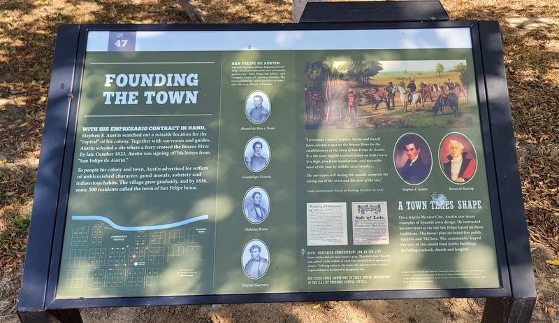
With his Empresario contract in hand, Stephen F. Austin searched out a suitable location for the "capital" of his colony. Together with surveyors and guides, Austin selected a site where a ferry crossed the Brazos River. By late October 1823, Austin was signing off his letters from "San Felipe de Austin."
To people his colony and town, Austin advertised for settlers of unblemished character, good morals, sobriety and industrious habits. The village grew gradually, and by 1836, some 500 residents called the town of San Felipe home.
San Felipe de Austin was a link between cultures. Regional governor Felipe de la Garza named the town to honor his patron saint - Saint Philip (San Felipe) - and recognize Stephen F. Austin as founder. The town patriotically named its streets to honor other Mexican officials and leaders.
"Lieutenant Colonel Stephen Austin and myself have selected a spot on the Brazos River for the establishment of the town of San Felipe de Austin. It is the most eligible location found on both rivers; it is high, free from inundations, and accessible most of the year by middle-sized vessels....
The surveyors will during this month, complete the laying out of the town and division of the lots."
Land commissioner Baron de Bastrop, October 20, 1823
A Town Takes Shape
On a trip to Mexico City, Austin saw many examples of Spanish town design. He instructed his surveyors to lay out San Felipe based on those traditions. The town's plan included five public squares and 582 lots. The community hoped the sale of lots would fund public buildings, including a school, church and hospital.
Center Portraits:
Manuel de Mier y Terán
Guadalupe Victoria
Nicholas Bravo
Vicente Guerrero
Right Side Portraits:
Stephen F. Austin
Baron de Bastrop
Captions
Lower Right (1): Above: Newspaper Announcement and Ad for Lots - Some settlers did not heed Austin's plan. They built their "shanties and cabins" in the middle of what were intended to be squares and streets. To bring order to the town, the ayuntamiento (council) required them to be moved to designated lots.
Lower Right (2): Top: Stick Stock (Surveyors in Texas before Annexation to the U.S.), by Theodore Gentilz (Details)
Images courtesy: Beinecke Rare Book and Manscript Library, Yale University; Baron de Bastrop by Diana L. Huntdt; Los Gobernantes de Mexico, by Manuel Rivera Cambus, 1873; Copy of George Catlin's portrait of Stephen F. Austin by Robert Joy, San Jacinto Museum of History; Stick Stock, San Antonio Museum of Art
Sponsor Plaque on top
This wayside is generosity underwritten by
The Brown Foundation, Inc.
Erected by San Felipe de Austin State Historic Site.
Topics. This historical marker is listed in these topic lists: Hispanic Americans • Immigration • Industry & Commerce • War, Texas Independence. A significant historical month for this entry is October 1823.
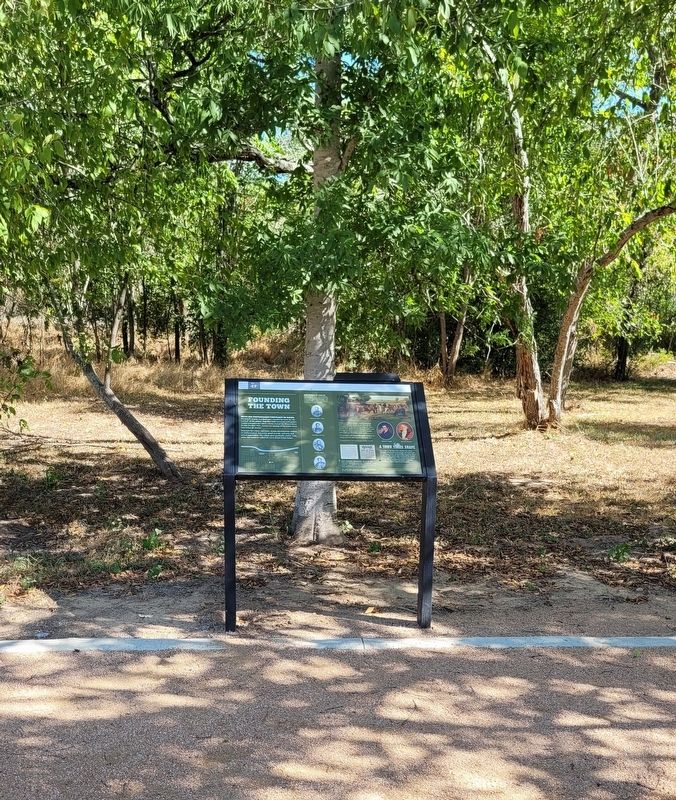
Location. 29° 48.352′ N, 96° 5.77′ W. Marker is in San Felipe, Texas, in Austin County. Marker can be reached from the intersection of 2nd Street and Farm to Market Road 1458. The marker is located in the western section of the San Felipe de Austin State Historic Site along the pathway. Touch for map. Marker is at or near this postal address: 220 2nd Street, San Felipe TX 77473, United States of America. Touch for directions.
Other nearby markers. At least 8 other markers are within walking distance of this marker. Building the Town (within shouting distance of this marker); A Home on Commerce Square (within shouting distance of this marker); Governing the Town (within shouting distance of this marker); Bottomland Farms (about 300 feet away, measured in a direct line); Spanish Town (about 300 feet away); Burning of the Town
(about 300 feet away); Rio Brazos (about 300 feet away); Clopper Store (about 400 feet away). Touch for a list and map of all markers in San Felipe.
More about this marker. The marker is located on the grounds of the San Felipe de Austin Historic Site. There is a small fee to access the historic site and markers.
Also see . . .
1. San Felipe de Austin History. Texas Historical Commission
San Felipe de Austin was founded in 1824 by Stephen F. Austin as the unofficial capital of his colony. It became the first urban center in the Austin colony, which stretched northward from the Gulf of Mexico as far as the Old San Antonio Road and extended from the Lavaca River in the west to the San Jacinto River in the east. By October 1823, after briefly considering a location on the lower Colorado River, Austin decided to establish his capital on the Brazos River. The site chosen was on a high, easily defensible bluff overlooking broad, fertile bottomlands. The location offered a number of advantages, including a central location and sources of fresh water independent of the Brazos.(Submitted on September 18, 2022, by James Hulse of Medina, Texas.)
2. Austin, Stephen Fuller (1793–1836)
. Texas State Historical Association
Stephen Fuller Austin, founder of Anglo-American Texas, son of Moses and Maria (Brown) Austin, was born at the lead mines in southwestern Virginia on November 3, 1793. In 1798 Moses Austin moved his family to other lead mines in southeastern Missouri and established the town of Potosi in what is now Washington County. There Stephen grew to the age of eleven, when his father sent him to a school in Connecticut, from which he returned westward and spent two years at Transylvania University in Lexington, Kentucky. At Potosi, Moses Austin was engaged in the mining, smelting, and manufacturing of lead and, in addition, conducted a general store. After his return from Transylvania in the spring of 1810, Stephen Austin was employed in the store and subsequently took over the management of most of the lead business. He served the public as adjutant of a militia battalion and for several years was a member of the Missouri territorial legislature, in which he was influential in obtaining the charter for the Bank of St. Louis. After failure of the Austin business in Missouri, he investigated opportunities for a new start in Arkansas and engaged in land speculation and mercantile activities. While he was there the territorial governor appointed him circuit judge of the first judicial district of Arkansas. He took the oath of office and qualified in July 1820, but he only briefly held court, for at the end of August he was in Natchitoches, Louisiana, and in December in New Orleans, where he had made arrangements to live in the home of Joseph H. Hawkins and study law. At this time Moses Austin was on his way to San Antonio to apply for a grant of land and permission to settle 300 families in Texas.(Submitted on September 18, 2022, by James Hulse of Medina, Texas.)
Credits. This page was last revised on March 6, 2024. It was originally submitted on September 18, 2022, by James Hulse of Medina, Texas. This page has been viewed 102 times since then and 14 times this year. Photos: 1, 2, 3, 4. submitted on September 18, 2022, by James Hulse of Medina, Texas.


