Lewes & Rehoboth Hundred in Rehoboth Beach in Sussex County, Delaware — The American Northeast (Mid-Atlantic)
The Nation's Summer Capitol
Rehoboth Beach
| — | Beach Blast Facts | — |
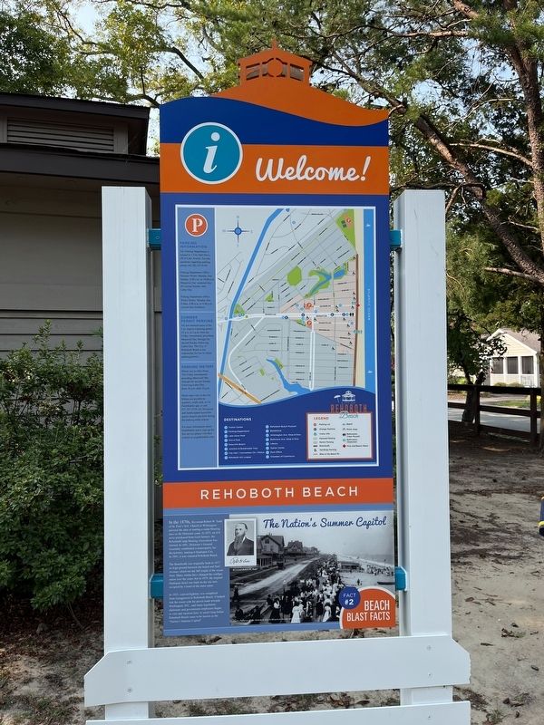
In the 1870s, Reverend Robert W. Todd of St. Paul's M.E. Church in Wilmington pursued the idea of starting a camp Meeting area on the Delaware coast. In 1873, on 414 acres purchased from local farmers, the RehobothCamp Meeting Association was formed. In 1891, Delaware's General Assembly established a municipality for the territory, naming it Henlopen City. In 1891, it was renamed Rehoboth Beach.
The Boardwalk was originally built in 1873 on high ground between the beach and Surf Avenue, which ran the full length of the ocean front. Many storms have changed the configuration over the years; but in 1879, the original Henlopen Hotel was built on the site now occupied by a hotel of the same name.
In 1925, a paved highway was completed from Georgetown to Rehoboth Beach. It helped link the resort with the paved roads toward Washington, D.C.; and many legislators, diplomats and government employees began to visit and vacation here. It wasn't long before Rehoboth Beach came to be known as the "Nation's Summer Capital".
Erected 2022 by City of Rehoboth Beach, Delaware. (Marker Number 2.)
Topics. This historical
this page online
Location. 38° 42.951′ N, 75° 5.508′ W. Marker is in Rehoboth Beach, Delaware, in Sussex County. It is in Lewes & Rehoboth Hundred. It is at the intersection of Grove Street and Henlopen Avenue, on the left when traveling north on Grove Street. Touch for map. Marker is at or near this postal address: 171 Henlopen Ave, Rehoboth Beach DE 19971, United States of America. Touch for directions.

Regionally, this marker is on Delaware’s Beaches. It is also in the American Mid-Atlantic, on the Delmarva Peninsula, and on the Eastern Seaboard. Globally, it is in the North Atlantic Region, North America, the Western Hemisphere, the Western World, and the Anglosphere. Historically, it finds itself in what was once New Netherland, one of the original Thirteen Colonies, and the Antebellum South.
Other nearby markers. At least 8 other markers are within walking distance of this marker: Traveling to the Beach (about 300 feet away,
Additional commentary.
1. Capital or Capitol?
Both words are used on this marker. However, they are two different things. A capital usually refers to a city or government center. A capitol usually refers to the physical building that houses the government. (e.g. Washington, DC is the nation's capital while the Capitol Building that houses the legislative branch of the government in the Capitol Hill neighborhood is the nation's capitol.)
— Submitted September 18, 2022, by Devry Becker Jones of Washington, District of Columbia.
Credits. This page was last revised on June 5, 2026. It was originally submitted on September 18, 2022, by Devry Becker Jones of Washington, District of Columbia. This page has been viewed 289 times since then and 24 times this year. Photos: 1, 2. submitted on September 18, 2022, by Devry Becker Jones of Washington, District of Columbia.
