Resaca in Gordon County, Georgia — The American South (South Atlantic)
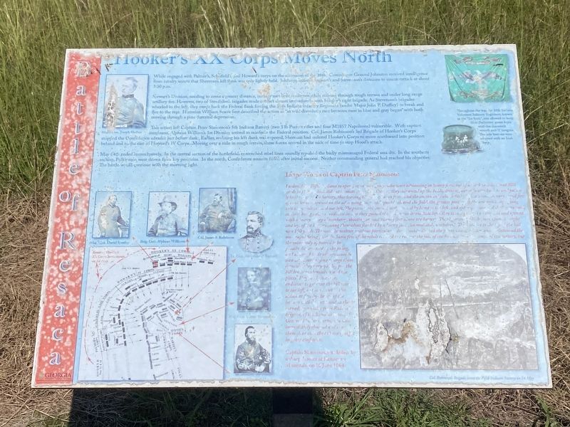
Hooker's XX Corps Moves North
— Battle of Resaca —
Stewart's Division needing to cover a greater distance, initially met little resistance while moving through rough terrain and under long range artillery fire. however, two of Stevenson's bridges made contact almost immediately with Stanley's right brigade. As Stevenson's brigades wheeled to the left, they swept back the Federal flank forcing the 35th Indiana Infantry Regiment (under Major John P. Duffey ) to break and flee to the rear. Historian William Scaife best described the action as "in wild disorder, a race between men in blue and gray began"with both moving through a pine-forested depression.
This action left Captain Peter Simonson's 5th Indiana battery (two 3 lb Parrott rifles and four M1857 Napoleons) vulnerable. With capture imminent, Alpheus Williams's 1st Division arrived to reinforce the Federal position. Col. James Robinson's 3rd Brigade of Hooker's Corps stopped the Confederate advance just before dark. Earlier, realizing his left flank was exposed, Sherman had ordered Hooker's Corps to move northward into position behind and to the east of Howard's IV Corps. Moving over a mile in rough terrain , these forces arrived in the nick of time to stop Hood's attack.
May 14th ended inconclusively. In the central section of the battlefield, entrenched rebel line soundly repulsed the badly mismanaged Federal assaults. In the southern section, Polk's men were driven from key positions. In the north, Confederate assaults failed after initial success. Neither commanding general had reached his objective.
In the words of Captain Peter Simonson:
I ordered the Fifth Indiana to open fire on the enemy, who were advancing in heavy force out of a thick woods, about 800 ards in front, which did not immediately check them as they advanced up the fields, driving our infantry back to and part of it in the rear of the battery, thus leaving the field clear in front and the enemy only about 400 yards distant. A very rapid fire of canister was opened on the advancing foe, a which quickly cleared the field, the greater portion of the enemy's troops going into the woods toward our left. The pieces were immediately turned by hand to the left, and spherical case and shell were used , canister being held in readiness case they gained the hilton our immediate left. They soon appeared on this hill and opened with a heavy volley of musketry, shooting at least twenty feet above the battery. The regiment , which were upon the right and left of the battery seeing themselves flanked by a heavy force, immediately withdrew. The distance to the top of the hill was 150 yards, The men themselves, without particular orders, double shotted the pieces with canister, and maintained the most rapid firing possible. Some few of the rebels (indecipherable) the road at the foot of the hill, within city yards of the battery, but the main body appeared to be greatly disconcerted by the firing, and although their officers could be seen and heard trying to urge them forward, they very quickly put the hill between themselves and the pieces. They (indecipherable) endeavor to get over the hill more to our left but were met in this attack at first by the fire of the battery with canister, and as they turned , by a volley from Robinson's brigade, of William's division, of General Hooker's Corps, and who immediately charged and drove them clear over the hill to of sight in great confusion.
Captain Simonsson was killed by a sharpshooter at Kennesaw Mountain on 16 June 1864.
(caption)
Throughout the war, the 35th Indiana Volunteer Infantry Regiment, known as the "1st Irish", was allowed to keep their distinctive green kepis with the shamrock wreath and "1" insignia. The side buttons were adorned with an Irish harp.
Topics. This historical marker is listed in this topic list: War, US Civil. A significant historical date for this entry is May 14, 1864.
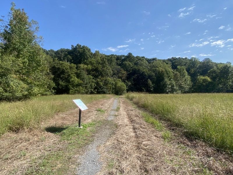
Location. 34° 36.405′ N, 84° 57.719′ W. Marker is in Resaca, Georgia, in Gordon County. Marker can be reached from the intersection of Resaca Lafayette Road NW (Georgia Route 136) and Worley Road, on the right when traveling west. Located at the Resaca Battlefield Historic Site. Touch for map. Marker is in this post office area: Resaca GA 30735, United States of America. Touch for directions.
Other nearby markers. At least 8 other markers are within walking distance of this marker. Battle of Resaca (approx. 0.4 miles away); 103rd O.V.I. (approx. 0.4 miles away); Battle of Resaca, Georgia (approx. 0.7 miles away); a different marker also named Battle of Resaca (approx. 0.7 miles away); a different marker also named Battle of Resaca (approx. 0.7 miles away); a different marker also named Battle of Resaca, Georgia (approx. 0.7 miles away); The Resaca Confederate Cemetery (approx. ¾ mile away); a different marker also named Battle of Resaca (approx. ¾ mile away). Touch for a list and map of all markers in Resaca.
Also see . . . Resaca Battlefield Historic Site. Gordon County Parks & Recreation Department. (Submitted on September 20, 2022.)
Credits. This page was last revised on September 20, 2022. It was originally submitted on September 19, 2022, by Darren Jefferson Clay of Duluth, Georgia. This page has been viewed 97 times since then and 19 times this year. Photos: 1, 2. submitted on September 19, 2022, by Darren Jefferson Clay of Duluth, Georgia. • Bernard Fisher was the editor who published this page.

