North Capitol in Nashville in Davidson County, Tennessee — The American South (East South Central)
Walkway of the Counties
⎯⎯⎯
Mountains

Photographed by Darren Jefferson Clay, November 11, 2022
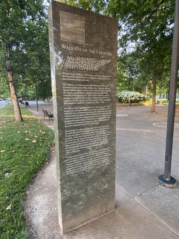
1. Walkway of the Counties / Mountains Marker
The walkway is divided at points representing the three grand divisions of Tennessee-West, Middle, East. Along the path are circular granite plaques, one for each Tennessee county. beneath the plaques are buried time capsules containing memorabilia collected for the Bicentennial. These plaques and time capsules populate the walkway and provide a symbolic presence for the counties at the Bicentennial Mall. The capsules will be unearthed and opened on Tennessee's Tricentennial, June 1, 2096.
The land of Tennessee is rich and diverse. To the west the state is bordered by the Mississippi River, the largest in North America, and to the east it is bordered by the ancient Appalachian Mountains which include the majestic, beloved Smokies. The north and south borders of the state are defined primarily by survey lines, as if the great parallelogram shape of Tennessee was established as a slice of America, possessing an intriguing variety
this page online
The planting area adjacent to the walkway is essentially level at the south end and becomes progressively more rolling and hilly, rising to the highest mounds as the path reaches the northern terminus. These land forms represent the varied topography across the state from the west to the mountains of the east. Groupings of native plants have been selected to correspond to the land forms and their growth regions. Additional markers explain their character and significance of the state's nine physiographic regions each with unique geology, topography, and associated plant communities.
Through topography, planting, rock outcrops, county markers and interpretive singing, the area adds to the sense of place and awareness of the natural environment of Tennessee. Unlike the Pathway of History on the west edge of the park where the passage of events is recorded in stone, time here is marked by the slow change of the seasons: the first blooms of dogwood and redbud, the blossoms of summer, the blaze of maples and sumacs in the fall, and the holly berries of winter.
Photographed by Darren Jefferson Clay, June 11, 2022
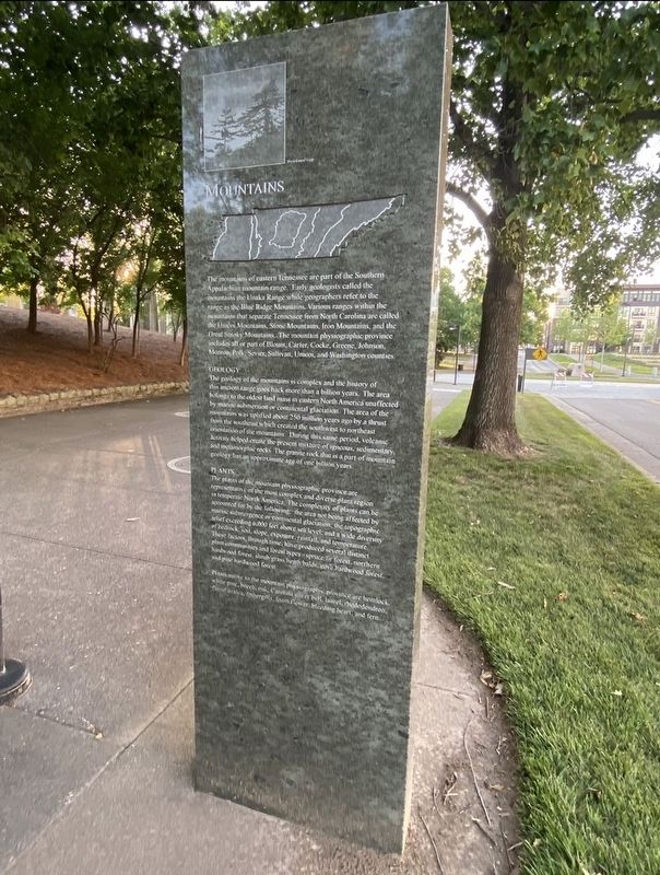
2. Walkway of the Counties / Mountains Marker
Geology
The geology of the mountains is complex and the history of the ancient range goes back more than a billion years. The area belongs to the oldest land mass in eastern North America unaffected by marine submersion or continental glaciation. The area of the mountains was uplifted about 250 million years ago by a thrust from the southeast which created the southwest to northeast orientation of the mountains. During this same period, volcanic activity helped create the present mixture of igneous, sedimentary, and metamorphic rocks. The granite rock that is a part of mountain geology has
Photographed by Darren Jefferson Clay, June 11, 2022
3. Walkway of the Counties / Mountains Marker
Plants
The plants of the mountain physiographic province are representative of the most complex and diverse plant region in temperate North America. The complexity of plants can be accounted for by the following: the area not being affected by marine submergence or continental glaciation, the topographic relief exceeding 6,000 feet above sea level, and a wide diversity of bedrock, soil, slope, exposure, rainfall, and temperature. These facts, through time, have produced several distinct plant communities and forest types - spruce, fir forest, northern hardwood forest, shrub grass heath bands, cove hardwood forest, and pine hardwood forest.
Plants native to the mountain physiographic province are hemlock, white pine, beech, oak, Carolina silver bell, laurel, rhododendron, flame azalea, fothergilla, foam flower, bleeding heart, and fern.
Topics and series. This historical marker is listed in this topic list: Natural Features. In addition, it is included in the Time Capsules series list.
Location. 36° 10.366′ N, 86° 47.283′ W. Marker is

Photographed by Darren Jefferson Clay, June 11, 2022
4. Walkway of the Counties / Mountains Marker

Regionally, this marker is in Middle Tennessee. It is also in the American South and specifically in the Upper South. Globally, it is in North America, the Western Hemisphere, the Western World, and the Anglosphere. Historically, it finds itself in what was once the territory of the Mississippian Culture, one of the Confederate States of America, and the Antebellum South.
Other nearby markers. At least 8 other markers are within walking distance of this marker: Washington County (here, next to this marker); Sullivan County (here, next to this marker); Unicoi County (a few steps from this marker); Hamblen County (a few steps from this marker); Carter County (a few steps from this marker); Greene County (a few steps from this marker); Johnson County (a few steps from this marker); Cocke County (a few steps from this marker). Touch for a list and map of all markers in Nashville.
Credits. This page was last revised on February 7, 2023. It was originally submitted on September 20, 2022, by Darren Jefferson Clay of Duluth, Georgia. This page has been viewed 242 times since then and 28 times this year. Photos: 1. submitted on November 11, 2022, by Darren Jefferson Clay of Duluth, Georgia. 2, 3, 4. submitted on September 29, 2022, by Darren Jefferson Clay of Duluth, Georgia. • Mark Hilton was the editor who published this page.
