North Capitol in Nashville in Davidson County, Tennessee — The American South (East South Central)
Ridge and Valley ⎯⎯⎯ Cumberland Plateau
Photographed by Darren Jefferson Clay, June 11, 2022
1. Ridge and Valley / Cumberland Plateau Marker
Inscription.
Ridge and Valley, also, Cumberland Plateau. .
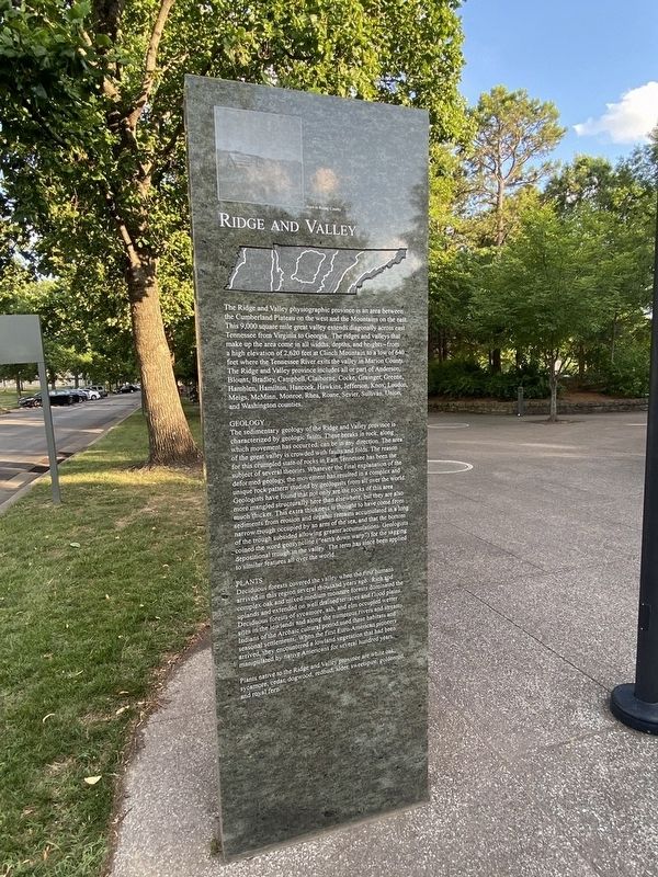
Ridge and Valley. The Ridge and Valley physiographic province is an area between the Cumberland Plateau on the west and the Mountains on the east. This 9,000 square mile great valley extends diagonally across east Tennessee from Virginia to Georgia. The ridges and valleys make up the area come in all widths, depths, and heights-from a high elevation of 2,620 feet in Clinch Mountain to a low of 640 feet where the Tennessee River exits the valley in Marion County. The Ridge and Valley province includes all or part of Anderson, Blount, Bradley, Campbell, Claiborne, Cocke, Grainger, Greene, Hamblen, Hamilton, Hancock, Hawkins, Jefferson, Knox, Loudon, Meigs, McMinn, Monroe, Rhea, Roane, Sevier, Sullivan, Union, and Washington counties., Geology The sedimentary geology of the Ridge and Valley province is characterized by geologic faults. These breaks in rocks, along which movement has occurred, can be in any direction. The area of the great valley is crowded with faults and folds. The reason for this crumpled state of rocks in East Tennessee has been the subject of several theories. Whatever the final explanation of the deformed geology, the movement has resulted in a complex and unique rock pattern studied by geologists from all over the world. Geologists have found that not only are the rocks of this area more mangled structurally here than elsewhere, but they are also much thicker. This extra thickness is thought to have come from sediments from erosion and organic remains accumulated in a long trough occupied by an arm of the sea, and that the bottom of the trough subsided allowing greater accumulations. Geologists coined the word geosyncline ("earth down warp") for the sagging depositional trough in the valley. The term has since been applied to similar features all over the world. , Plants Deciduous forests covered the valley when the first humans arrived in this region several thousand years ago. Rich and complex oak and mixed medium moisture forests dominated the uplands and extended on well drained terraces and flood plains. Deciduous forests of sycamore, ash, and elm occupied wetter sites in the lowlands and along the numerous rivers and streams. indies of the Archaic cultural period used these habitats and seasonal settlements. When the first Euro-American pioneers arrived, they encountered a lowland vegetation that had been manipulated by native Americans for several hundred years. , Plants native to the Ridge and Valley province are white, oak, sycamore, cedar, dogwood, redbud, alder, sweetspine, goldenrod, and royal fern.,
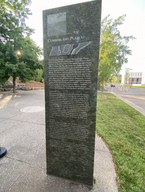
Cumberland Plateau. The Cumberland Plateau is a part of the Appalachian Plateau which extends from the southern border of New York to central Alabama. Its character is that of a flat topped ridge approximately 1000 feet higher than the valley on the cast. Around the edge of the plateau is an almost continuous line of cliffs interrupted by narrow stream cut ravines running back into the interior of the plateau. The plateau, containing about 4,300 square miles, is about 55 miles wide along the northern border of the state and narrows to about 38 miles in width in Marion County. Much of the interior of the plateau is a flat tableland of poorly drained soils, in which there exists a variety of wetland situations including floodplains, swamp forests, natural ponds, and wet meadows. The Cumberland Plateau includes all or part of Anderson, Bledsoe, Campbell, Cumberland, Fentress, Grundy, Hamilton, Marion, Morgan, Overton, Rhea, Sequatchie, Scott, Van Buren, and White counties. , Geology Hard rock layers of the plateau were folded daring the mountain building process. Along the eastern edge the rocks were folded or broken so that the same layers of rocks that compose the flat rim rock on the west are tilted vertically in the east to form an escarpment armored with sandstone layers. This effect is absent on the west which has eroded and has less extreme slopes. Faults were also a part of the mountain building process. The Sequatchie Valley is a product of a 180 mile break and subsequent erosion creating a large linear valley. The Cumberland Mountains of the plateau are composed mostly of shale layered with coal beds. Coal, which occurs throughout the plateau, is the most important mineral product in the state. bedrock over much of the plateau is coarse sandstone with outcrops of limestone and shale is the gorges., Plants The plateau plant communities reflect the differences in soils and moisture that are related to geologic substrate and topographic position. Upland vegetation ranges from red maple dominated stands on poorly drained soils to pines on dry ridges and cliff edges. Broad flatlands and gentle slopes of the plateau are covered with mixed oaks and hickory. Gorge communities are dominated by sugar maple, basswood, ash, and buckeye with hemlock being prominent in narrow of rare plants plus forests of black gum, red maple, and sweetgum. , Plants native to the Cumberland Plateau physiographic province are pine, hemlock, maple, beech, oak, yellowwood, serviceberry, smoke tree, sourwood, laurel, sweet shrub, viburnum, cumberland rosemary, and goatsbeard.
Ridge and Valley
The Ridge and Valley physiographic province is an area between the Cumberland Plateau on the west and the Mountains on the east. This 9,000 square mile great valley extends diagonally across east Tennessee from Virginia to Georgia. The ridges and valleys make up the area come in all widths, depths, and heights-from a high elevation of 2,620 feet in Clinch Mountain to a low of 640 feet where the Tennessee River exits the valley in Marion County.
The Ridge and Valley province includes all or part of Anderson, Blount, Bradley, Campbell, Claiborne, Cocke, Grainger, Greene, Hamblen, Hamilton, Hancock, Hawkins, Jefferson, Knox, Loudon, Meigs, McMinn, Monroe, Rhea, Roane, Sevier, Sullivan, Union, and Washington counties.
Geology
The sedimentary geology of the Ridge and Valley province is characterized by geologic faults. These breaks in rocks, along which movement has occurred, can be in any direction. The area of the great valley is crowded with faults and folds. The reason for this crumpled state of rocks in East Tennessee has been the subject of several theories. Whatever the final explanation of
Click or scan to see this page online
the deformed geology, the movement has resulted in a complex and unique rock pattern studied by geologists from all over the world. Geologists have found that not only are the rocks of this area more mangled structurally here than elsewhere, but they are also much thicker. This extra thickness is thought to have come from sediments from erosion and organic remains accumulated in a long trough occupied by an arm of the sea, and that the bottom of the trough subsided allowing greater accumulations. Geologists coined the word geosyncline ("earth down warp") for the sagging depositional trough in the valley. The term has since been applied to similar features all over the world.
Plants
Deciduous forests covered the valley when the first humans arrived in this region several thousand years ago. Rich and complex oak and mixed medium moisture forests dominated the uplands and extended on well drained terraces and flood plains. Deciduous forests of sycamore, ash, and elm occupied wetter sites in the lowlands and along the numerous rivers and streams. indies of the Archaic cultural period used these habitats and seasonal settlements.
Photographed by Darren Jefferson Clay, June 11, 2022
2. Ridge and Valley / Cumberland Plateau Marker
When the first Euro-American pioneers arrived, they encountered a lowland vegetation that had been manipulated by native Americans for several hundred years.
Plants native to the Ridge and Valley province are white, oak, sycamore, cedar, dogwood, redbud, alder, sweetspine, goldenrod, and royal fern.
Cumberland Plateau
The Cumberland Plateau is a part of the Appalachian Plateau which extends from the southern border of New York to central Alabama. Its character is that of a flat topped ridge approximately 1000 feet higher than the valley on the cast. Around the edge of the plateau is an almost continuous line of cliffs interrupted by narrow stream cut ravines running back into the interior of the plateau. The plateau, containing about 4,300 square miles, is about 55 miles wide along the northern border of the state and narrows to about 38 miles in width in Marion County. Much of the interior of the plateau is a flat tableland of poorly drained soils, in which there exists a variety of wetland situations including floodplains, swamp forests, natural ponds, and wet meadows. The Cumberland Plateau includes all or part of Anderson,
Photographed by Darren Jefferson Clay, June 11, 2022
3. Ridge and Valley / Cumberland Plateau Marker
Bledsoe, Campbell, Cumberland, Fentress, Grundy, Hamilton, Marion, Morgan, Overton, Rhea, Sequatchie, Scott, Van Buren, and White counties.
Geology
Hard rock layers of the plateau were folded daring the mountain building process. Along the eastern edge the rocks were folded or broken so that the same layers of rocks that compose the flat rim rock on the west are tilted vertically in the east to form an escarpment armored with sandstone layers. This effect is absent on the west which has eroded and has less extreme slopes. Faults were also a part of the mountain building process. The Sequatchie Valley is a product of a 180 mile break and subsequent erosion creating a large linear valley. The Cumberland Mountains of the plateau are composed mostly of shale layered with coal beds. Coal, which occurs throughout the plateau, is the most important mineral product in the state. bedrock over much of the plateau is coarse sandstone with outcrops of limestone and shale is the gorges.
Plants
The plateau plant communities reflect the differences in soils and moisture that are related to geologic substrate and topographic position. Upland vegetation ranges from red maple dominated stands on poorly drained soils to pines on dry ridges and cliff edges. Broad flatlands and gentle slopes of the plateau are covered with mixed oaks and hickory. Gorge communities are dominated by sugar maple, basswood, ash, and buckeye with hemlock being prominent in narrow of rare plants plus forests of black gum, red maple, and sweetgum.
Plants native to the Cumberland Plateau physiographic province are pine, hemlock, maple, beech, oak, yellowwood, serviceberry, smoke tree, sourwood, laurel, sweet shrub, viburnum, cumberland rosemary, and goatsbeard.
Topics. This historical marker is listed in this topic list: Natural Features.
Location. 36° 10.328′ N, 86° 47.258′ W. Marker is in Nashville, Tennessee, in Davidson County. It is in North Capitol. It is on 6th Avenue North, on the left when traveling north. Located within the Bicentennial Capitol Mall State Park. Touch for map. Marker is at or near this postal address: 1000 6th Ave N, Nashville TN 37208, United States of America. Touch for directions.

Regionally, this marker is in Middle Tennessee. It is also in the American South and specifically in the Upper South. Globally, it is in North America, the Western Hemisphere, the Western World, and the Anglosphere. Historically, it finds itself in what was once the territory of the Mississippian Culture, one of the Confederate States of America, and the Antebellum South.
Credits. This page was last revised on February 7, 2023. It was originally submitted on September 20, 2022, by Darren Jefferson Clay of Duluth, Georgia. This page has been viewed 370 times since then and 55 times this year. Photos:1, 2, 3. submitted on September 29, 2022, by Darren Jefferson Clay of Duluth, Georgia. • Mark Hilton was the editor who published this page.
