Granville in Licking County, Ohio — The American Midwest (Great Lakes)
Granville's Earliest Residents
Photographed by Cosmos Mariner, September 12, 2022
1. Granville's Earliest Residents Marker
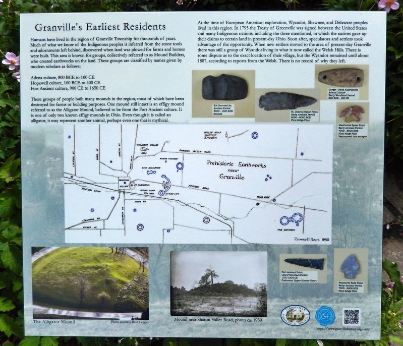
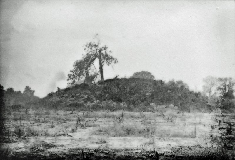
Humans have lived in the region of Granville Township for thousands of years. Much of what we know of the Indigenous peoples is inferred from the stone tools and adornments left behind, discovered when land was plowed for farms and homes were built. This area is known for groups, collectively referred to as Mound Builders, who created earthworks on the land. These groups are classified by names given by modern scholars as follows:
Adena culture, 800 BCE to 100 CE
Hopewell culture, 100 BCE to 400 CE
Fort Ancient culture, 900 CE to 1650 CE
These groups of people built many mounds in the region, most of which have been destroyed for farms or building purposes. One mound still intact is an effigy mound referred to as the Alligator Mound, believed to be from the Fort Ancient culture. It is one of only two known effigy mounds in Ohio. Even though it is called an alligator, it may represent another animal, perhaps even one that is mythical.
At the time of European American exploration, Wyandot, Shawnee, and Delaware peoples lived in this region. In 1795 the Treaty of Greenville was signed between the United States and many Indigenous
this page online
Erected 2022 by Granville Historical Society; and Granville Community Foundation.
Topics. This historical marker is listed in these topic lists: Anthropology & Archaeology • Indigenous Peoples and Communities • Settlements & Settlers. A significant historical year for this entry is 1795.
Location. 40° 4.064′ N, 82° 31.168′ W. Marker is in Granville, Ohio, in Licking County. It is at the intersection of East Broadway (Ohio Route 661) and Linden Place, on the right when traveling east on East Broadway. Marker is located in the garden courtyard directly in front of the Granville Historical Society Museum. Touch for map.
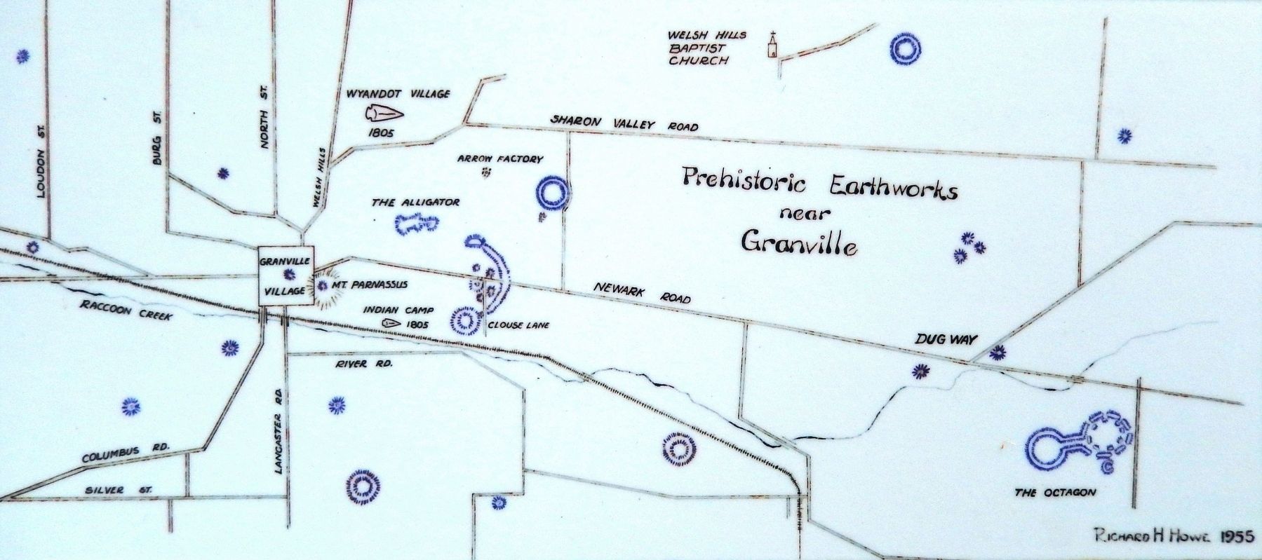
Courtesy Richard H. Howe, 1955
2. Marker detail: Prehistoric Earthworks near Granville

Regionally, this marker is in the Columbus Metropolitan Area. It is also in the American Midwest, in the Corn Belt, in Appalachia, and specifically in Northern Appalachia. Globally, it is in North America, the Western Hemisphere, the Western World, and the Anglosphere. Historically, it finds itself in what was once the Haudenosaunee (Iroquois) Confederacy, the territory of the Mississippian Culture, and the Northwest Territory.
Other nearby markers. At least 8 other markers are within walking distance of this marker: Granville's Broadway (here, next to this marker); Bank of the Alexandrian Society (here, next to this marker); Granville's Welsh Hills (here, next to this marker); St. Luke's Episcopal Church (a few steps from this marker); Bolen Memorial Park (within shouting distance of this marker); Founding of Granville, The Licking Company / The Granville Site, "The most eligible part" (within shouting distance of this marker); Granville Opera House (within shouting distance of this marker);
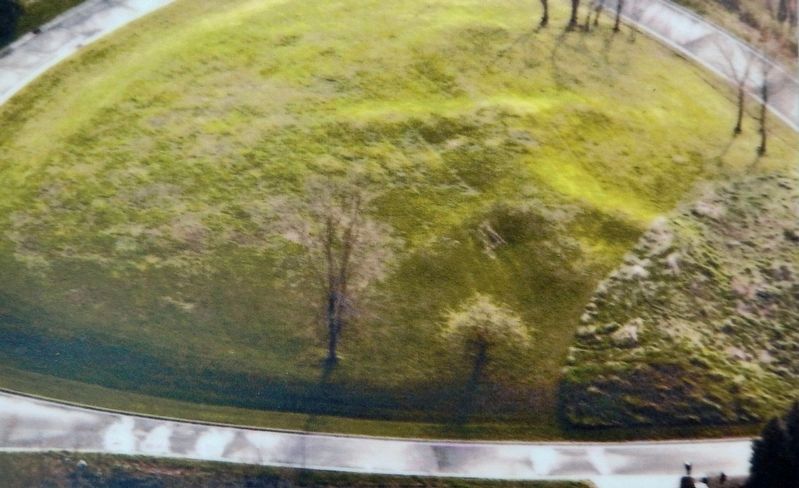
Courtesy Brad Lepper
3. Marker detail: Alligator Mound
Also see . . .
1. Visit Alligator Mound: A Fort Ancient Effigy. Great American Hikes website entry (Submitted on July 2, 2026, by Larry Gertner of New York, New York.)
2. Granville museum takes village’s history outdoors.
The “Granville’s Earliest Residents” board includes a map of the area’s Native American mounds. An aerial photo of the Alligator Mound on the hill at the end of Bryn Du Drive was provided by Brad Lepper, Senior Archeologist for the Ohio History Connection’s World Heritage Program, and there’s a photo of the mound provided by the Society’s Archives. The Society’s photographer, Ron Sherwood, made photos of the Native American tools found in the area from the Society’s collection.(Submitted on September 21, 2022, by Cosmos Mariner of Cape Canaveral, Florida.)
3. Treaty of Greenville - 1795.
Redefined the boundary between indigenous peoples' lands and territory for European American community settlement. It ended the Northwest Indian War in the Ohio Country,(Submitted on September 21, 2022, by Cosmos Mariner of Cape Canaveral, Florida.)limited Indian country to northwestern Ohio, and began the practice of annual payments following the land concessions. The parties to the treaty were a coalition of Native American tribes known as the Western Confederacy, and the United States government represented by General Anthony Wayne and local frontiersmen. The treaty became synonymous with the end of the frontier in that part of the Northwest Territory that would become the new state of Ohio.September 12, 20224. Marker detail: Mound near Sharon Valley Road, ca. 1930
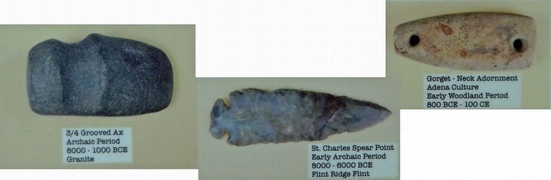
5. Marker detail: Artifacts
¾ Grooved Ax
Archaic Period
8000-1000 BCE
Granite
Archaic Period
8000-1000 BCE
Granite
St. Charles Spear Point
Early Archaic Period
8000-6000 BCE
Flint Ridge Flint
Gorget - Neck Adornment
Adena Culture
Early Woodland Period
800 BCE - 100 CE
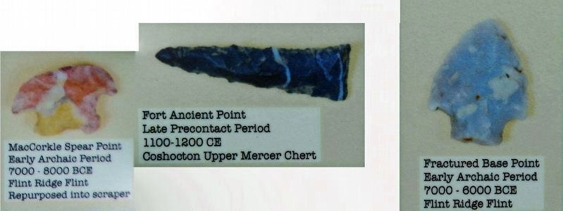
6. Marker detail: Artifacts
MacCorkle Spear Point
Early Archaic Period
7000-8000 BCE
Flint Ridge Flint
Repurposed into scraper
Early Archaic Period
7000-8000 BCE
Flint Ridge Flint
Repurposed into scraper
Fort Ancient Point
Late Precontact Period
1100-1200 CE
Coshocton Upper Mercer Chert
Fractured Base Point
Early Archaic Period
7000-6000 BCE
Flint Ridge Flint
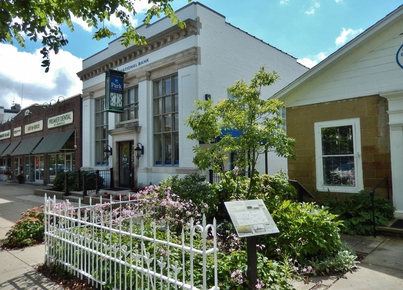
Photographed by Cosmos Mariner, September 12, 2022
7. Granville's Earliest Residents Marker
Credits. This page was last revised on July 2, 2026. It was originally submitted on September 21, 2022, by Cosmos Mariner of Cape Canaveral, Florida. This page has been viewed 579 times since then and 80 times this year. Photos: 1, 2, 3, 4, 5, 6, 7. submitted on September 21, 2022, by Cosmos Mariner of Cape Canaveral, Florida.
