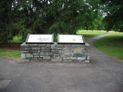
Near Sharpsburg in Washington County, Maryland — The American Northeast (Mid-Atlantic)
"Back Boys, For God's Sake Move Back;"
"You Are In A Bad Fix"
Inscription.
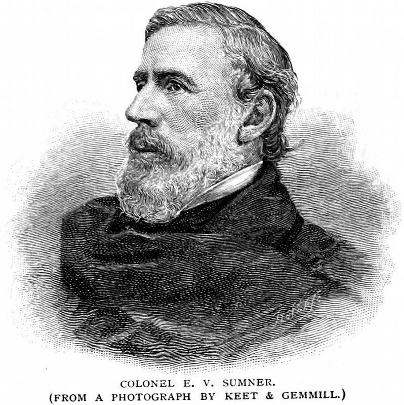
Gen. Edwin Vose Sumner, Union Second Corps Commander
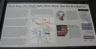
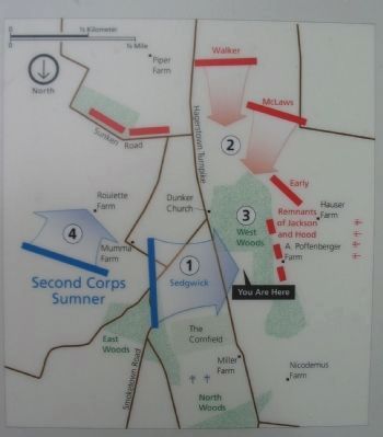
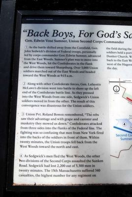
(1) As the battle shifted away from the Cornfield, Gen. John Sedwick's division of Federal troops, personally led by corps commander Gen. Edwin Sumner, advanced from the East Woods. Sumner's plan was to move into the West Woods, hit the Confederates in the flank and drive them toward Sharpsburg. Over 5,000 Union soldiers marched out of the East Woods and headed toward the West Woods at 9:15 a.m.
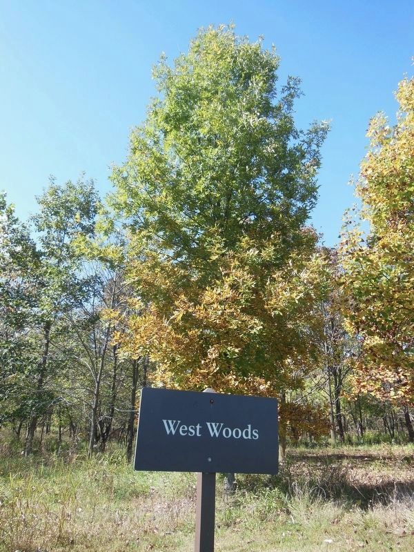
(2) Along with other Confederate forces, Gen. Lafayette McLaws's division went into battle to shore up the left end of the Confederate battle line. As they pressed into the West Woods from one side, Sedgwick's Union soldiers moved in from the other. The result of this convergence was disastrous for the Union soldiers.
(3) Union Pvt. Roland Bowen remembered, "The rebs saw their advantage and with grape and canister and musketry they mowed us down." Confederates attacked from three sides into the flanks of the Federal line. The fighting was so confusing that men from New York fired into the backs of the soldiers in front of them. Within twenty minutes, the Union troops fell back from the West Woods toward the north and east.
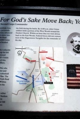
(4) As Sedgwick's men fled the West Woods, the other two divisions of the Second Corps assaulted the Sunken Road. Sedgwick had lost 2,200 out of 5,300 men in twenty minutes. The 15th Massachusetts suffered 340 casualties, the highest number for any regiment on the field during the battle. By 11:00 a.m. other Union soldiers held a portion of the West Woods around the Dunker Church. Within an hour they too were driven back to the East Woods. Federal forces did not venture west of the Hagerstown Turnpike for the remainder of the day.
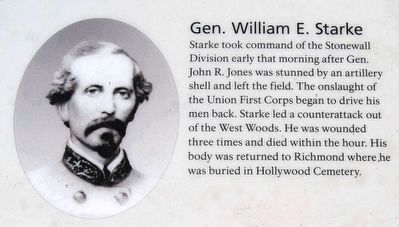
Gen. William E. Starke
Starke took command of the Stonewall Division early that morning after Gen. John R. Jones was stunned by an artillery shell and left the field. The onslaught of the Union First Corps began to drive his men back. Starke led a counterattack out of the West Woods. He was wounded three times and died within the hour. His body was returned to Richmond where he was buried in Hollywood Cemetery.
Flag of the 125th Pennsylvania Infantry
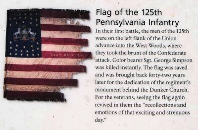
In their first battle, the men of the 125th were on the left flank of the Union advance into the West Woods, where they took the brunt of the Confederate attack. Color bearer Sgt. George Simpson was killed instantly. The flag was saved and was brought back forty-two years later for the dedication of the regiment's monument behind the Dunker Church. For the veterans, seeing the flag again revived in them the "recollections and emotions of that exciting and strenuous day."
West Woods Massacre
Approximate Time of Action: 9:30 a.m. to 10:30 a.m.
Approximate Number of Soldiers engaged:
Union 6,000
Confederate 8,000
Total 14,000
Approximate Number of Casualties for Each Army:
Union Army of the Potomac 2,300 killed, wounded, missing
Confederate Army of Northern Virginia 2,000 killed, wounded, missing
Erected 2009 by Antietam National Battlefield - National Park Service - U.S. Department of the Interior.
Topics. This historical marker is listed in this topic list: War, US Civil. A significant historical date for this entry is September 17, 1862.
Location. 39° 28.697′ N, 77° 44.969′ W. Marker is near Sharpsburg, Maryland, in Washington County. Marker is on Dunker Church Road / Old Hagerstown Pike, on the right when traveling south. Located at stop five of the driving tour of Antietam Battlefield, near the Philadelphia Brigade monument. Touch for map. Marker is in this post office area: Sharpsburg MD 21782, United States of America. Touch for directions.
Other nearby markers. At least 10 other markers are within walking distance of this marker. "The Jaws of Death" (here, next to this marker); "With Flags Flying" (here, next to this marker); The Onward Rush to Victory or Defeat (here, next to this marker); Philadelphia Brigade Monument (within shouting distance of this marker); "We May Never Meet Again" (within shouting distance of this marker); Philadelphia Brigade Park (within shouting distance of this marker); The Baltimore Battery (within shouting distance of this marker); a different marker also named Baltimore Battery (within shouting distance of this marker); Brigadier General William E. Starke (within shouting distance of this marker); Brockenbrough’s 2nd Baltimore, Maryland Battery (within shouting distance of this marker). Touch for a list and map of all markers in Sharpsburg.
More about this marker. In the center of the marker is a map depicting the action described in the text. Key points of the battle are indicated with the numbers referenced in the text. On the right is a portrait of Gen. Starke and a photo of the 125th Pennsylvania flag.
Related marker. Click here for another marker that is related to this marker. This marker replaced an older one at this location titled "The Jaws of Death."
Also see . . . Antietam Battlefield. National Park Service site. (Submitted on July 9, 2009, by Craig Swain of Leesburg, Virginia.)
Photographed By Brian Scott, September 19, 2015
6. "Back Boys, For God's Sake Move Back;" Marker
Starke took command of the Stonewall Division early that morning after Gen. John R. Jones was stunned by an artillery shell and left the field. The onslaught of the Union First Corps began to drive his men back. Starke led a counterattack out of the West Woods. He was wounded three times and died within the hour. His body was returned to Richmond where he was buried in Hollywood Cemetery.
Photographed By Brian Scott, September 19, 2015
7. "Back Boys, For God's Sake Move Back;" Marker
In their first battle, the men of the 125th were on the left flank of the Union advance into the West Woods, where they took the brunt of the Confederate attack. Color bearer Sgt. George Simpson was killed instantly. The flag was saved and was brought back forty-two years later for the dedication of the regiment's monument behind the Dunker Church. For the veterans, seeing the flag again revived in them the "recollections and emotions of that exciting and strenuous day."
Credits. This page was last revised on March 31, 2022. It was originally submitted on July 9, 2009, by Craig Swain of Leesburg, Virginia. This page has been viewed 1,469 times since then and 19 times this year. Photos: 1, 2, 3. submitted on July 9, 2009, by Craig Swain of Leesburg, Virginia. 4, 5, 6, 7. submitted on October 16, 2015, by Brian Scott of Anderson, South Carolina. 8. submitted on July 8, 2009, by Craig Swain of Leesburg, Virginia. 9. submitted on December 22, 2018, by Allen C. Browne of Silver Spring, Maryland. 10. submitted on April 17, 2021, by Bradley Owen of Morgantown, West Virginia.
