Near Marbury in Autauga County, Alabama — The American South (East South Central)
Myrick Chapel Cemetery
Autauga County
| — | Established 1870 | — |

Photographed by Mark Hilton, September 25, 2022
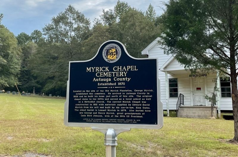
1. Myrick Chapel Cemetery Marker
Located on the site of the Old Myrick Plantation, George Myrick established this cemetery. He arrived in Autauga County in 1826 and he built his home just north of this site. The original chapel dates to the 1870s and served as a local school as well as a Methodist church. The current Myrick Chapel was constructed in 1912 with materials supplied by Edward David Myrick from his mill and built by his son-in-law, Sion Oates. The oldest burial is Lemuel Myrick in 1879. Also buried here are George and Nancy Myrick, great grandparents of Lady Bird Johnson, wife of the 36th US President.
Listed in the Alabama Historic Cemetery Register, January 16, 2015
Erected 2020 by the Myrick Chapel Family Society.
Topics. This historical marker is listed in these topic lists: Cemeteries & Burial Sites • Religion & Religious Structures. A significant historical year for this entry is 1826.
Location. 32° 39.61′ N, 86° 29.602′ W. Marker is near Marbury, Alabama, in Autauga County. It is on County Road 99 north of County Road 68W, on the right when traveling north. Touch for map. Marker is in this post office area: Marbury AL 36051,
this page online

Regionally, this marker is in the Tri-Counties River Region. It is also in the American South, specifically in the Deep South, and in the Black Belt. Globally, it is in North America, a Gulf of Mexico state, the Western Hemisphere, the Western World, and the Anglosphere. Historically, it finds itself in what was once New Spain, the territory of the Mississippian Culture, one of the Confederate States of America, and the Antebellum South.
Other nearby markers. At least 8 other markers are within 5 miles of this marker, measured as the crow flies: Mountain Creek Post Office (approx. 4.2 miles away); Woven Wire Fence (approx. 4.2 miles away); Steam Locomotive Bell (approx. 4.2 miles away); The Alabama Confederate Soldiers' Home (approx. 4.3 miles away); Site of the E. L. More, Fox Maull, Lizzie Cameron, (approx. 4.3 miles away); Alabama Forests (approx. 4.3 miles away); Mess Hall c. 1920-1929 (approx. 4.3 miles away); Memorial Tree (approx. 4.3 miles away). Touch for a list and map of all markers in Marbury.
Photographed by Mark Hilton, September 25, 2022
2. Myrick Chapel with cemetery on far left upper corner and marker.

Photographed by Mark Hilton, September 25, 2022
3. Myrick Chapel Cemetery

Photographed by Mark Hilton, September 25, 2022
4. Myrick Chapel
Credits. This page was last revised on May 7, 2024. It was originally submitted on September 25, 2022, by Mark Hilton of Montgomery, Alabama. This page has been viewed 2,830 times since then and 130 times this year. Photos: 1, 2, 3, 4. submitted on September 25, 2022, by Mark Hilton of Montgomery, Alabama.
