Moncks Corner in Berkeley County, South Carolina — The American South (South Atlantic)
Too Formidable to Take
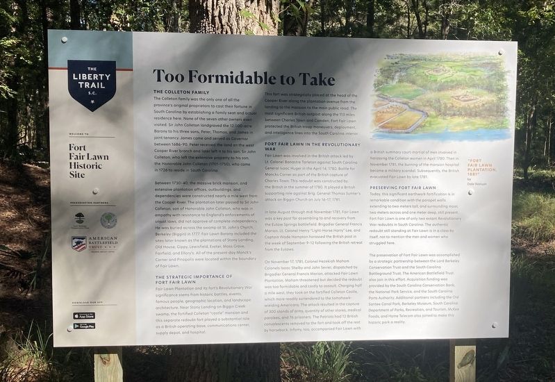
Fort Fair Lawn Historic Site
— The Liberty Trail S.C. —
The Colleton Family
The Colleton family was the only one of all the privince's original proprietors to cast their fortune in South Carolina by establishing a family seat and actual residence here. None of the seven other owners even visited. Sir John Colleton landgraved the 12,000-acre Barony to his three sons, Peter, Thomas, and James in joint tenancy. James came and served as Governor between 1686-90. Peter received the land on the west Cooper River branch and later left it to his son, Sir John Colleton, who left the extensive property to his son, the Honorable John Colleton (1701-1750), who came in 1726 to reside in South Carolina.
Between 1730-1740, the massive brick mansion, and extensive plantation offices, outbuildings, and dependencies were constructed nearly a mile west from the Cooper River. The plantation later passed to Sir John Colleton, son of Honorable John Colleton, who was in empathy with resistance to England's enforcements of unjust laws, did not approve of complete independency. He was bured across the swamp at St. John's Church, Berkeley (Biggin) in 1777. Fair Lawn Barony included the sites later known as the plantations of Stony Landing, Old House, Gippy, Lewisfield, Exeter, Moss Grove, Fairfield, and Ellory's. All of the present-day Monck's Corner and Pinopolis were located within the boundary of Fair Lawn.
The Strategic Importance of Fort Fair Lawn
Fair Lawn Plantation and its fort's Revolutionary War significance stems from historic battles, events, famous people, geographic location, and landscape architecture. Near Stony Landing on Biggin Creek swamp, the fortified Colleton "castle" mansion and this separate redoubt fort played a substantial role as a British operating base, communications center, supply depot, and hospital.
This fort was strategically placed at the head of the Cooper River along the plantation avenue from the landing to the mansion to the main public road. The most significant British outpost along the 113 miles between Charles Town and Camden, Fort Fair Lawn protected the British troop maneuvers, deployment, and intelligence lines in the South Carolina interior.
Fort Fair Lawn in the Revolutionary War
Fair Lawn was involved in the British attack led by Lt. Colonel Banastre Tarleton against South Carolina General Isaac Huger in the April 14, 1780, Battle for Moncks Corner as part of the British capture of Charles Town. This redoubt was constructed by the British in the summer of 1780. It played a British supporting role against Brig. General Thomas Sumter's attack on Biggin Church on July 16-17, 1781.
In late-August through mid-November 1781, Fair Lawn was a key post for assembling to and recovery from Eutaw Springs battlefield. Brigadier General Francis Marion, Lt. Colonel Henry "Light-Horse Harry" Lee, and Captain Wade Hampton harassed the British post in the week of September 9-12 following the British retreat from the Eutaws.
On November 17, 1781, Colonel Hezekiah Maham Colonels Isaac Shelby and John Sevier, dispatched by Brigadier General Francis Marion, attacked Fair Lawn Plantation. Maham threatened but decided the redoubt was too formidable and costly to assault. Charging half a mile west, they took on the fortified Colleton Castle, which more readily surrendered to the tomahawk-wielding Americans. The attack resulted in the capture of 300 stands of arms, quantity of other stores, medical parolees, and 76 prisoners. The Patriots had 12 British convalescents removed to the fort and took off the rest by horseback. Infamy, too, accompanied Fair Lawn with a British summary court-martial of men involved in harassing the Colleton women in April 1780. Then in November 1781, the burning of the mansion hospital became a military scandal. Subsequently, the British evacuated Fair Lawn by late 1781.
Preserving Fort Fair Lawn
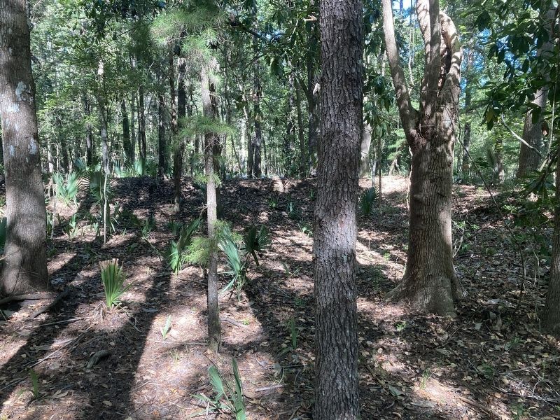
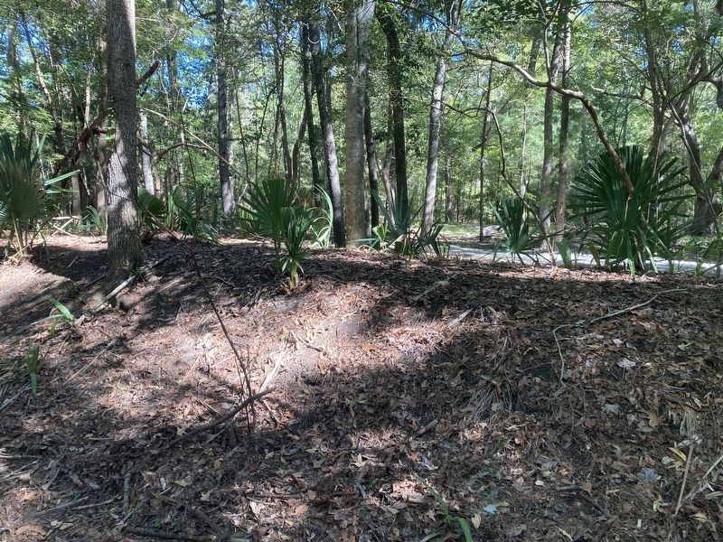
Today, this significant earthwork fortification is in remarkable condition with the parapet walls extending to two meters tall, and surrounding moat, two meters across and one meter deep, still present. Fort Fair Lawn is one of only two extant Revolutionary War redoubts in South Carolina. The authentic redoubt still standing at Fair Lawn is in a class by itself, not to mention the men and women who struggled here.
The preservation of Fort Fair Lawn was accomplished by a strategic partnership between the Lord Berkeley Conservation Trust and the South Carolina Battleground Trust. The American Battlefield Trust also join in this effort. Acquisition funding was provided by the South Carolina Conservation Bank, the National Park Service, and the South Carolina Ports Authority. Additional partners including the Old Santee Canal Park, Berkeley Museum, South Carolina Department of Parks, Recreation, and Tourism, McKee Foods, and Home Telecom also joined to make this historic park a reality. (caption) "Fort Fair Lawn Plantation, 1881" by Dale Watson
Erected 2022 by Lord Berkeley Conversation Trust, South Carolina Battleground Trust, American Battlefield Trust.
Topics. This historical marker is listed in these topic lists: Colonial Era • Forts and Castles • Settlements & Settlers • War, US Revolutionary. A significant historical date for this entry is November 17, 1781.
Location. 33° 11.592′ N, 79° 58.291′ W. Marker is in Moncks Corner, South Carolina , in Berkeley County. Marker can be reached from Stoney Landing Road, 0.8 miles east of Rembert C Dennis Boulevard (Bypass U.S. 52), on the right when traveling east. The fort remains are reachable by following a trail from the Berkeley County Museum. It is approximately a 0.75 mile walk through the woods from the trail head to the fort. Touch for map. Marker is at or near this postal address: 950 Stoney Landing Rd, Moncks Corner SC 29461, United States of America. Touch for directions.
Other nearby markers. At least 8 other markers are within one mile of this marker, measured as the crow flies. Colleton House: “Unmanly Practices” or Legitimate Target? (within shouting distance of this marker); Fort Fair Lawn: An Archeaological Treasure (within shouting distance of this marker); C.S.S. David (about 300 feet away, measured in a direct line); Berkeley County Museum and Heritage Center: A County's Story (about 400 feet away); Berkeley County Confederate Monument (about 400 feet away); Stony Landing House (about 500 feet away); Santee Canal (approx. 0.2 miles away); Wadboo Barony (approx. 1.1 miles away). Touch for a list and map of all markers in Moncks Corner.
Credits. This page was last revised on September 27, 2022. It was originally submitted on September 26, 2022. This page has been viewed 289 times since then and 53 times this year. Photos: 1, 2, 3. submitted on September 26, 2022. • Bernard Fisher was the editor who published this page.


