Hinckley in Pine County, Minnesota — The American Midwest (Upper Plains)
The Hinckley Fire
Photographed by Liz Koele, November 10, 2021
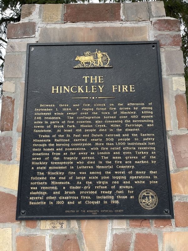
1. The Hinckley Fire Marker
Between three and five o’clock on the afternoon of September 1, 1894, a raging forest fire driven by strong southwest winds swept over the town of Hinckley, killing 248 residents. The conflagration burned over 480 square miles in parts of five counties, also consuming the surrounding towns of Brook Park, Mission Creek, Miller, Partridge, and Sandstone. At least 418 people died in the disaster.
Trains of the St. Paul and Duluth railroad and the Eastern Minnesota Railroad carried nearly 500 people to safety through the burning countryside. More than 1,500 individuals lost their homes and possessions, with fire relief efforts receiving donations from as far away as London and even Turkey as news of the tragedy spread. The mass graves of the Hinckley townspeople who died in the fire are marked by a state monument in Lutheran Memorial Cemetery.
The Hinckley fire was among the worst of many that followed the end of large scale pine logging operations in northern Minnesota. As the virgin red and white pine was removed, a tinder-dry refuse of stumps, slashings, and brush provided ready fuel for several other disastrous fires,
this page online
Erected 1985 by Minnesota Historical Society.
Topics. This historical marker is listed in these topic lists: Disasters • Environment. A significant historical date for this entry is September 1, 1894.
Location. 46° 1.244′ N, 92° 56.406′ W. Marker is in Hinckley, Minnesota, in Pine County. It is on St. Croix Scenic Byway, on the right when traveling north. Touch for map. Marker is in this post office area: Hinckley MN 55037, United States of America. Touch for directions.

Regionally, this marker is in Central Minnesota. It is also in the American Midwest and in the Corn Belt. Globally, it is in North America, the Great North Woods, the Western Hemisphere, the Western World, and the Anglosphere. Historically, it finds itself in what was once Rupert’s Land, the territory of the Mississippian Culture, and the Northwest Territory.
Other nearby markers. At least 8 other markers are within 14 miles of this marker, measured as the crow flies: The Great Hinckley Fire (approx. one mile away); Sandstone Area Veterans Memorial (approx. 8½ miles away); Forming Blocks (approx. 10.3
Photographed by Liz Koele, November 10, 2021
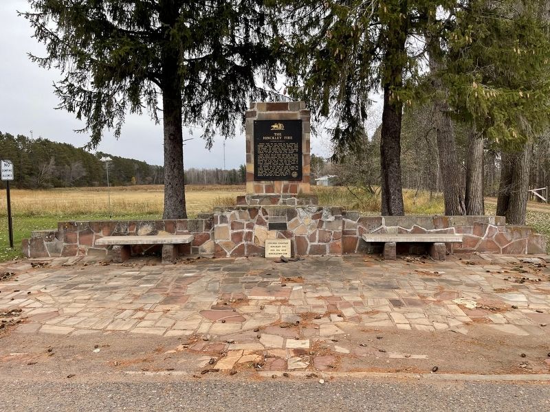
2. The Hinckley Fire Marker
Credits. This page was last revised on September 29, 2022. It was originally submitted on September 29, 2022, by Liz Koele of St. Paul, Minnesota. This page has been viewed 654 times since then and 67 times this year. Photos: 1, 2. submitted on September 29, 2022, by Liz Koele of St. Paul, Minnesota. • J. Makali Bruton was the editor who published this page.
