Corpus Christi in Nueces County, Texas — The American South (West South Central)
Felix Von Blucher
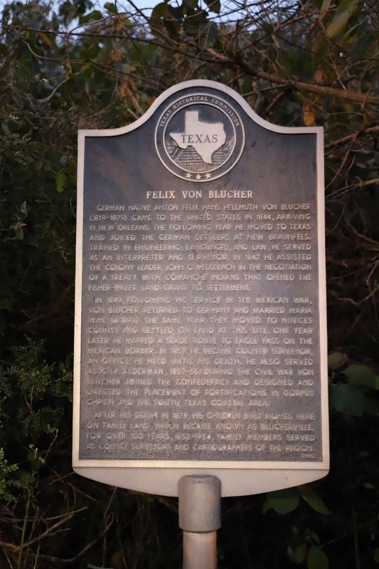
German native Anton Felix Hans Hellmuth von Blucher (1819-1879) came to the United States in 1844, arriving in New Orleans. The following year he moved to Texas and joined the German settlers at New Braunfels. Trained in engineering, languages, and law, he served as an interpreter and surveyor. In 1847 he assisted the colony leader, John O. Meusebach, in the negotiation of a treaty with Comanche Indians that opened the Fisher-Miller land grant to settlement.
In 1849, following his service in the Mexican War, Von Blucher returned to Germany and married Maria Imme (d. 1893). The same year they moved to Nueces County and settled on land at this site. One year later he mapped a trade route to Eagle Pass on the Mexican border. In 1852 he became county surveyor, an office he held until his death. He also served as city alderman, 1852-56. During the Civil War Von Blucher joined the Confederacy and designed and directed the placement of fortifications in Corpus Christi and the South Texas coastal area.
After his death in 1879, his children built homes here on family land, which became known as Blucherville. For over 100 years, 1852-1954, family members served as county surveyors and cartographers of the region.
Erected 1980 by Texas Historical Commission. (Marker Number 6306.)
Topics. This historical marker is listed in these topic lists: Communications • Immigration • Industry & Commerce • Native Americans • Settlements & Settlers • War, Mexican-American. A significant historical year for this entry is 1845.
Location. 27° 47.505′ N, 97° 24.001′ W. Marker is in Corpus Christi, Texas, in Nueces County. Marker is on South Carrizo Street just south of Blucher Street, on the left when traveling south. Touch for map. Marker is at or near this postal address: 212 S Carrizo St, Corpus Christi TX 78401, United States of America. Touch for directions.
Other nearby markers. At least 8 other markers are within walking distance of this marker. LULAC (approx. 0.2 miles away); Site of Cheston L. Heath School (approx. 0.2 miles away); Confederate Army Deserters Hanged in Corpus Christi (approx. ¼ mile away); Site of Kinney's Trading Post (approx. ¼ mile away); Centennial House (approx. ¼ mile away); Corpus Christi Cathedral Site (approx. ¼ mile away); Corpus Christi Cathedral (approx. ¼ mile away); Antonio E. Garcia (approx. 0.3 miles away). Touch for a list and map of all markers in Corpus Christi.
Credits. This page was last revised on September 30, 2022. It was originally submitted on September 29, 2022, by Dave W of Co, Colorado. This page has been viewed 84 times since then and 9 times this year. Photo 1. submitted on September 29, 2022, by Dave W of Co, Colorado. • Devry Becker Jones was the editor who published this page.
