Marietta in Washington County, Ohio — The American Midwest (Great Lakes)
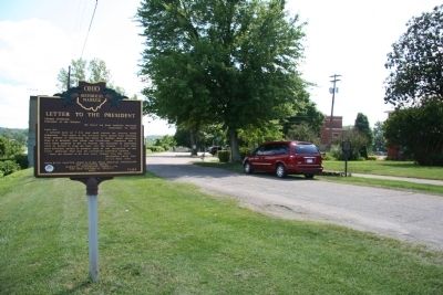
Lewis and Clark Expedition / Letter to the President
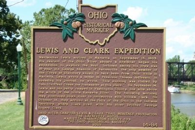
Meriwether Lewis arrived in Marietta on September 13, 1803. His descent of the Ohio River aboard a keelboat began his expedition to explore the West. Included among his crew was 18-year old George Shannon of Barnesville, the only member of the Corps of Discovery known to have been from Ohio. While in Marietta, Lewis wrote a letter to President Thomas Jefferson. In updating his journal, he wrote,"This evening was visited by Colo. [Griffen] Green the Postmaster at this place." On September 14, Lewis and his party camped in Washington County, one mile above the mouth of the Little Kanawha River. The following morning they continued down river to rendezvous with William Clark. On October 14, they arrived at the Falls of the Ohio in the Indiana Territory, where Clark lived with his older brother George Rogers Clark.
[Marker Reverse]:
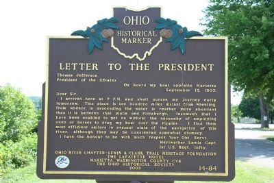
Thomas Jefferson
President of the UStates
September 13, 1803.
I arrived here at 7 P.M. and shall pursue my journey early tomorrow. This place is one hundred miles distant from Wheeling, from whence in descending the water is reather more abundant than it is between that place and Pittsburgh, insomuch that I have been enabled to get on without the necessity of employing oxen or horses to drag my boat over the ripples I find them most efficient sailors in present state of the navigation of this river, although they may be considered somewhat clumsey.
I have the honour to be with much respect Your Obt. Servt.
Meriwether Lewis Capt.
1st U.S. Regt. Infty.
Erected 2003 by Ohio River Chapter-Lewis & Clark Trail Heritage Foundation, and The Ohio Historical Society. (Marker Number 14-84.)
Topics and series. This historical marker is listed in these topic lists: Exploration • Heroes • Military • Notable Events. In addition, it is included in the Former U.S. Presidents: #03 Thomas Jefferson, the Lewis & Clark Expedition, and the Ohio Historical Society / The Ohio History Connection series lists. A significant historical month for this entry is September 1892.
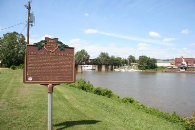
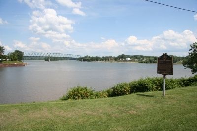
Location. 39° 24.611′ N, 81° 27.453′ W. Marker is in Marietta, Ohio, in Washington County. Marker is on Fort Street, 0 miles north of Fort Square, on the right when traveling north. This historical marker is located where the Muskingum River empties into the Ohio River, on the high west bank overlooking
the Muskingum River. This marker is situated very near the site of old Fort Harmar and across the Muskingum River from downtown Marietta. Touch for map. Marker is in this post office area: Marietta OH 45750, United States of America. Touch for directions.
Other nearby markers. At least 8 other markers are within walking distance of this marker. Barber House (a few steps from this marker); Site of the United States Fort Harmar (within shouting distance of this marker); Fort Harmar (within shouting distance of this marker); Save Harmar Bridge (about 400 feet away, measured in a direct line); B&O Harmar Bridge (about 400 feet away); Harmar Lodge No. 390 (about 500 feet away); Harmar Post Office (about 600 feet away); Fearing House (about 700 feet away). Touch for a list and map of all markers in Marietta.
Also see . . . Lewis and Clark Expedition. This web link was both published and made available by, "Absolute Astronomy.com," in it's quest to enable "exploring the universe of knowledge" (Submitted on July 11, 2009, by Dale K. Benington of Toledo, Ohio.)
Credits. This page was last revised on June 16, 2016. It was originally submitted on July 11, 2009, by Dale K. Benington of Toledo, Ohio. This page has been viewed 1,805 times since then and 39 times this year. Photos: 1, 2, 3, 4, 5. submitted on July 11, 2009, by Dale K. Benington of Toledo, Ohio. • Kevin W. was the editor who published this page.
