Stapleton on Staten Island in Richmond County, New York — The American Northeast (Mid-Atlantic)
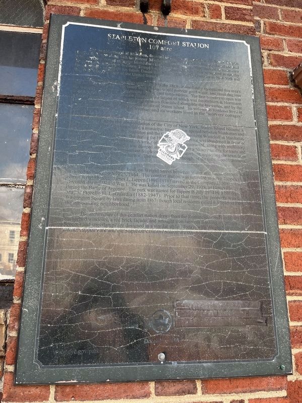
Stapleton Comfort Station
.107 acre

Photographed By Devry Becker Jones (CC0), October 8, 2022
1. Stapleton Comfort Station Marker
Unfortunately, the marker has significantly weathered.
The neighborhood of Stapleton, founded in 1836, was named for William J. Staples (1807-1883), who along with his partner Minthorn Thompkins (1807-1881), purchased the land in the northeast corner of Staten Island from the Vanderbilt family. They decided to name their development Stapleton because Tompkins's name had already been preserved in nearby Tompkinsville, named for his father, Daniel Tompkins (1774-1825), Governor of New York and the sixth Vice President of the United States.
German immigrants who settled here in the 1860s immediately recognized this area's beer brewing potential. The many fresh springs would provide food, water, and caves dug into the hillsides could be used for storing beer in cool temperatures. The first brewery to open was the Bechtel, and several others soon followed, the largest of which was the Rubsam & Hormann Atlantic Brewery. Several bottling companies flourished alongside the breweries, and by the 1870s Stapleton was the commercial center of Staten Island. Its well-to-do residents lived in grand houses along St. Paul's Avenue, and its workers lived in the "workers' cottages" downtown.
In 1898, upon consolidation of New York City, Staten Island became a borough of Greater New York. Ten years later, a municipal ferry service was opened between Manhattan and Staten Island. Two boats, the Stapleton and the Castleton, ran between Whitehall in Manhattan and Canal Street in Stapleton. But during the 1920s ferry service was abandoned in favor of an international marine terminal. Landfill was dumped in to create a 50-acre facility for trains and tracks. Unfortunately, the project separated and blocked Stapleton from its waterfront, separating the town from its direct connection with the harbor. The natural features, though, of the hills, woods, animals and trees remained.
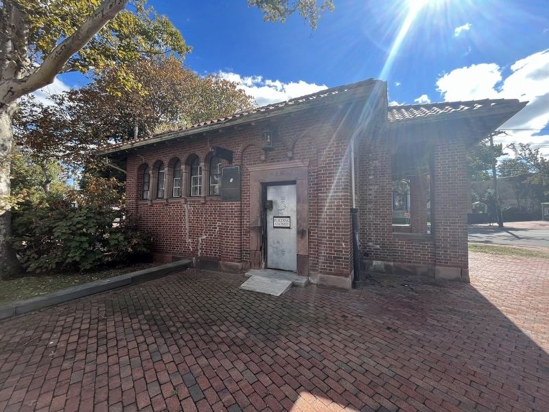
This small parcel of land on Wright Street between Water and Canal Streets was assigned to Parks on July 23, 1964. The comfort station was intended to serve Tappen Park across Wright Street. James J. Tappen (1891-1918) served in the Company D, 38th Infantry, during the Battle of Argonne. The park was named for Tappen in July 1934 by a bill signed by Mayor Fiorello H. LaGuardia (1882-1947). Prior to that time, the property was called Washington Square by laws dating from 1867, though local residents called it Stapleton Park for the surrounding neighborhood.
The architecture of this comfort station draws from the Romanesque and Gothic styles and has arched windows, a red brick façade, and wrought iron lanterns flanking its entrance. The benches and streetlamps are designed in a similar style. Today, with Wright street closed to traffic, Tappen Park and the Stapleton Comfort
Erected by NYC Parks.
Topics and series. This historical marker is listed in these topic lists: Industry & Commerce • Parks & Recreational Areas • Settlements & Settlers • Waterways & Vessels. In addition, it is included in the NYC Parks series list. A significant historical date for this entry is July 23, 1964.
Location. 40° 37.603′ N, 74° 4.67′ W. Marker has been reported damaged. Marker is on Staten Island, New York, in Richmond County. It is in Stapleton. Marker is at the intersection of Water Street and Canal Street, on the left when traveling west on Water Street. Touch for map. Marker is at or near this postal address: 115 Canal St, Staten Island NY 10304, United States of America. Touch for directions.
Other nearby markers. At least 8 other markers are within walking distance of this location. Edgewater Village Hall (within shouting distance of this marker); 364 Van Duzer Street (approx. 0.2 miles away); Rev. Dr. Maggie Howard Playground (approx. ¼ mile away); Stapleton Waterfront Park (approx. 0.3 miles away); Saint Paul's Memorial Church (approx. 0.4 miles away); Hero Park (approx. half a mile away); a different marker also named Hero Park (approx. half a mile away); World War I Memorial (approx. 0.6 miles away). Touch for a list and map of all markers in Staten Island.
Credits. This page was last revised on February 17, 2023. It was originally submitted on October 10, 2022, by Devry Becker Jones of Washington, District of Columbia. This page has been viewed 61 times since then and 9 times this year. Photos: 1, 2. submitted on October 10, 2022, by Devry Becker Jones of Washington, District of Columbia.
