Near Middlesboro in Bell County, Kentucky — The American South (East South Central)
An Object Lesson Road
Cumberland Gap National Historical Park
| — | National Park Service, U.S. Department of the Interior | — |

September 28, 2022
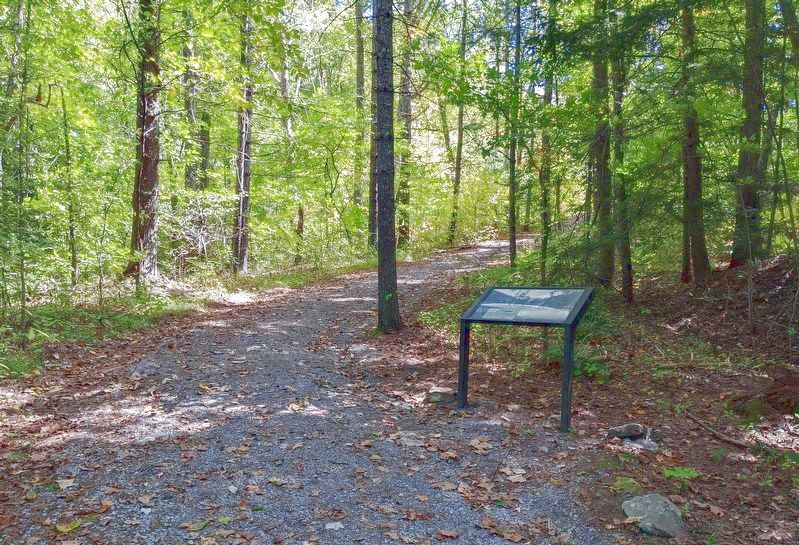
1. An Object Lesson Road Marker
The next half-mile of trail follows the 1907 roadbed of an "Object Lesson Road." Early in the 20th century, most rural roads, especially here in the Appalachians, were little better than in the days of Daniel Boone. The U.S. Department of Agriculture sponsored the building of short segments of smooth, crushed-rock roads graded for good drainage in key, high-visibility spots around the nation. The object of the lesson was to convince voters of the convenience and value of building better roads with up-to-date techniques.
(Caption:)
The walk from here up to the Saddle of the Gap is easier than on the Wilderness Road trail. The Object Lesson Road was built to keep the grade under 8 percent.
Erected by National Park Service, U.S. Department of the Interior.
Topics. This historical marker is listed in this topic list: Roads & Vehicles. A significant historical year for this entry is 1907.
Location. 36° 36.509′ N, 83° 40.672′ W. Marker is near Middlesboro, Kentucky, in Bell County. It can be reached from Sugar Run Overlook Road (Kentucky Route 988). Marker is a wayside exhibit on the Object Lesson Road, a trail that
this page online

Regionally, this marker is in Eastern Kentucky and in the Cumberland Plateau. It is also in the American South, specifically in the Upper South, in Appalachia, and specifically in Southern Appalachia. Globally, it is in North America, the Western Hemisphere, the Western World, and the Anglosphere. Historically, it finds itself in what was once the territory of the Mississippian Culture and also the Antebellum South.
Other nearby markers. At least 8 other markers are within walking distance of this marker: Two-Way Traffic (within shouting distance of this marker); Cumberland Gap / Grant Visits Cumberland Gap (within shouting distance of this marker); A Masterful Retreat (within shouting distance of this marker); Warriors' Path (about 300 feet away, measured in a direct line); Forts and Batteries, North and South (approx. 0.2 miles away); Two Armies, One Railroad (approx. 0.2 miles away); a different marker also named An Object Lesson Road
September 28, 2022
2. An Object Lesson Road Marker
Other markers no longer nearby. Defense of the Gap (was approx. 0.2 miles away but has been permanently removed); Invasion through the Gap (was approx. 0.2 miles away but has been permanently removed).
September 30, 2022
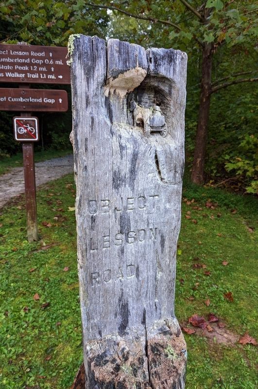
3. Object Lesson Road trail marker
This carved wood trail marker is at the northern terminus of the Object Lesson Road and visible from the Thomas Walker Parking Area.
Credits. This page was last revised on October 13, 2022. It was originally submitted on October 7, 2022. This page has been viewed 639 times since then and 36 times this year. Last updated on October 12, 2022. Photos: 1, 2, 3. submitted on October 7, 2022. • Devry Becker Jones was the editor who published this page.
