Near Ewing in Lee County, Virginia — The American South (Mid-Atlantic)
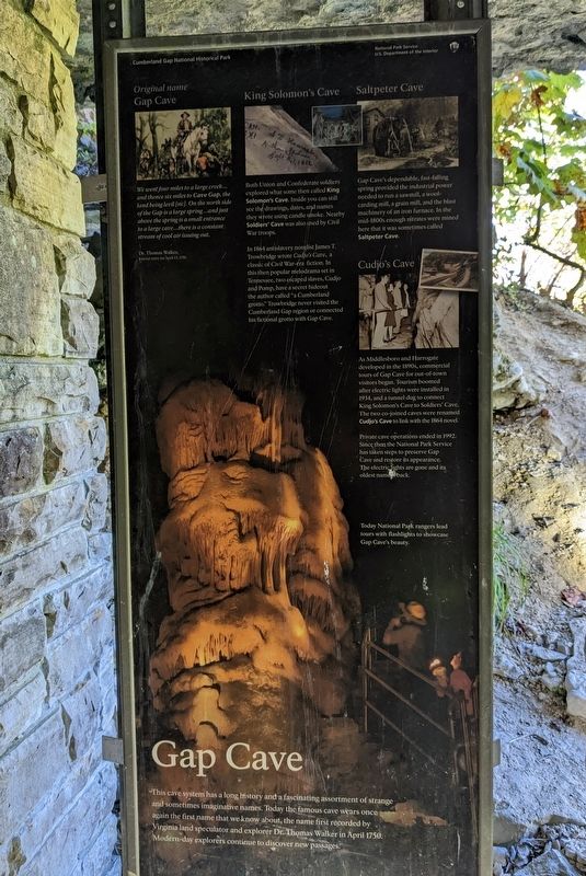
Gap Cave
— Cumberland Gap National Historical Park —
Original name
Gap Cave
We went four miles to a large creek...and thence six miles to Cave Gap, the land being levil [sic]. On the north side of the Gap is a large spring...and just above the spring is a small entrance to a large cave...there is a constant stream of cool air issuing out.
. Dr. Thomas Walker,
Journal entry for April 13, 1750
King Solomon's Cave
Both Union and Confederate soldiers explored what some then called King Solomon's Cave. Inside you can still see the drawings, dates, and names they wrote using candle smoke. Nearby Soldiers' Cave was also used by Civil War troops.
In 1864 antislavery novelist James T. Trowbridge wrote Cudjo's Cave, a classic of Civil War-era fiction. In this then popular melodrama set in Tennessee, two escaped slaves, Cudjo and Pomp, have a secret hideout the author called “a Cumberland grotto.” Trowbridge never visited the Cumberland Gap region or connected his fictional grotto with Gap Cave.
Saltpeter Cave
Gap Cave's dependable, fast-falling spring provided the industrial power needed to run a sawmill, a wool-carding mill, a grain mill, and the blast machinery of an iron furnace. In the mid-1800s enough nitrates were mined here that is was sometimes called Saltpeter Cave.
Cudjo's Cave
As Middlesboro and Harrogate developed in the 1890s, commercial tours of Gap Cave for out-of-town visitors began. Tourism boomed after electric lights were installed in 1934, and a tunnel dug to connect King Solomon's Cave to Soldiers' Cave. The two co-joined caves were renamed Cudjo's Cave to link with the 1864 novel.
Private cave operations ended in 1992. Since then the National Park Service has taken steps to preserve Gap Cave and restore its appearance. The electric lights are gone and its oldest name is back.
Today National Park rangers lead tours with flashlights to showcase Gap Cave's beauty.
Erected by National Park Service, U.S. Department of the Interior.
Topics. This historical marker is listed in these topic lists: Exploration • Industry & Commerce • Parks & Recreational Areas • War, US Civil. A significant historical date for this entry is April 13, 1750.
Location. 36° 36.168′ N, 83° 40.02′ W. Marker is near Ewing, Virginia, in Lee County. Marker can be reached from North Cumberland Road, 0.3 miles north of Wilderness Road (U.S. 58), on the right when traveling north. Marker is an upright wayside at the entrance to Gap Cave, which is accessed from a side trail off the Wilderness Road Trail. Touch for map. Marker is in this post office area: Ewing VA 24248, United States of America. Touch for directions.
Other nearby markers. At least 8 other markers are within walking distance of this marker. Iron Furnace (about 600 feet away, measured in a direct line); Warriors' Path (approx. 0.2 miles away); Gateway to Kaintuck (approx. 0.2 miles away); Hiking in the Gap (approx. 0.2 miles away); Russell Berkau 1867 - 1936 (approx. 0.2 miles away in Tennessee); Three States Cornerstone (approx. 0.2 miles away in Tennessee); Generations Have Enjoyed this View (approx. 0.2 miles away); On Guard in Cumberland Gap (approx. 0.2 miles away). Touch for a list and map of all markers in Ewing.
Credits. This page was last revised on October 13, 2022. It was originally submitted on October 4, 2022. This page has been viewed 221 times since then and 47 times this year. Last updated on October 12, 2022. Photos: 1. submitted on October 4, 2022. • Bernard Fisher was the editor who published this page.
