Near Middlesboro in Bell County, Kentucky — The American South (East South Central)
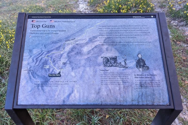
Top Guns
Cumberland Gap National Historical Park
— National Park Service, U.S. Department of the Interior —
Cumberland Gap is the strongest position I have ever seen except Gibraltar.
General George W. Morgan, 1862
The zigzag-shaped mounds you see here are the remnants of a 240-foot-long, 6-foot-high, log-and-earth Civil War field fortification. For four years artillery pieces emplaced here drew a bead on anyone climbing Pinnacle Mountain along Harlan Road. As Confederate troops fortified the Gap in August 1861, they cut down all the trees on this mountain for a mile in front of the defenses to clear the view for the gunners.
This daunting position, the highest of more than a dozen earthworks built by Confederate and Federal defenders, was never used in battle.
"Long Tom"
The most famous defender of this outpost was a huge cannon that survived being thrown off Pinnacle Mountain—twice—during the advance and retreat of the armies. Affectionately called "Long Tom," the siege gun was laboriously hauled back to the top. After its second long drop, Long Tom finished the war repositioned below, near Gap Cave.
In Memory of the Union's First Fallen General
In 1862 Federal troops renamed this outpost to honor Nathaniel Lyon, the first American general to die in battle since the War of 1812. General Lyon fell at Wilson's Creek, Missouri on August 10, 1861.
Too Steep for Troops to Climb
What made the defenses around Cumberland Gap so difficult to attack also made them tough to resupply.
Erected by National Park Service, U.S. Department of the Interior.
Topics. This historical marker is listed in these topic lists: Forts and Castles • War, US Civil.
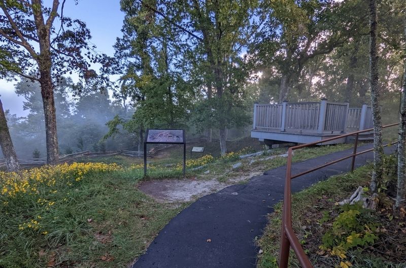
Location. 36° 36.343′ N, 83° 39.961′ W. Marker is near Middlesboro, Kentucky, in Bell County. Marker can be reached from Pinnacle View Road, 2˝ miles Old Wilderness Road (Kentucky Route 988) when traveling east. Located along a trail south of the Pinnacle Overlook Parking Lot. Touch for map. Marker is in this post office area: Middlesboro KY 40965, United States of America. Touch for directions.
Other nearby markers. At least 8 other markers are within walking distance of this marker. "This American Gibraltar" (a few steps from this marker); Pinnacle Overlook (about 300 feet away, measured in a direct line); Gateway to Kaintuck (about 300 feet away); Generations Have Enjoyed this View (about 400 feet away in Virginia); a different marker also named Gateway to Kaintuck (about 400 feet away); a different marker also named Pinnacle Overlook (about 400 feet away); Boundaries Settled (about 500 feet away in Virginia); Gap Cave (approx. 0.2 miles away in Virginia). Touch for a list and map of all markers in Middlesboro.
Credits. This page was last revised on October 13, 2022. It was originally submitted on October 12, 2022. This page has been viewed 134 times since then and 11 times this year. Last updated on October 13, 2022. Photos: 1, 2. submitted on October 12, 2022. • Devry Becker Jones was the editor who published this page.

