National Harbor in Oxon Hill in Prince George's County, Maryland — The American Northeast (Mid-Atlantic)
You Are Standing at Historic Salubria
Photographed by Richard E. Miller, November 16, 2013
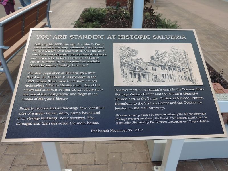
1. You Are Standing at Historic Salubria Marker
Following his 1827 marriage, Dr. John H. Bayne constructed a two story, columned, wood framed house a few feet from this marker. Over the years the house was expanded; the southward extension included a 5 by 18 foot, one-and-a-half story structure where Dr. Bayne practiced medicine. “Salubria” means “healthy, beneficial”.
The slave population at Salubria grew from 3 or 4 in the 1830s to 19 as recorded in the 1860 census. There were three slave houses. Archaeology failed to identify them. One of the slaves was Judah, a 14 year old girl whose story was one of the most graphic and tragic in the annals of Maryland history.
Property records and archaeology have identified sites of a green house, dairy, pump house and farm storage buildings; none survived. Fire damaged and then destroyed the main house.
Discover more of the Salubria story in the Potomac River Heritage Visitors Center and the Salubria Memorial Garden here at the Tanger Outlets at National Harbor. Directions to the Visitors Center and the Garden are located on the mall directory.
Erected 2013 by The African American Heritage Presentation Group,
this page online
Topics. This historical marker is listed in these topic lists: African Americans • Agriculture • Anthropology & Archaeology • Architecture. A significant historical year for this entry is 1827.
Location. 38° 47.648′ N, 77° 0.049′ W. Marker is in Oxon Hill, Maryland, in Prince George's County. It is in the National Harbor. It can be reached from Oxon Hill Road south of Tanger Boulevard, on the right when traveling north. Touch for map. Marker is at or near this postal address: 6800 Oxon Hill Rd, Oxon Hill MD 20745, United States of America. Touch for directions.

Regionally, this marker is in the Washington Metropolitan Area. It is also in the American South, specifically in the Upper South, in the Mid-Atlantic, and on the Eastern Seaboard. Globally, it is in the North Atlantic Region, North America, the Western Hemisphere, the Western World, and the Anglosphere. Historically, it finds itself in what was once one of the original Thirteen Colonies and also the Antebellum South.
Other nearby markers. At
Photographed by Richard E. Miller, November 29, 2013
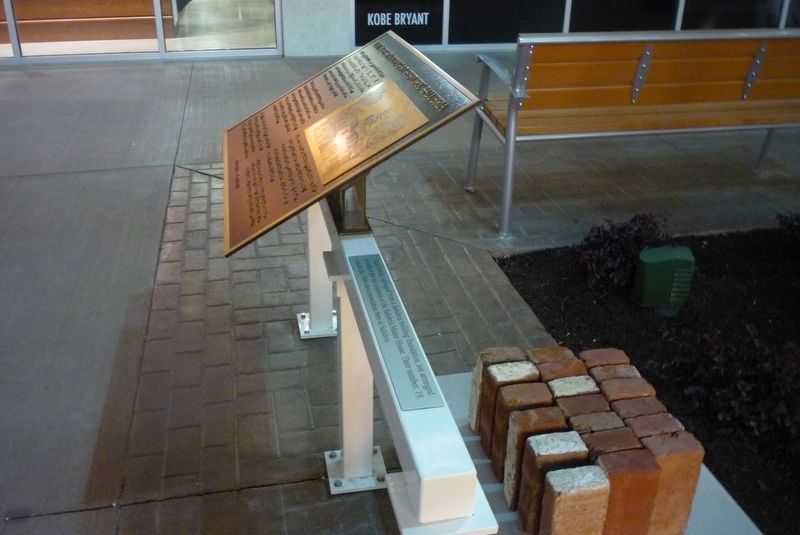
2. You Are Standing at Historic Salubria Marker
With an exhibit of bricks salvaged from a Salubria building foundation, "... arranged to reflect the six columns of the Salubria Manor House. Their number, 19, equals the 1860 slave population here at Salubria."
Another marker is no longer nearby. Judah and Resistance (was approx. 0.2 miles away but has been confirmed missing).
Credits. This page was last revised on May 5, 2025. It was originally submitted on October 14, 2022, by Richard E. Miller of Oxon Hill, Maryland. This page has been viewed 1,333 times since then and 136 times this year. Photos: 1, 2. submitted on December 31, 2013, by Richard E. Miller of Oxon Hill, Maryland. • Devry Becker Jones was the editor who published this page.
