New Bern in Craven County, North Carolina — The American South (South Atlantic)
Battle of New Bern
Photographed by Don Morfe
1. Battle of New Bern Marker
North Carolina Highway Historical Marker Program website entry
Click for more information.
Click for more information.
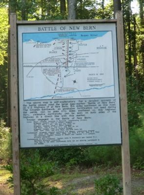
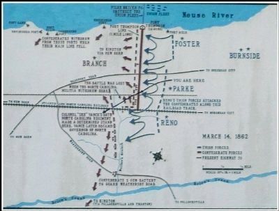
The above map is self-explanatory. For a detailed account of the battle please read the large map-marker "Battle of New Bern" on U.S. Highway 17 at New Bern, 5¼ miles west of this road. The Croatan Earthwork, an extensive fortification not used during the battle, can be seen 6-3/10 miles southeast on this highway. Here, extensive earthworks can be seen on both sides of the highway in a direct line with this marker.
Troops engaged in the Battle of New Bern:
Union: Major General Ambrose Burnside - commanding Division.
Brigadier General John G. Parke's Brigade
4th and 5th R.I. Inf.; 8th and 11th Conn. Inf.
Brigadier General Jesse L. Reno's Brigade
21st Mass., 51st N.Y., 9th N.J., and 51st Pa. Inf.
Brigadier General John G. Foster's Brigade
23rd, 24th, 25th, and 27th Mass. and 10th Conn. Inf.
Confederate: Brigadier General Lawrence O'B. Branch - commanding Brigade
7th, 26th, 27th, 28th, 33rd, 35th, and 37th N.C. Inf.; 19th N.C. Regt. (1st Cavalry); Captain Thomas H. Brem's and Captain A.C. Latham's artillery batteries.
Confederates in Fort Thompson: Captain John N. Whitford's and Captain W.A. Herring's artillery
this page online
(The men in the other Confederate forts did not directly participate in the battle).
Erected 1962 by Archives and Highway Departments, Confederate Centennial Commission. (Marker Number CC-2.)
Topics and series. This historical marker is listed in these topic lists: Forts and Castles • War, US Civil. In addition, it is included in the North Carolina Division of Archives and History series list.
Location. 35° 2.862′ N, 77° 0.929′ W. Marker is in New Bern, North Carolina, in Craven County. It can be reached from Battlefield Parkway south of Taberna Way, on the right when traveling south. Touch for map. Marker is at or near this postal address: 300 Battlefield Parkway, New Bern NC 28562, United States of America. Touch for directions.

Regionally, this marker is in the Coastal Plain. It is also in the American South, specifically in the Upper South, in the Tidewater, and on the Eastern Seaboard. Globally, it is in the North Atlantic Region, North America, the Western Hemisphere, the Western World, and the Anglosphere. Historically, it finds itself in what
August 15, 2014
2. Battle of New Bern Map
Other nearby markers. At least 8 other markers are within walking distance of this marker: The Burnside Expedition (within shouting distance of this marker); Opening Volleys (within shouting distance of this marker); New Bern Battlefield Park (within shouting distance of this marker); Advance From Slocum's Creek (within shouting distance of this marker); Final Stand (within shouting distance of this marker); Breakthrough at the Brickyard (within shouting distance of this marker); From Annapolis to Roanoke (within shouting distance of this marker); Attack in the Brickyard (within shouting distance of this marker). Touch for a list and map of all markers in New Bern.
Also see . . . New Bern Battlefield Park. New Bern Historical Society (Submitted on September 9, 2014.)
Photographed by Don Morfe
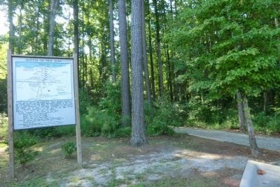
3. Battle of New Bern marker with trail in the background
Photographed by Don Morfe
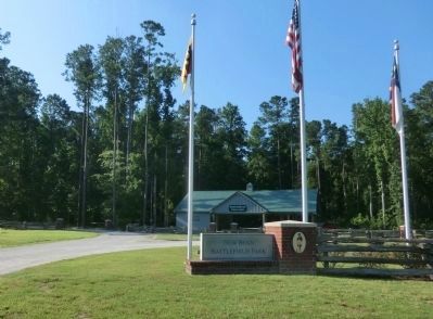
4. New Bern Battlefield Park Entrance
Credits. This page was last revised on October 17, 2022. It was originally submitted on September 9, 2014, by Don Morfe of Baltimore, Maryland. This page has been viewed 1,513 times since then and 96 times this year. Last updated on October 14, 2022, by Carl Gordon Moore Jr. of North East, Maryland. Photos: 1. submitted on September 9, 2014, by Don Morfe of Baltimore, Maryland. 2. submitted on September 9, 2014. 3, 4. submitted on September 9, 2014, by Don Morfe of Baltimore, Maryland. • Bernard Fisher was the editor who published this page.
