Perth in Lanark County, Ontario — Central Canada (North America)
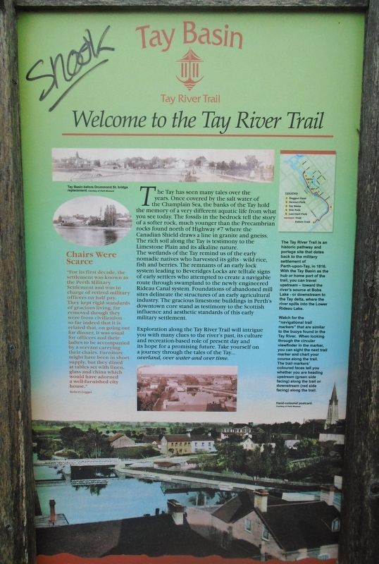
Welcome to the Tay River Trail
Tay Basin
— Overland, Over Water, Over Time —
The Tay has seen many tales over the years. Once covered by the salt water of the Champlain Sea, the banks of the Tay hold the memory of a very different aquatic life from what you see today. The fossils in the bedrock tell the story of a softer rock, much younger than the Precambrian rocks found north of Highway #7 where the Canadian Shield draws a line in granite and gneiss. The rich soil along the Tay is testimony to the Limestone Plain and its alkaline nature. The wetlands of the Tay remind us of the early nomadic natives who harvested its gifts - wild rice, fish and berries. The remnants of an early lock system leading to Beveridges Locks are telltale signs of early settlers who attempted to create a navigable route through swampland to the newly engineered Rideau Canal system. Foundations of abandoned mill sites delineate the structures of an early agricultural industry. The gracious limestone buildings in Perth's downtown core stand as testimony to the Scottish influence and aesthetic standards of this early military settlement.
Exploration along the Tay River Trail will intrigue you with many clues to the river's past, its culture and recreation-based role of present day and its hope for a promising future. Take yourself on a journey through the tales of the Tay... overland, over water and over time.
[Photo captions, clockwise from top left, read]
• Tay Basin before Drummond St. bridge replacement
• The Tay River Trail is an historic pathway and portage site that dates back to the military settlement of Perth-upon-Tay, in 1816. With the Tay Basin as the hub or home port of the trail, you can travel upstream - toward the rivers' source at Bobs Lake - or downstream to the Tay delta, where the river spills into the Lower Rideau Lake.
• Watch for the "navigational trail markers" that are similar to the buoys found in the Tay River. When looking through the circular viewfinder on the marker, you can sight the next trail marker and chart your course along the trail. The trail markers' coloured faces tell you whether you are heading upstream (green side facing) along the trail or downstream (red side facing) along the trail.
• Hand-coloured postcard.
Chairs Were Scarce
"For its first decade, the settlement was known as the Perth Military Settlement and was in charge of retired military officers on half pay. They kept rigid standards of gracious living, far removed though they were from civilization - so far indeed that it is related that, on going out for dinner, it was usual for officers and their ladies to be accompanied by a servant carrying their chairs. Furniture might have been
in short
supply, but they dined
at tables set with linen,
glass and china which
would have adorned
a well-furnished city
house."
Robert Legget
Topics. This historical marker is listed in these topic lists: Parks & Recreational Areas • Settlements & Settlers • Waterways & Vessels. A significant historical year for this entry is 1816.
Location. 44° 53.975′ N, 76° 14.89′ W. Marker is in Perth, Ontario, in Lanark County. Marker is at the intersection of Basin Street and Tay Street, on the right when traveling north on Basin Street. Touch for map. Marker is in this post office area: Perth ON K7H 1E9, Canada. Touch for directions.
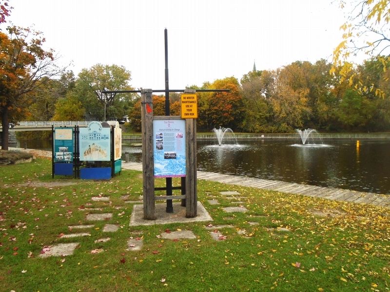
Other nearby markers. At least 8 other markers are within walking distance of this marker. Hub of Activity & Change (here, next to this marker); Boats, Boats, Boats (here, next to this marker); Perth Military Settlement (here, next to this marker); Perth, A Unique Blend / Perth un mélange exceptionnel (here, next to this marker); The First Canal/ Le premier canal Tay (here, next to this marker); By Barge and Bateau / Par barges et chalands (here, next to this marker); Tay Canal Revival / Renaissance du canal Tay (here, next to this marker); The Canal Evolves / l'Évolution du canal (here, next to this marker). Touch for a list and map of all markers in Perth.
Also see . . . Friends of the Tay Watershed . (Submitted on October 15, 2022, by William Fischer, Jr. of Scranton, Pennsylvania.)
Additional keywords. Welcome to the Tay River Trail
Credits. This page was last revised on October 15, 2022. It was originally submitted on October 15, 2022, by William Fischer, Jr. of Scranton, Pennsylvania. This page has been viewed 55 times since then and 8 times this year. Photos: 1, 2. submitted on October 15, 2022, by William Fischer, Jr. of Scranton, Pennsylvania.

