Carson City, Nevada — The American Mountains (Southwest)
Stewart Indian School
1890 – 1980
Photographed by Syd Whittle, July 6, 2009
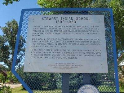
1. Stewart Indian School Marker
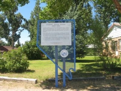
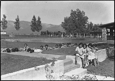
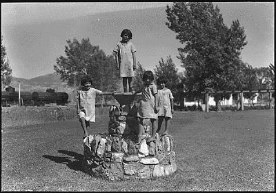
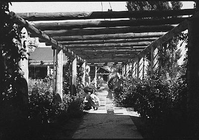
Originally known as the Carson Indian Training School. Stewart Indian School, operated by the U.S. Bureau of Indian Affairs, provided vocational training and academic education for American Indian students from throughout the west for nearly a century.
W.D.C. Gibson, the first superintendent, renamed the boarding school in honor of U.S. Senator William Morris Stewart of Nevada, the principal figure in obtaining Congressional authorization and funding for the institution.
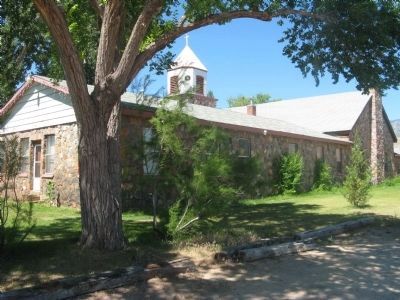
In the early 1920’s Superintendent Frederick Snyder initiated a building program. Students worked with stone masons, some of American Indian ancestry, to construct the handsome stone structures that still grace the grounds
Erected by Nevada Division of Historical Preservation and Archeology and the Carson City Historical Commission. (Marker Number 91.)
Topics. This historical marker is listed in these topic lists: Education • Indigenous Peoples and Communities.
Location. 39° 7.064′ N, 119° 45.378′ W. Marker is in Carson City, Nevada. It is on Snyder Avenue near Clear Creek Drive, on the right
this page online

Regionally, this marker is in the Lake Tahoe Basin and in Greater Reno Area. It is also in the American Mountain West. Globally, it is in North America, the Western Hemisphere, the Western World, and the Anglosphere. Historically, it finds itself in what was once New Spain and also Mexico’s Alta California.
Other nearby markers. At least 8 other markers are within 4 miles of this marker, measured as the crow flies: Dat-So-La-Lee (about 500 feet away, measured in a direct line); Eagle Valley (approx. 0.8 miles away); Logging Wagon (approx. 2.3 miles away); Historic Flume and Lumberyard (approx. 2.4 miles away); Gardner’s Ranch (approx. 2.4 miles away); Nevada State Children’s Home (approx. 3 miles away); Chinatown (approx. 3.1 miles away); Kit Carson 1843 – 44 (approx. 3.1 miles away). Touch for a list and map of all markers in Carson City.
Regarding Stewart Indian School. The Stewart Indian School is on Snyder Ave., one mile east of US Hwy. 395. The
Photographed by Syd Whittle, July 6, 2009
2. Stewart Indian School Marker
Also see . . .
1. Stewart Indian School. Wikipedia entry:
Links to National Register of Historic Places Nomination Form (Submitted on May 16, 2024, by Larry Gertner of New York, New York.)
2. The Reservation Boarding School System in the United States, 1870 - 1928. Two Frog website entry (Submitted on July 13, 2009, by Syd Whittle of Mesa, Arizona.)
3. New Amended Text for Marker. The Nevada State Historic Preservation Office (SHPO) recently updated the text of the roughly 260 state historical markers in Nevada. The Nevada SHPO placed the amended text of the markers on its website for each individual marker and will change the actual markers in the field as funding allows. Minor changes have been made to the marker for grammar, readability, and content. The marker indicates the school is listed in the National Register of Historic Places. The link will take you to the Nevada SHPO page for the marker with the amended text. (Submitted on October 24, 2013, by Duane Hall of Abilene, Texas.)
Additional keywords. Forced
Photographed by Bill Kirchner, October 7, 2013
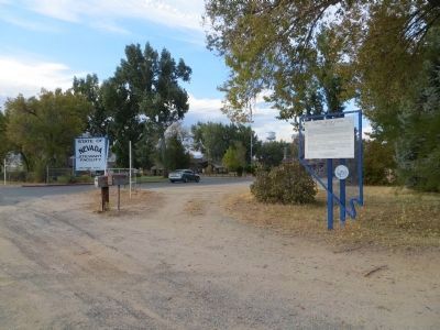
3. Stewart Indian School Marker
Photographed by Syd Whittle, July 6, 2009
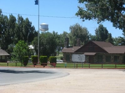
4. Stewart Indian School
A Site map of the school grounds can be seen in the center of the photo.
Photographed by Syd Whittle, July 6, 2009
5. Stewart Indian School
National Archives and Records Administration
6. Children and Grounds at the Stewart Indian School
National Archives and Records Admin.
7. Children and Grounds at the Stewart Indian School
National Archives and Records Admin.
8. Children and Grounds at the Stewart Indian School
Credits. This page was last revised on May 16, 2024. It was originally submitted on July 13, 2009, by Syd Whittle of Mesa, Arizona. This page has been viewed 1,895 times since then and 36 times this year. Photos: 1, 2. submitted on July 13, 2009, by Syd Whittle of Mesa, Arizona. 3. submitted on October 25, 2013, by Bill Kirchner of Tucson, Arizona. 4, 5, 6, 7, 8. submitted on July 13, 2009, by Syd Whittle of Mesa, Arizona.
