Perth in Lanark County, Ontario — Central Canada (North America)
Canal Fever
⎯⎯⎯
la Fièvre des canaux du Canada
Photographed by William Fischer, Jr., October 7, 2022
1. Canal Fever / la Fièvre des canaux du Canada Marker

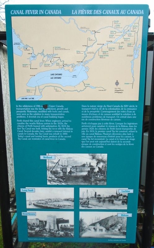
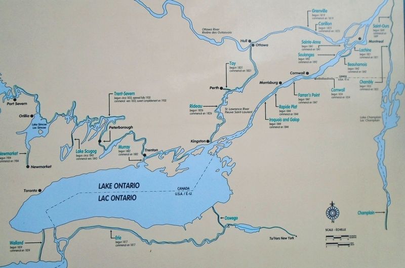
Perth shared this canal fever. When engineers arrived to canalize the nearby Rideau system in the 1820s, the citizens of Perth buzzed with anticipation. By 1834 the first Tay Canal was built, linking the town with the Rideau Canal. Several decades later, amidst a renewed interest in canals in Canada, the Tay Canal was rebuilt in 1890. Today's canal and turning basin, products of the second Tay Canal, are reminders of canal fever in Canada.
[Bottom illustrations, clockwise from top, read]
Welland · Lachine · Rideau · Trent-Severn · Long Sault
Perth n'échappa pas à cette fièvre. Lorsque les ingénieurs arrivèrent pour canaliser le réseau de la Rideau, dans les années 1820, les citoyens de Perth furent transportés de joie. En 1834, le premier canal Tay fut construit, reliant la ville au canal Rideau. Plusieurs décennies plus tard, à une époque de renouveau d'intérêt pour les canaux, le canal Tay fut reconstruit. Le canal et le bassin de virage que l'on peut voir aujourd'hui datent de la seconde époque de construction et sont les vestiges de la fièvre des canaux au Canada.
[Illustrations du bas, dans le sens des aiguilles d'une montre à partir du haut, lire]
Welland · Lachine · Rideau · Trent-Severn
this page online
Topics. This historical marker is listed in these topic lists: Industry & Commerce • Settlements & Settlers • Waterways & Vessels. A significant historical year for this entry is 1834.
Location. 44° 53.976′ N, 76° 14.885′ W. Marker is in Perth, Ontario, in Lanark County. It is at the intersection of Basin Street and Tay Street, on the right when traveling north on Basin Street. Marker kiosk is just south of the "Crystal Palace". Touch for map. Marker is in this post office area: Perth ON K7H 1E9, Canada. Touch for directions.

Regionally, this marker is in the Haliburton Highlands to Ottawa Valley and in Eastern Ontario. It is also in Central Canada. Globally, it is in North America, the Western Hemisphere, the Western World, and the Anglosphere. Historically, it finds itself in what was once a British colony, the Viceroyalty of New France, the Haudenosaunee (Iroquois) Confederacy, and Rupert’s Land.
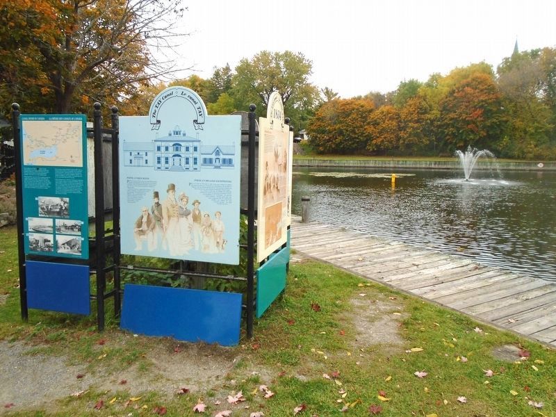
Other nearby markers. At least 8 other markers are within walking distance of this marker: Perth, A Unique Blend / Perth un mélange exceptionnel (here, next to this marker); The First Canal / Le premier canal Tay
Photographed by William Fischer, Jr., October 7, 2022
2. Canal Fever / la Fièvre des canaux du Canada Marker
Also see . . .
1. Celebrating the Tay Canal. Rideau Canal National Historic Site website entry (Submitted on October 16, 2022, by William Fischer, Jr. of Reynoldsburg, Ohio.)
2. Economic Transformation and Continuity, 1818-1860s: The Canal Era. BC Open Text website entry (Submitted on October 16, 2022, by William Fischer, Jr. of Reynoldsburg, Ohio.)
3. Canals and Inland Waterways. The Canadian Encyclopedia website entry (Submitted on October 16, 2022, by William Fischer, Jr. of Reynoldsburg, Ohio.)
Additional keywords. Canal Fever / la Fièvre des canaux du Canada
Photographed by William Fischer, Jr., October 7, 2022
3. Canal Fever / la Fièvre des canaux du Canada Map on Marker
Credits. This page was last revised on March 21, 2025. It was originally submitted on October 16, 2022, by William Fischer, Jr. of Reynoldsburg, Ohio. This page has been viewed 191 times since then and 29 times this year. Photos: 1, 2, 3. submitted on October 16, 2022, by William Fischer, Jr. of Reynoldsburg, Ohio.
