North 25 in Trenton in Mercer County, New Jersey — The American Northeast (Mid-Atlantic)
Delaware and Raritan Canal State Park / The Bel-Del

Photographed By Devry Becker Jones (CC0), October 15, 2022
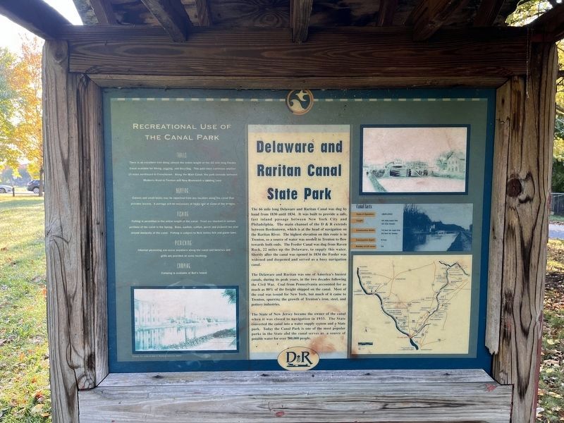
1. Delaware and Raritan Canal State Park side of the marker
Delaware and Raritan Canal State Park
The 66 mile long Delaware and Raritan Canal was dug by hand from 1830 until 1834. It was built to provide a safe, fast inland passage between New York City and Philadelphia. The main channel of the D & R extends between Bordentown, which is at the head of navigation on the Raritan River. The highest elevation on this route is in Trenton, so a source of water was needed in Trenton to flow towards both ends. The Feeder Canal was dug from Raven Rock, 22 miles up the Delaware, to supply this water. Shortly after the canal was opened in 1834 the Feeder was widened and deepened and served as a busy navigation canal.
The Delaware and Raritan was one of America's busiest canals, during its peak years, in the two decades following the Civil War. Coal from Pennsylvania accounted for as much as 80% of the freight shipped on the canal. Most of the coal was bound for New York, but much of it came to Trenton, spurring the growth of Trenton's iron, steel, and pottery industries.
The State of New Jersey became the owner of the canal when it was closed to navigation in 1933. The State converted the canal into a water supply system and a State park. Today the Canal Park is one of the most popular parks in the State and the canal serves as a source of potable water for over 700,000 people.
Canal facts
Years of Operation: 1834 - 1932
Length: 44 mile main line, 22 mile feeder
Construction Width: 74 feet for main line, 50 feet for feeder
Construction Depth: 8 feet
Number of Lift Locks: 15
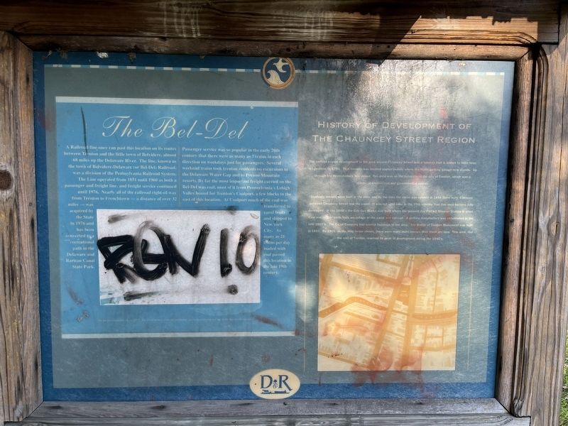
The Bel-Del
A Railroad line once ran past this location on its routes between Trenton and the little town of Belvidere, almost 68 miles up the Delaware River. The line, known as the town of Belvidere-Delaware (or Bel-Del) Railroad, was a division of the Pennsylvania Railroad System. The Line operated from 1851 until 1960 as both a passenger and freight line, and freight service continued until 1976. Nearly all of the railroad right-of-way from Trenton to Frenchtown — a distance of over 32 miles — was acquired by the State in 1976 and has been converted to a recreational path in the Delaware and Raritan Canal State Park.
Passenger service was so popular in the early 20th century that there were as many as 7 trains in each direction on weekdays just for passengers. Several weekend trains took trenton residents on excursions to the Delaware Water Gap and to Pocono Mountain resorts. By far the most important freight carried on the Bel-Del was coal, most of it from Pennsylvania's Lehigh Valley bound

Photographed By Devry Becker Jones (CC0), October 15, 2022
2. The Bel-Del side of the marker
While the marker has unfortunately been defaced, it remains legible.
History of Development of The Chauncey Street Region
The earliest known development in the area around Chauncey Street was a tannery that is known to have been in operation by 1750. That tannery was located approximately where the State parking garage now stands. Up through the Revolutionary War period, this area was on the outskirts of the city of Trenton, which was a provincial commercial and governmental center.
Gradually, houses were built in the area, and by the time the canal was opened in 1834 there were 4 houses between Chauncey Street and the canal. It was not until later in the 19th century that this area became fully developed. In the 1880's the City Gas Works was built where the present day PSE&G Breaker Station is sited. Coal and lumber yards took advantage of the canal and railroad. A pottery manufactory was established in the late 1880's. The Canal Company had several buildings in the area. The Battle of Trenton Monument was built in 1893. By 1905, as the map below shows, there were many more houses than there are now. This area, like the rest of Trenton, reached its peak of development during the 1940's.
Topics and series. This historical marker is listed in these topic lists: Industry & Commerce • Natural Resources • Parks & Recreational Areas • Railroads & Streetcars • Settlements & Settlers • Waterways & Vessels. In addition, it is included in the Pennsylvania Railroad (PRR) series list. A significant historical year for this entry is 1830.
Location. 40° 13.461′ N, 74° 45.952′ W. Marker has been reported damaged. Marker is in Trenton, New Jersey, in Mercer County. It is in North 25. Marker is on Chauncey Street west of North Warren Street (U.S. 206), on the right when traveling west. Touch for map. Marker is at or near this postal address: 301 N Warren St, Trenton NJ 08618, United States of America. Touch for directions.
Other nearby markers. At least 8 other markers are within walking distance of this location. Black Soldiers and Patriots (about 600 feet away, measured in a direct line); Trenton Battle Monument (about 600 feet away); a different marker also named Trenton Battle Monument (about 600 feet away); Headquarters of Colonel Johann Gottlieb Rall (about 700 feet away); John Fitch’s Gun Shop (about 700 feet away); Fitch’s Shop (about 700 feet away); Route Taken by Washington (about 800 feet away); Mount Zion A.M.E. Church (approx. 0.2 miles away). Touch for a list and map of all markers in Trenton.
Credits. This page was last revised on February 16, 2023. It was originally submitted on October 17, 2022, by Devry Becker Jones of Washington, District of Columbia. This page has been viewed 70 times since then and 14 times this year. Photos: 1, 2. submitted on October 17, 2022, by Devry Becker Jones of Washington, District of Columbia.
Editor’s want-list for this marker. A wide shot of the marker in context. • Can you help?