Downtown in Trenton in Mercer County, New Jersey — The American Northeast (Mid-Atlantic)
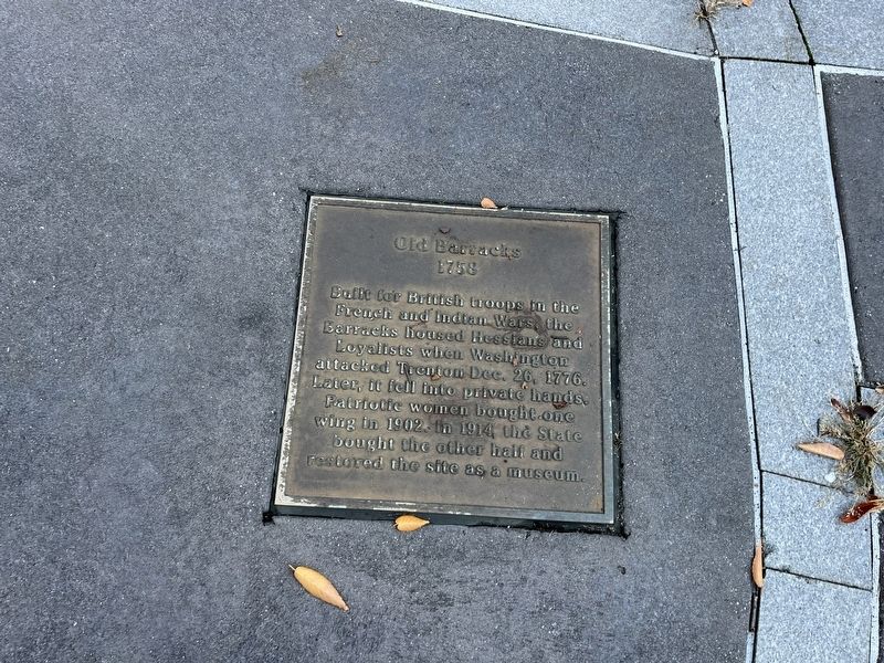
Old Barracks
1758
Erected 2004 by City of Trenton, New Jersey.
Topics. This historical marker is listed in these topic lists: Colonial Era • Forts and Castles • War, French and Indian • War, US Revolutionary. A significant historical date for this entry is December 26, 1776.
Location. 40° 13.281′ N, 74° 45.966′ W. Marker is in Trenton, New Jersey, in Mercer County. It is in Downtown. Marker is at the intersection of North Warren Street (U.S. 206) and West Hanover Street, on the right when traveling south on North Warren Street. Touch for map. Marker is at or near this postal address: 31 N Warren St, Trenton NJ 08608, United States of America. Touch for directions.
Other nearby markers. At least 8 other markers are within walking distance of this marker. Old Masonic Lodge (here, next to this marker); New Jersey State House (here, next to this marker); War Memorial (here, next to this marker); New Jersey State Museum (here, next to this marker); First Presbyterian Church (here, next to this marker); Friends Meeting House (here, next to this marker); Trenton Public Library (here, next to this marker); St. Michael's Episcopal Church (here, next to this marker). Touch for a list and map of all markers in Trenton.
Credits. This page was last revised on February 16, 2023. It was originally submitted on October 17, 2022, by Gary Nigh of Trenton, New Jersey. This page has been viewed 62 times since then and 9 times this year. Photos: 1. submitted on October 17, 2022, by Devry Becker Jones of Washington, District of Columbia. 2. submitted on December 4, 2007, by Gary Nigh of Trenton, New Jersey. • Devry Becker Jones was the editor who published this page.

