Marker Logo HMdb.org THE HISTORICAL
MARKER DATABASE
“Bite-Size Bits of Local, National, and Global History”
San Marcos in Hays County, Texas — The American South (West South Central)
 

Thompson's Island Homeplace


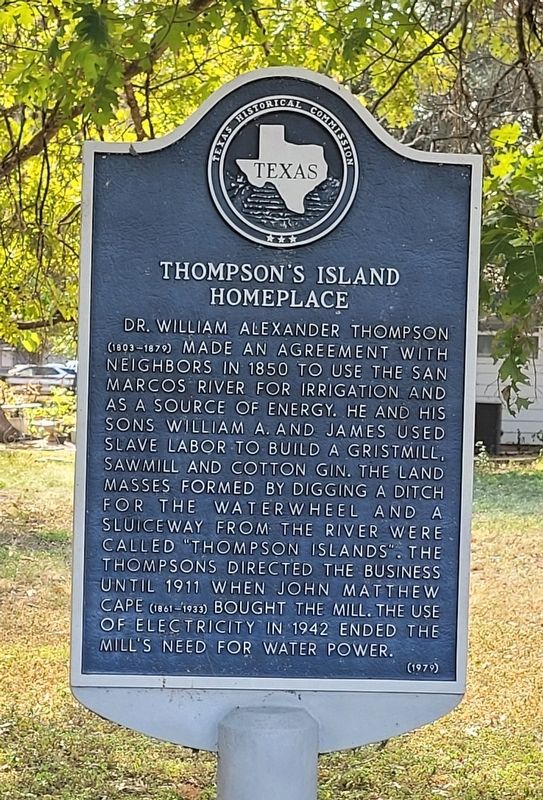
Thompson's Island Homeplace Marker image. Click for full size.
Photographed By James Hulse, October 14, 2022
1. Thompson's Island Homeplace Marker
Inscription. Dr. William Alexander Thompson (1803-1879) made an agreement with neighbors in 1850 to use the San Marcos River for irrigation and as a source of energy. He and his sons William A. and James used slave labor to build a gristmill, sawmill and cotton gin. The land masses formed by digging a ditch for the waterwheel and a sluiceway from the river were called "Thompson Islands". The Thompsons directed the business until 1911 when John Matthew Cape (1861-1933) bought the mill. The use of electricity in 1942 ended the mill's need for water power.
 
Erected 1979 by Texas Historical Commission. (Marker Number 10332.)
 
Topics. This historical marker is listed in these topic lists: African AmericansAgricultureIndustry & Commerce. A significant historical year for this entry is 1850.
 
Location. 29° 52.264′ N, 97° 55.669′ W. Marker is in San Marcos, Texas, in Hays County. Marker is at the intersection of Conway Drive and River Road, on the left when traveling west on Conway Drive. The marker is located north of the home near Conway Drive. Touch for map. Marker is at or near this postal address: 600 Conway Drive, San Marcos TX 78666, United States of America. Touch for directions.
 
Other nearby markers. At least 8 other markers are within one mile of this marker, measured as the crow flies. Thompson's Islands (about 600 feet away, measured in a direct line); Rio Vista Dam
Paid Advertisement
Click on the ad for more information.
Please report objectionable advertising to the Editor.
Click or scan to see
this page online
(approx. 0.6 miles away); Southside School (approx. 0.7 miles away); Farmers Union Gin Company (approx. 0.9 miles away); The Dr. Eli T. Merriman Log Cabin (approx. one mile away); The Charles S. Cock House Museum (approx. one mile away); Mexican War Camp at San Marcos (approx. one mile away); Old Cock Home (approx. one mile away). Touch for a list and map of all markers in San Marcos.
 
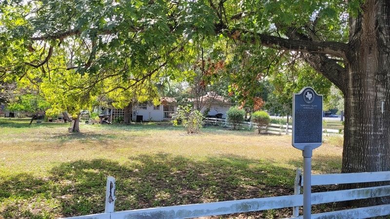
The Thompson's Island Homeplace and Marker image. Click for full size.
Photographed By James Hulse, October 14, 2022
2. The Thompson's Island Homeplace and Marker
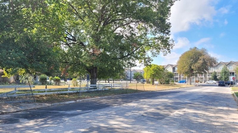
The view of the Thompson's Island Homeplace Marker from the street image. Click for full size.
Photographed By James Hulse, October 14, 2022
3. The view of the Thompson's Island Homeplace Marker from the street
 
 
Credits. This page was last revised on October 19, 2022. It was originally submitted on October 19, 2022, by James Hulse of Medina, Texas. This page has been viewed 230 times since then and 76 times this year. Photos:   1, 2, 3. submitted on October 19, 2022, by James Hulse of Medina, Texas.
Share this page.  
Share on Tumblr
m=208295

CeraNet Cloud Computing sponsors the Historical Marker Database.
This website earns income from purchases you make after using our links to Amazon.com. We appreciate your support.
Paid Advertisement
Apr. 18, 2024