Latchford in Timiskaming District, Ontario — Central Canada (North America)
The Ferguson Highway
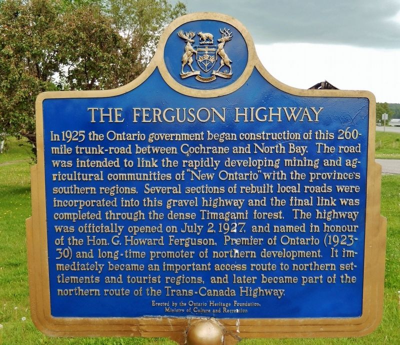
In 1925 the Ontario government began construction of this 260-mile trunk-road between Cochrane and North Bay. The road was intended to link the rapidly developing mining and agricultural communities of “New Ontario” with the province's southern regions. Several sections of rebuilt local roads were incorporated into the gravel highway and the final link was completed through the dense Temagami forest. The highway was officially opened on July 2, 1927, and named in honour of the Hon. G. Howard Ferguson, Premier of Ontario (1923-30) and long-time promoter of northern development. It immediately became an important access route to northern settlements and tourist regions, and later became part of the northern route of the Trans-Canada Highway.
Erected by Ontario Heritage Foundation, Ministry of Culture and Recreation.
Topics and series. This historical marker is listed in this topic list: Roads & Vehicles. In addition, it is included in the Canada, Ontario Heritage Foundation series list. A significant historical date for this entry is July 2, 1927.
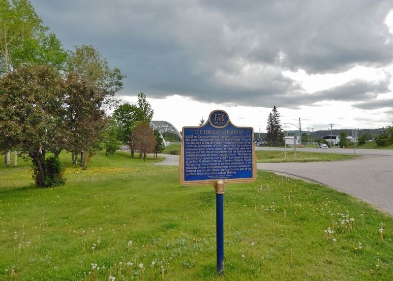
Location. 47° 19.455′ N, 79° 48.632′ W. Marker is in Latchford, Ontario, in Timiskaming District. Marker is on Main Street (Trans-Canada Highway) (Provincial Highway 11) 0.1 kilometers north of McLeod Avenue, on the right when traveling north. Marker is located near the wayside parking area on the south side of the Latchford Town Office. Touch for map. Marker is at or near this postal address: 10 Main Street, Latchford ON P0J 1N0, Canada. Touch for directions.
Other nearby markers. At least 8 other markers are within 13 kilometers of this marker, measured as the crow flies. Sherman Mine Iron Ore (a few steps from this marker); Founding of the Town of Latchford / Fondation de la Ville de Latchford (a few steps from this marker); Sergeant Aubrey Cosens, V.C. (about 90 meters away, measured in a direct line); Nipissing Vein No. 96 (approx. 11.4 kilometers away); Townsite #1 Shaft / Le puits n°1 de la mine Townsite (approx. 11.8 kilometers away); The Cobalt Town Hall / L'hôtel-de-ville de Cobalt (approx. 12.3 kilometers away); Cobalt Mining Camp (approx. 12.3 kilometers away); Silver Mining in Canada / Production de L'argent au Canada (approx. 12.3 kilometers away). Touch for a list and map of all markers in Latchford.
More about this marker. Both sides of this marker have the same inscription.
Also see . . .
1. Ferguson Highway.
In June 1923, Howard Ferguson campaigned to victory, with one of his pledges being the construction of a trunk road from North Bay to the farmland of New Liskeard and the mineral resources of Kirkland Lake and Cochrane. By then, a gravel road had already been constructed between Latchford and New Liskeard. This road started as a connection between the communities of Latchford and Cobalt, the latter of which was already connected with nearby Haileybury. The fully gravelled North Bay to Cochrane Trunk Road was ceremoniously opened by William Finlayson, the Department of Lands and Forests, on July 2, 1927.(Submitted on October 22, 2022, by Cosmos Mariner of Cape Canaveral, Florida.)
2. The History of Highway 11.
In the beginning, the Ferguson Highway was a quick and cheap political promise to the north. It was a response to the evolution of cars and trucks and an alternative to the railroads. What it really meant was that the road wandered from point to point, using the highest ground possible, avoiding the myriad of small lakes and wetlands of the Canadian Shield. Although the Ferguson Highway linked Cochrane and Timmins to North Bay, in reality the road couldn’t be used for much of the year. Every spring the freeze and thaw regime swallowed up whole sections and the rains washed away portions of the gravel roadbed and wooden bridges. Stonemasons were required for permanent bridges and these permanent structures were costly to the Crown. It wasn’t until the 1950s that all of Highway 11 was paved with some uniformity.(Submitted on October 22, 2022, by Cosmos Mariner of Cape Canaveral, Florida.)
Credits. This page was last revised on October 22, 2022. It was originally submitted on October 22, 2022, by Cosmos Mariner of Cape Canaveral, Florida. This page has been viewed 72 times since then and 16 times this year. Photos: 1, 2. submitted on October 22, 2022, by Cosmos Mariner of Cape Canaveral, Florida.

