Spring Hill in Maury County, Tennessee — The American South (East South Central)
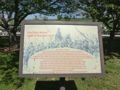
Schofield's Retreat
Night of November 29-30
Photographed by Don Morfe, April 23, 2014
1. Schofield's Retreat Marker
Topics. This historical marker is listed in
this page online
Location. Marker has been reported permanently removed. It was located near 35° 43.927′ N, 86° 57.205′ W. Marker was in Spring Hill, Tennessee, in Maury County. It could be reached from Main Street (U.S. 31) half a mile south of Saturn Parkway (State Route 396), on the left when traveling south. Located on the grounds of Rippavilla Plantation. Touch for map. Marker was at or near this postal address: 5700 Main St, Spring Hill TN 37174, United States of America.
We have been informed that this marker is no longer there and will not be replaced. This page is an archival view of what was.
Regionally, this marker was in Middle Tennessee and in Greater Nashville. It was also in the American South and specifically in the Upper South. Globally, it was in North America, the Western Hemisphere, the Western World, and the Anglosphere. Historically, it found itself in what was once the territory of the Mississippian Culture, one of the Confederate States of America, and the Antebellum South.

Other nearby markers. At least 8 other markers are within walking
Photographed by Don Morfe, April 23, 2014
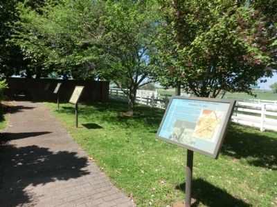
2. Schofield's Retreat Marker
Other markers no longer nearby. Confederate Movements After Sunset (was here, next to this marker but has been permanently removed); a different marker also named The Battle of Spring Hill (was within shouting distance of this marker but has been permanently removed); a different marker also named The Battle of Spring Hill (was approx. 0.2 miles away but has been replaced with another marker now near it); a different marker also named The Battle of Spring Hill (was approx. 0.2 miles away but has been replaced with another

Photographed by Don Morfe, April 23, 2014
3. Rippavilla Plantation Residence
Photographed by Sandra Hughes, March 4, 2016
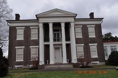
4. Rippavilla Plantation Spring Hill,TN
Credits. This page was last revised on October 23, 2022. It was originally submitted on July 4, 2014, by Don Morfe of Baltimore, Maryland. This page has been viewed 977 times since then and 54 times this year. Last updated on October 22, 2022, by Bradley Owen of Morgantown, West Virginia. Photos: 1, 2, 3. submitted on July 4, 2014, by Don Morfe of Baltimore, Maryland. 4. submitted on March 4, 2016, by Sandra Hughes Tidwell of Killen, Alabama, USA. • Mark Hilton was the editor who published this page.
