Spring Hill in Maury County, Tennessee — The American South (East South Central)
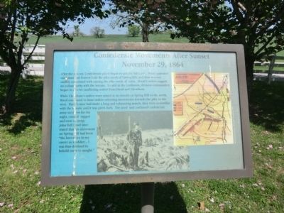
Confederate Movements After Sunset
November 29, 1864
Photographed by Don Morfe, April 23, 2014
1. Confederate Movements After Sunset Marker
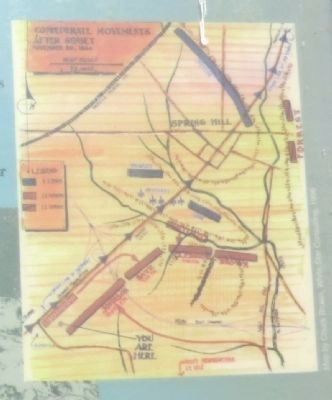
While Cheatham’s orders were aimed at an assault on Spring Hill to the north, Hood continued to issue orders orienting movements towards the pike to the west. Hood’s men had made long and exhausting march, they were unfamiliar with the terrain, and it was pitch dark. The tired and confused Confederate army sat down for the night, cooked supper and went to sleep. John Bell Hood later stated that this movement on Spring Hill had been “the best move in my career as a soldier… I was thus destined to behold to naught.”
Topics. This historical marker is listed in this topic list: War, US Civil.
Location. Marker has been reported permanently removed. It was located near 35° 43.925′ N, 86° 57.203′ W. Marker was
this page online
We have been informed that this marker is no longer there and will not be replaced. This page is an archival view of what was.
Regionally, this marker was in Middle Tennessee and in Greater Nashville. It was also in the American South and specifically in the Upper South. Globally, it was in North America, the Western Hemisphere, the Western World, and the Anglosphere. Historically, it found itself in what was once the territory of the Mississippian Culture, one of the Confederate States of America, and the Antebellum South.

Other nearby markers. At least 8 other markers are within walking distance of this location: Rippa Villa (here, next to this marker); a different marker also named Rippa Villa (a few steps from this marker); The Battle of Spring Hill (within shouting distance of this marker); Slave Fields To Battlegrounds
Photographed by Don Morfe, April 23, 2014
2. Close up of map shown on the marker
Other markers no longer nearby. Schofield's Retreat (was here, next to this marker but has been permanently removed); a different marker also named The Battle of Spring Hill (was within shouting distance of this marker but has been permanently removed); a different marker also named The Battle of Spring Hill (was approx. 0.2 miles away but has been replaced with another marker now near it); a different marker also named The Battle of Spring Hill (was approx. 0.2 miles away but has been replaced with another marker now near it).
Photographed by Don Morfe, April 23, 2014
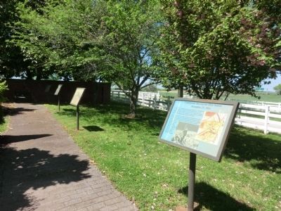
3. Markers along the path at the Plantation

Photographed by Don Morfe, April 23, 2014
4. Rippavilla Plantation Residence
Credits. This page was last revised on October 23, 2022. It was originally submitted on July 4, 2014, by Don Morfe of Baltimore, Maryland. This page has been viewed 878 times since then and 32 times this year. Last updated on October 22, 2022, by Bradley Owen of Morgantown, West Virginia. Photos: 1, 2, 3, 4. submitted on July 4, 2014, by Don Morfe of Baltimore, Maryland. • Mark Hilton was the editor who published this page.
