Jalapa in Grant County, Indiana — The American Midwest (Great Lakes)
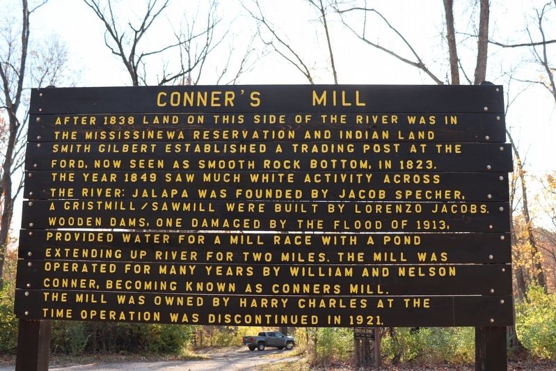
Conner's Mill
Topics. This historical marker is listed in these topic lists: Industry & Commerce • Native Americans • Settlements & Settlers • Waterways & Vessels. A significant historical year for this entry is 1849.
Location. 40° 37.728′ N, 85° 44.148′ W. Marker is in Jalapa, Indiana, in Grant County. Marker is on County Road 380 West, 0.8 miles south of County Road W600N, on the left when traveling south. There is a pull off to view the marker. You only see the back of the one sided marker from the road. Touch for map. Marker is at or near this postal address: 380 County Rd 380 W, Marion IN 46952, United States of America. Touch for directions.
Other nearby markers. At least 8 other markers are within 4 miles of this marker, measured as the crow flies. Here on December 17-18, 1812 (about 500 feet away, measured in a direct line); Mississinewa Battlefield (about 500 feet away); The Battle Of Mississinewa (approx. 0.4 miles away); Miami Indian Cemetery (approx. 0.8 miles away); Chief Meshingomesia (approx. 0.9 miles away); Miami Indian Memorial (approx. 2.1 miles away); Metocinyah's Village (approx. 2.2 miles away); La Fontaine Veterans Memorial (approx. 3.2 miles away). Touch for a list and map of all markers in Jalapa.
Credits. This page was last revised on October 25, 2022. It was originally submitted on October 23, 2022, by Trevor L Whited of Kokomo, Indiana. This page has been viewed 231 times since then and 64 times this year. Photo 1. submitted on October 23, 2022, by Trevor L Whited of Kokomo, Indiana. • Devry Becker Jones was the editor who published this page.
