Irwinville in Irwin County, Georgia — The American South (South Atlantic)
Irwinville
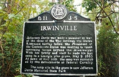
Photographed by Mike Stroud, July 1, 1993
1. Irwinville Marker
Erected by State of Georgia. (Marker Number 11 J-5.)
Topics and series. This historical marker is listed in these topic lists: Military • War, US Civil. In addition, it is included in the Georgia Historical Society series list. A significant historical date for this entry is May 9, 1865.
Location. Marker has been reported missing. It was located near 31° 39.873′ N, 83° 23.156′ W. Marker was in Irwinville, Georgia, in Irwin County. It was on Jeff Davis Road, on the right when traveling north. Touch for map. Marker was in this post office area: Irwinville GA 31760, United States of America. Touch for directions.

Regionally, this marker was on Georgia’s Coastal Plain. It
this page online
Other nearby markers. At least 8 other markers are within 9 miles of this location, measured as the crow flies: Jefferson Davis (about 400 feet away, measured in a direct line); a different marker also named Jefferson Davis (about 400 feet away); a different marker also named Jefferson Davis (about 400 feet away); Jefferson Davis Memorial State Park (approx. 1.1 miles away); First Baptist Church Bell (approx. 7.9 miles away); Gen. Bush's Home (approx. 8.2 miles away); Fitzgerald Rotary Club (approx. 8.4 miles away); Dedicated to the Veterans of 1898 - 1902 (approx. 8½ miles away). Touch for a list and map of all markers in Irwinville.
More about this marker. Was moved from SR 135 / 32 to Jefferson Davis Memorial Park Ga 32 in Irwinville
Related markers.
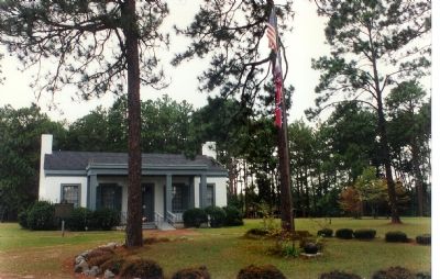
Photographed by Mike Stroud, July 1993
2. The Jefferson Davis Memorial Museum ca 1998
Additional commentary.
1. Text added?
Appears the following text may have been added, or blackened out, at the beginning of the marker:
Eleven miles northwest, near Irwinville,
— Submitted November 28, 2015, by Mark Hilton of Montgomery, Alabama.
Credits. This page was last revised on October 25, 2022. It was originally submitted on February 9, 2008, by Mike Stroud of Bluffton, South Carolina. This page has been viewed 1,835 times since then and 49 times this year. Last updated on October 24, 2022, by Dave W of Co, Colorado. Photos: 1, 2. submitted on February 9, 2008, by Mike Stroud of Bluffton, South Carolina. • Bernard Fisher was the editor who published this page.
