
Russellville in Pope County, Arkansas — The American South (West South Central)
William L. Lovely
(1750 - 1817)
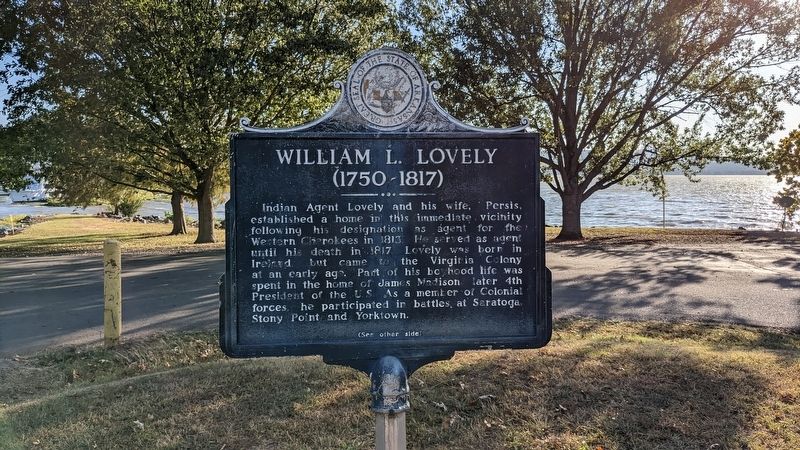
Photographed by Ashley Sides, October 14, 2022
1. William L. Lovely Marker
Major Lovely's plan to reduce the Indian frictions in this territory resulted in the Osage Indians relinquishing claim to the area now designated as N.W. Ark. and N.E. Okla.; and a U.S. edict that all whites (except Mrs. Lovely) vacate this area, then inhabited by the Cherokees. (History identifies the Osage transaction as the Lovely Purchase.)
In 1827 the Ark. Territorial Legislature organized the area to be vacated by the Cherokees as Lovely County. The nearby shoals on the Illinois Bayou were known as the Lovely Shoals. Following her husband's death, Persis Lovely continued to live in this area until her death in 1842.
Erected 1967 by Arkansas
this page online
Topics. This historical marker is listed in this topic list: Indigenous Peoples and Communities. A significant historical year for this entry is 1813.
Location. 35° 17.537′ N, 93° 12.331′ W. Marker is in Russellville, Arkansas, in Pope County. It is on State Park Drive. Touch for map. Marker is at or near this postal address: 100 State Park Dr, Russellville AR 72802, United States of America. Touch for directions.

Regionally, this marker is in the Arkansas River Valley and in the Cherokee Heritage Region. It is also in the American South and specifically in the Upper South. Globally, it is in North America, the Western Hemisphere, the Western World, and the Anglosphere. Historically, it finds itself in what was once the territory of the Mississippian Culture, the Louisiana Purchase, one of the Confederate States of America, and the Antebellum South.
Other nearby markers. At least 8 other markers are within 4 miles of this marker, measured as the crow flies: J. Madison White (approx. 3.3 miles away); Military Road Marker Stone (approx. 3½ miles away); Exploring the Arkansas (approx. 3½ miles

Photographed by Ashley Sides, October 14, 2022
2. William L. Lovely Marker

Photographed by Ashley Sides, October 14, 2022
3. William L. Lovely grave marker
Credits. This page was last revised on October 26, 2022. It was originally submitted on October 19, 2022, by Ashley Sides of Little Rock, Arkansas. This page has been viewed 1,146 times since then and 120 times this year. Last updated on October 25, 2022, by Ashley Sides of Little Rock, Arkansas. Photos: 1, 2, 3. submitted on October 19, 2022, by Ashley Sides of Little Rock, Arkansas. • J. Makali Bruton was the editor who published this page.
